• Skip to primary navigation
  • Skip to main content

Edges Like Sea Glass

By Leah LaRocco

  • Home
  • Blog
    • Thoughts On Life
    • House & Home
    • Gardening
    • Travel
    • Hiking
  • Marking The Miles
  • Contact
  • Subscribe

Yosemite

Yosemite: Yosemite Falls and Sentinel Dome

July 12, 2017 by Leah Leave a Comment

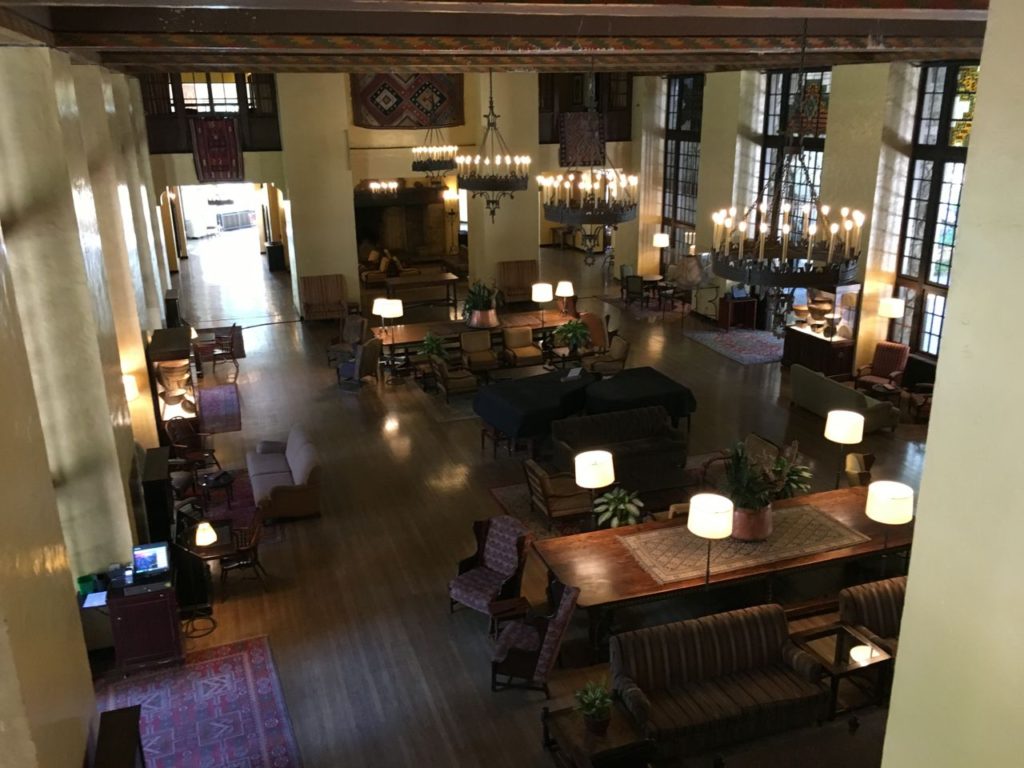
The use of seasons as an analogy for what we experience in life is a weary one, worn out from centuries of use by humanity to describe the phases of our lives that ebb and flow.  Relationships, families, jobs, the paths we travel on all have seasons.  The most dramatic seasonal changes that I perceptibly take notice of each year are winter turning to spring and summer turning to fall.  The changes from spring to summer and fall to winter are less visually profound, so they happen unconsciously.  My wardrobe is the main indicator of the subtler seasonal changes, a t-shirt taken out of a drawer, a down coat out of a closet.  In our city/suburban lives, seasons are easily overlooked unless intentionally observed.  In nature though, seasons are as vivid as a rainbow against a dark grey sky.

I have now seen Great Smoky Mountains National Park in all seasons.  Each one is strikingly different.  There is no mistaking the icy fronds of Fraser firs in winter, the bursting forth of formerly quiet streams in spring, the vibrant blooms of flame azaleas and rhododendrons in summer, and the autumnal golds, reds, and oranges of deciduous forests in October.  Every month holds a new experience in the varied landscapes of the mountains once tread upon by pioneers and loggers who struggled to tame the land.

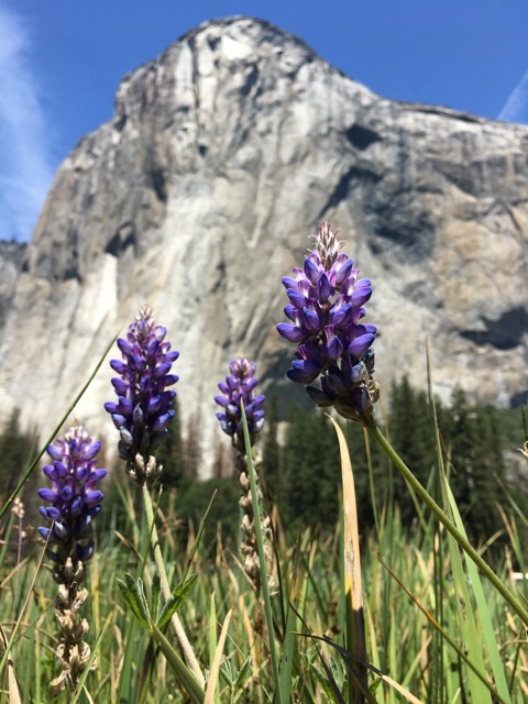
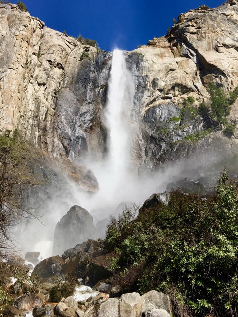
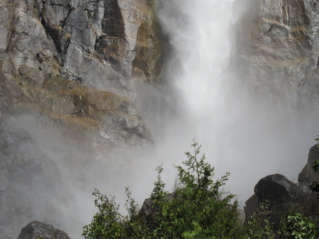
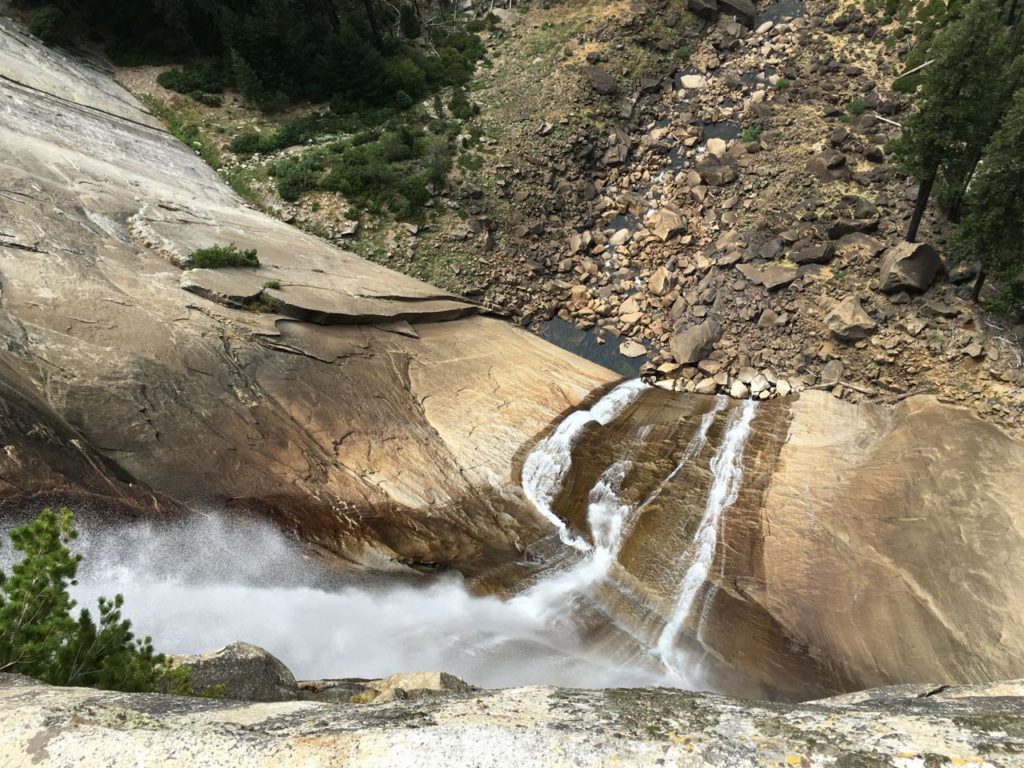
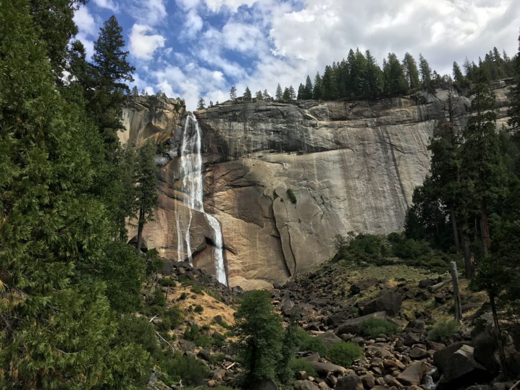
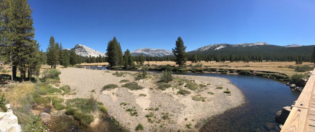
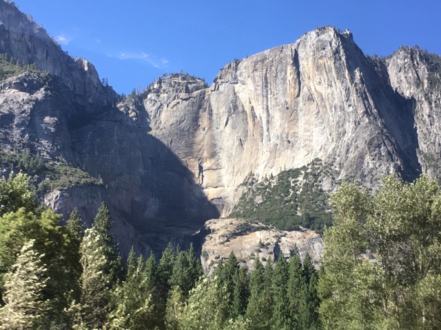
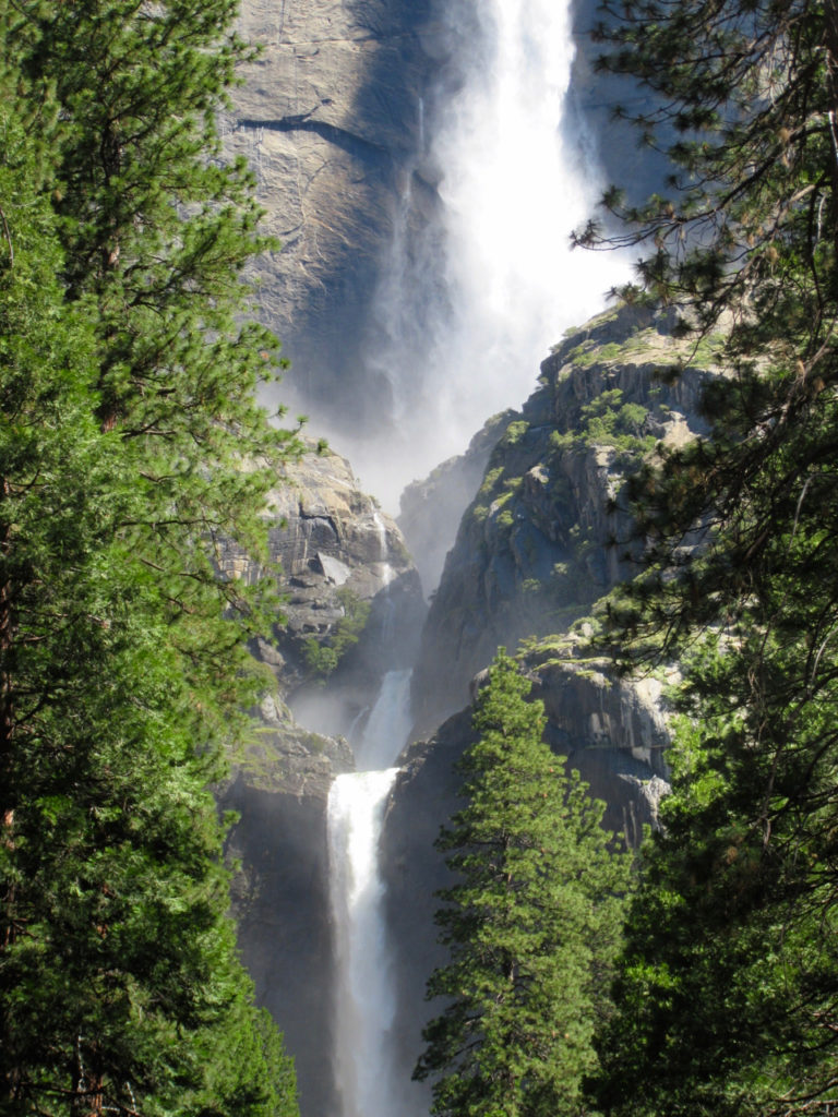
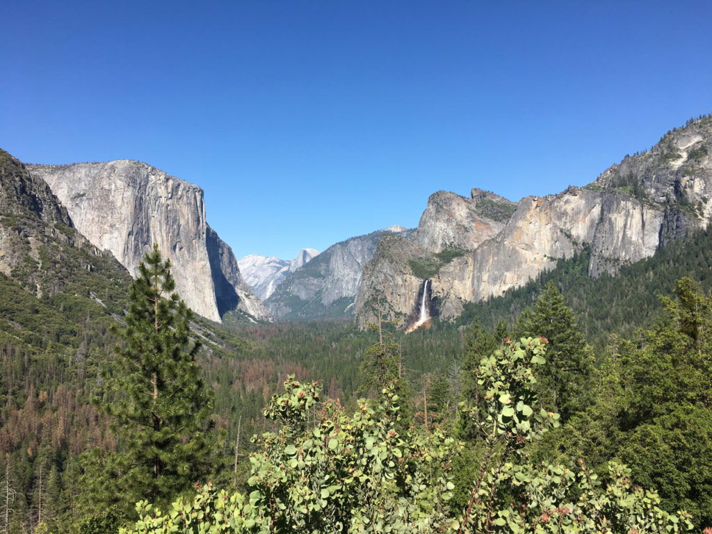
Yosemite is no exception.  The last time I was there, Yosemite falls looked like this.

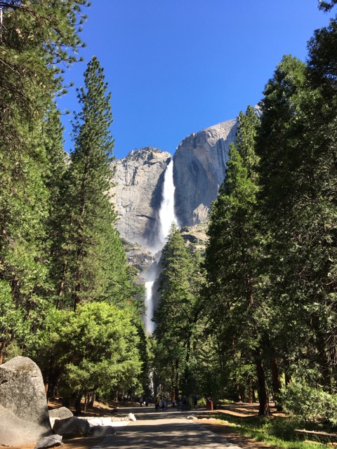
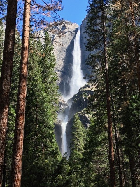
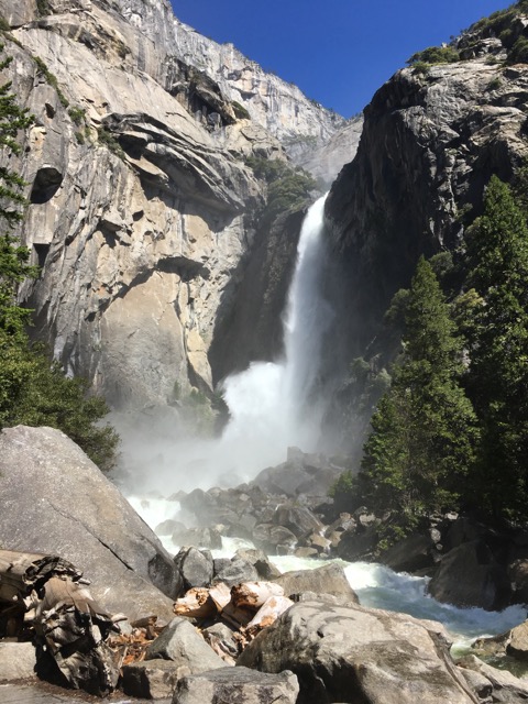
This time its form was as perfect as one could hope for, upper cascading into lower, misting the rocks at its lowest depth while continuing down streams leading to meadows.

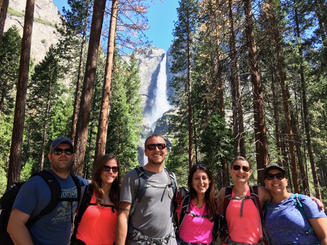
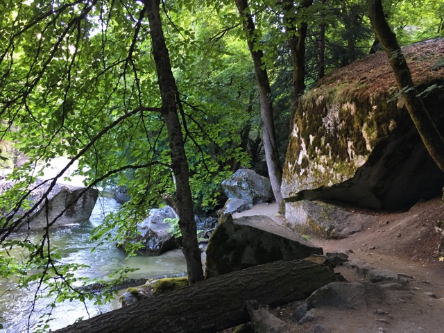
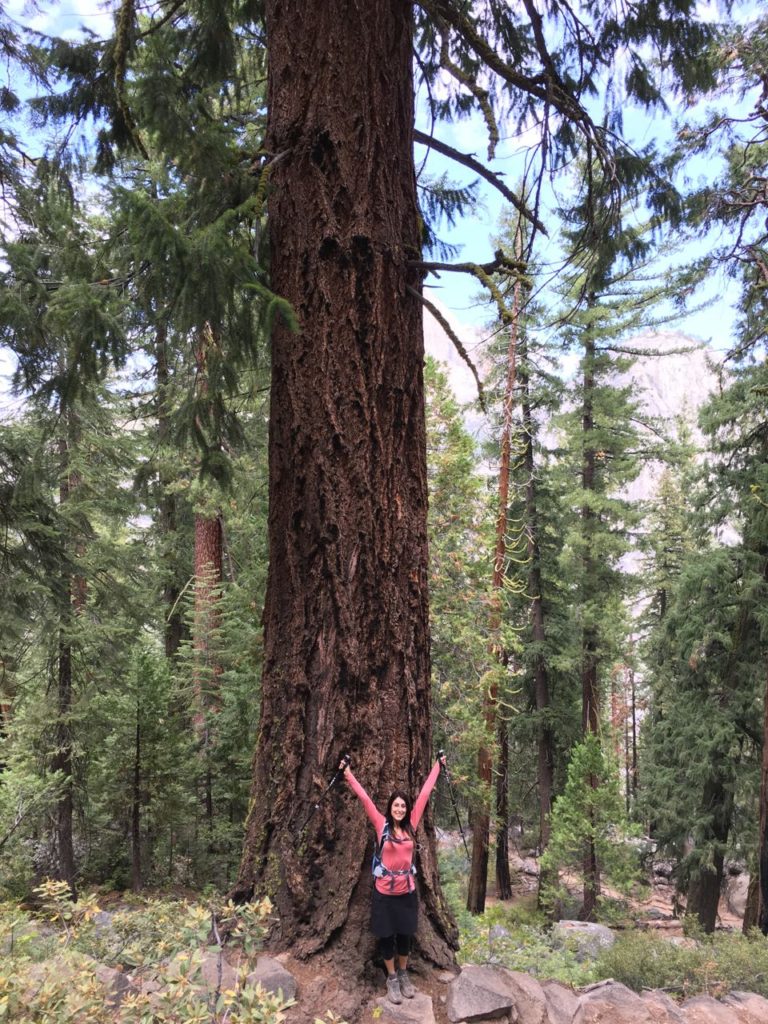
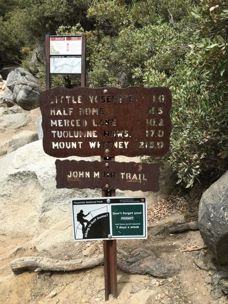
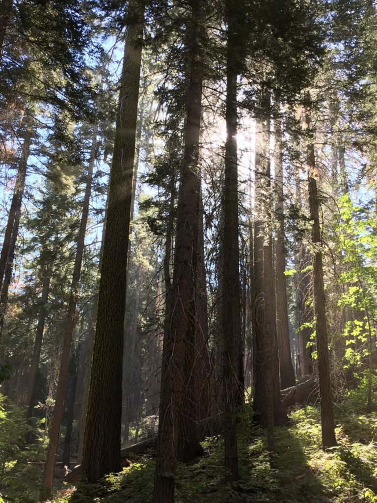
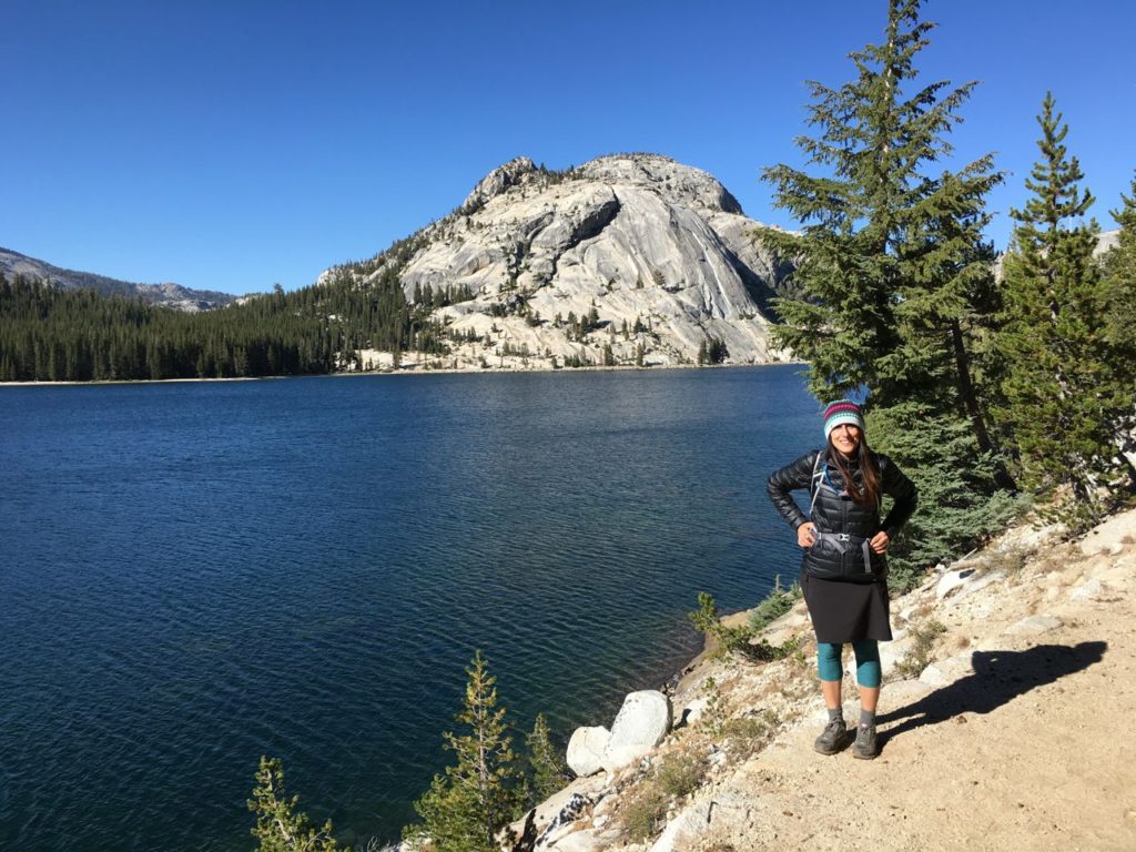
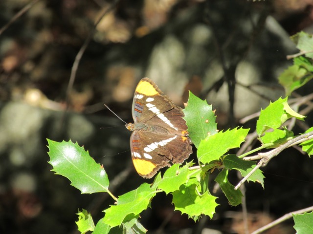
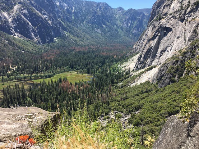
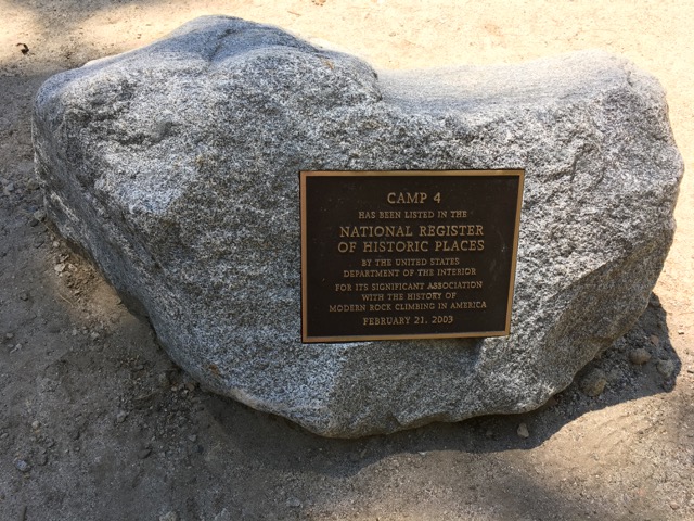
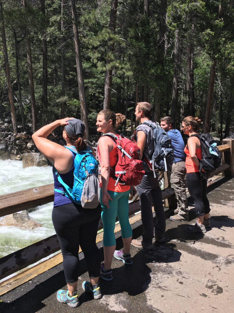
We arrived early at the falls to avoid the major crowds and then headed over to the Upper Yosemite Falls trail to Columbia Rock.  We weren’t planning to hike all the way up to upper falls, but wanted to snag some good views of the valley.  The trail begins at the edge of Camp 4 and heads up numerous switchbacks through dense forest with butterflies called California Sisters, whose host plant is the canyon live oak.

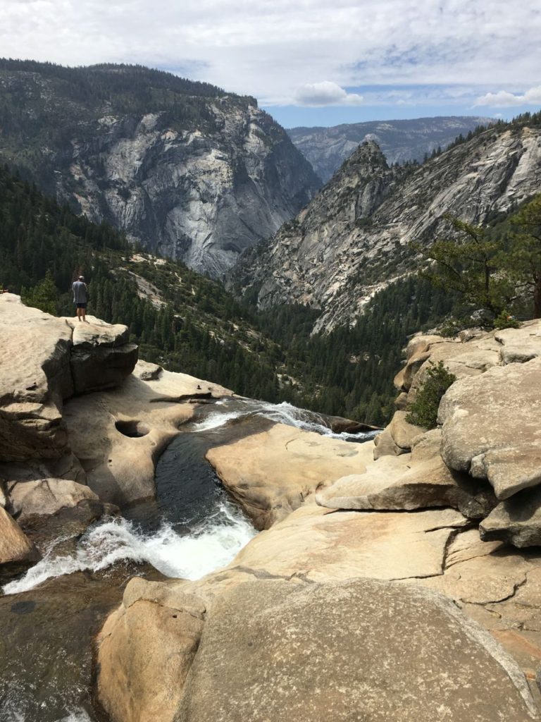
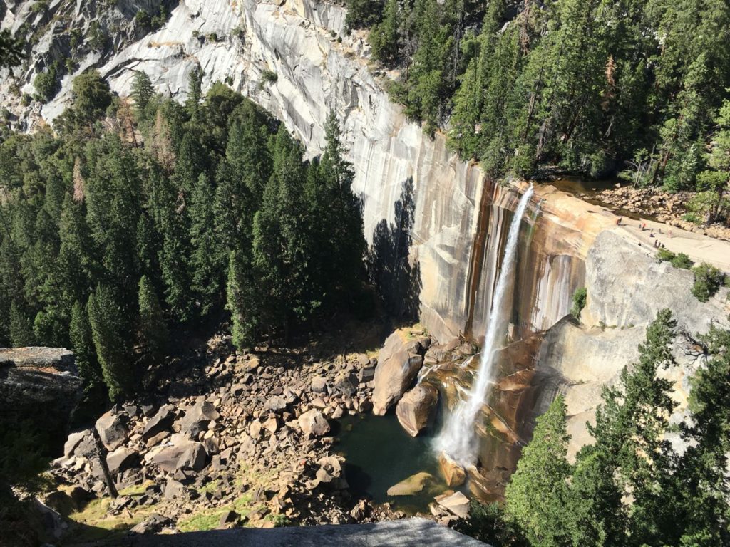
The trail is sandy and rocky, so utmost caution is required on the way down.  The higher we climbed the more the valley opened up to us.

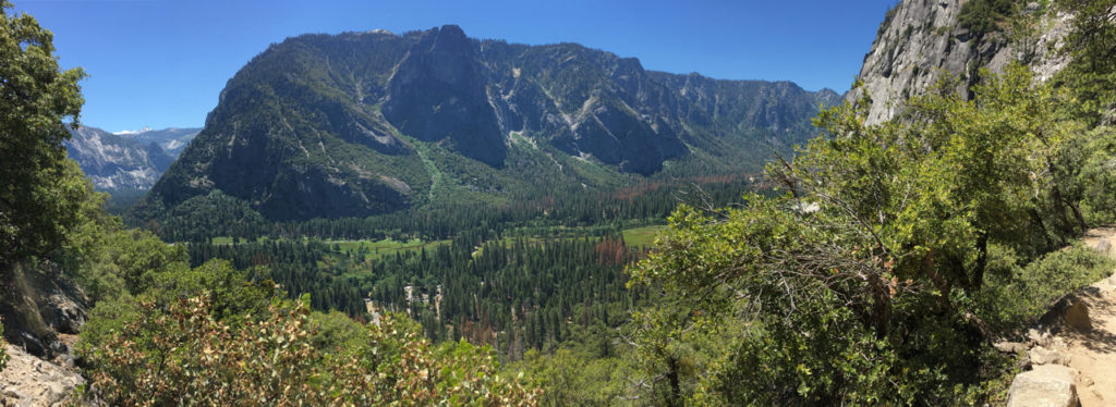
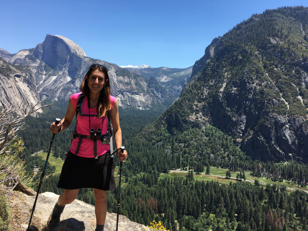
When we reached Columbia Rock, the tiny overlook area was already crowded so we headed back down to a small offshoot we’d seen just below to relax and take pictures.

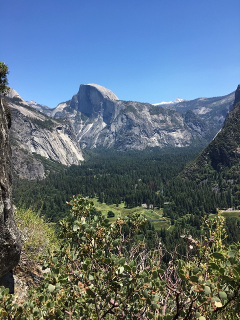
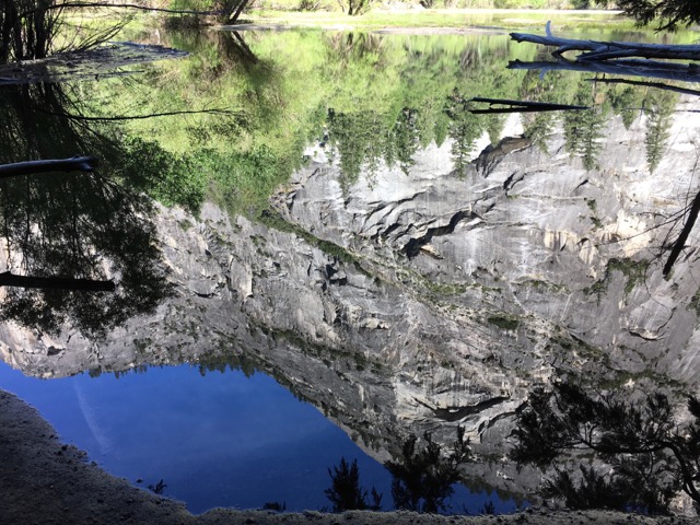
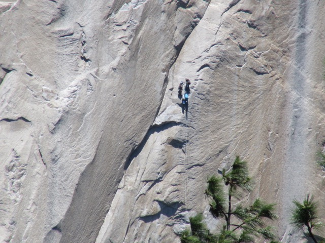
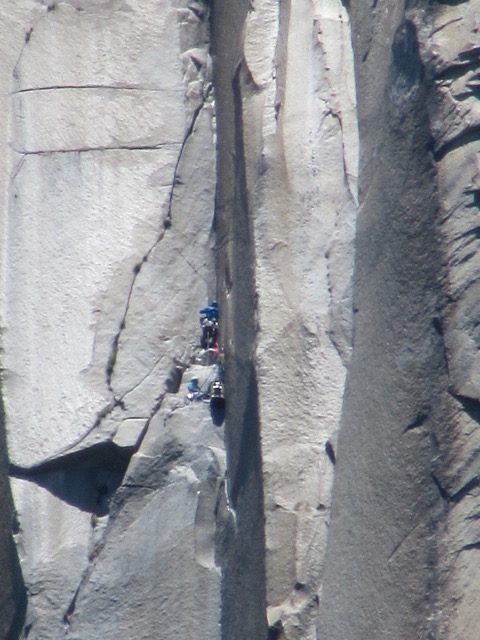
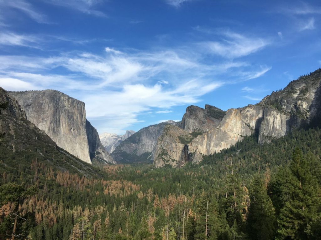
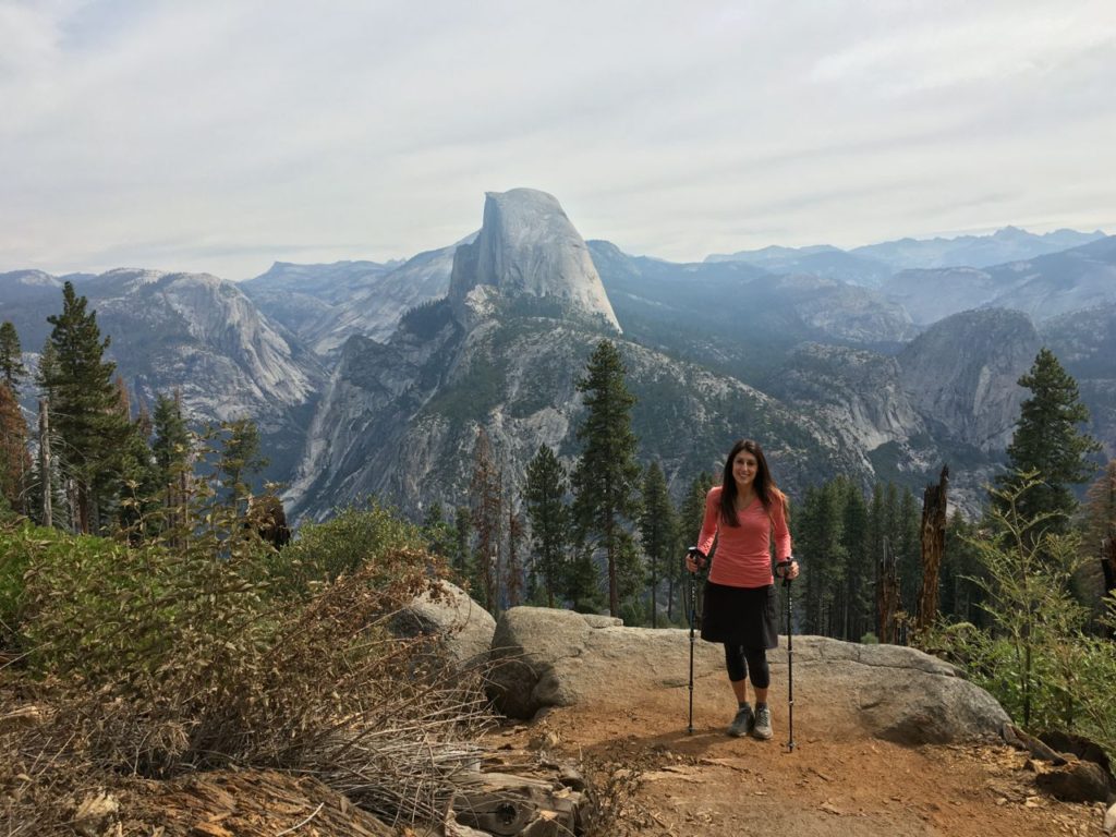
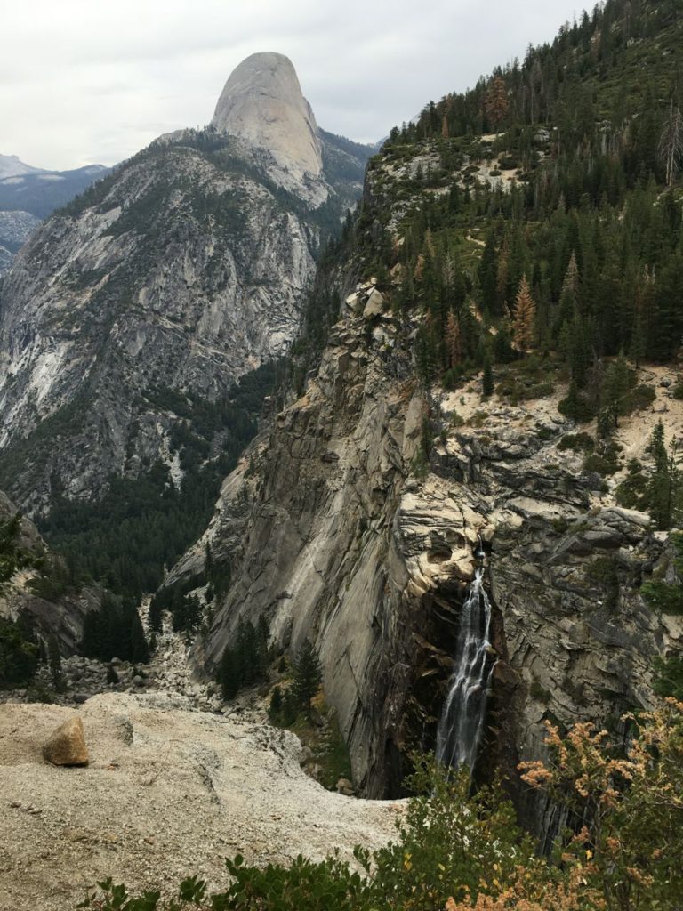
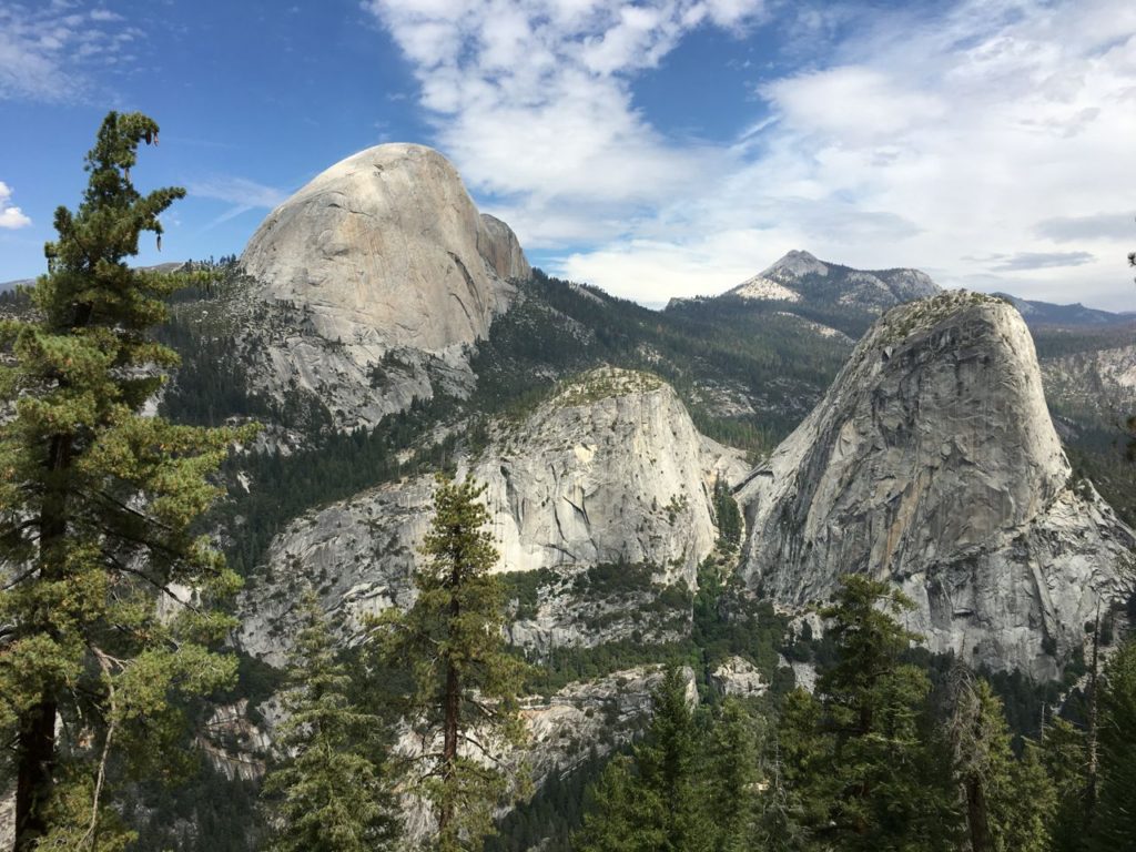
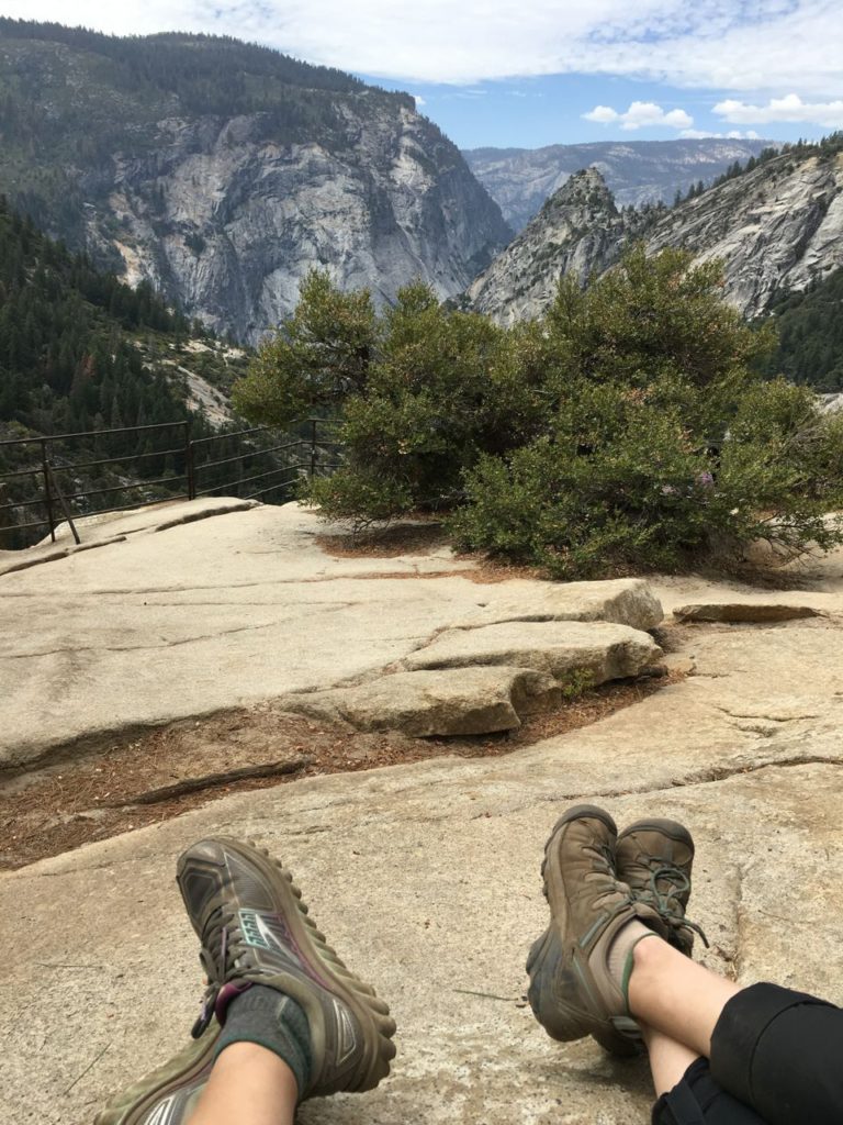
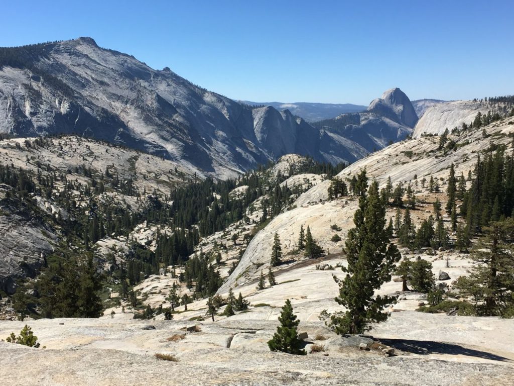
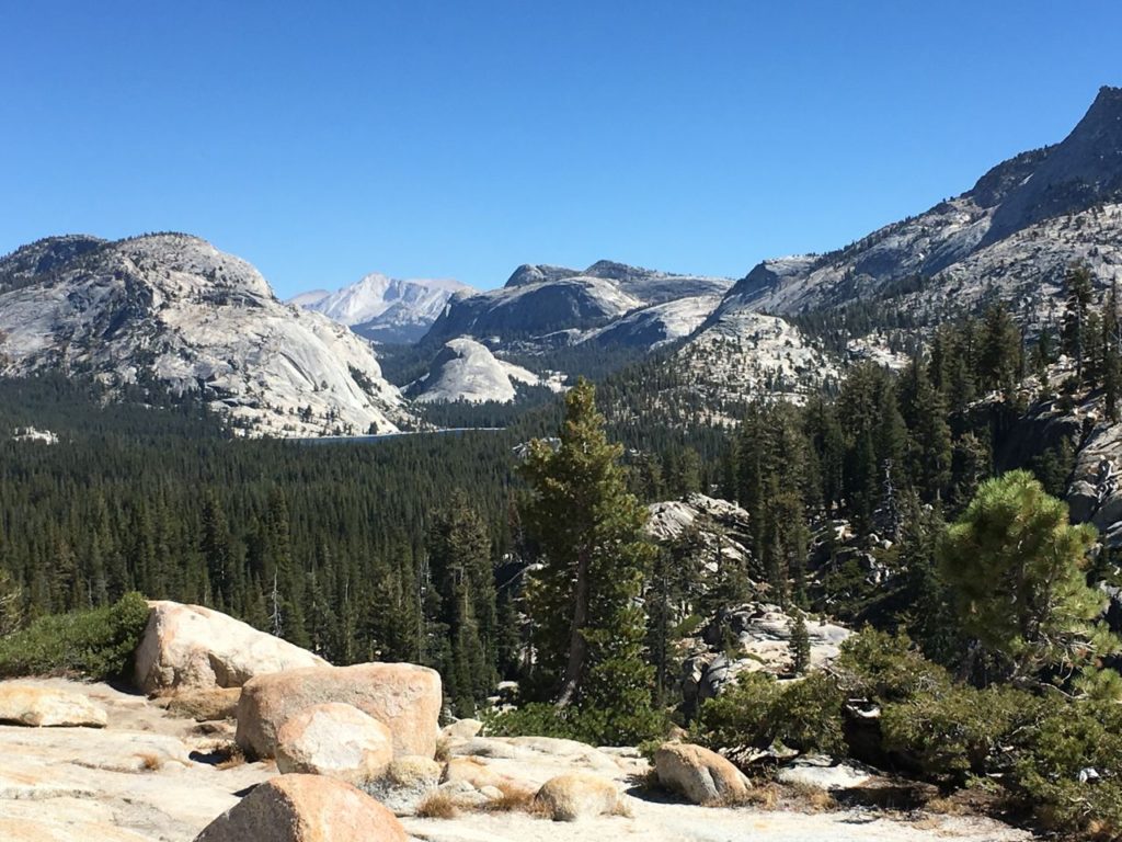
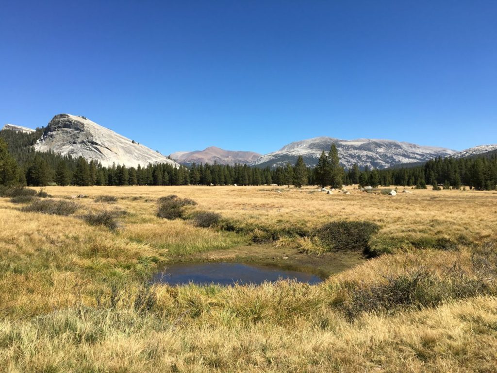
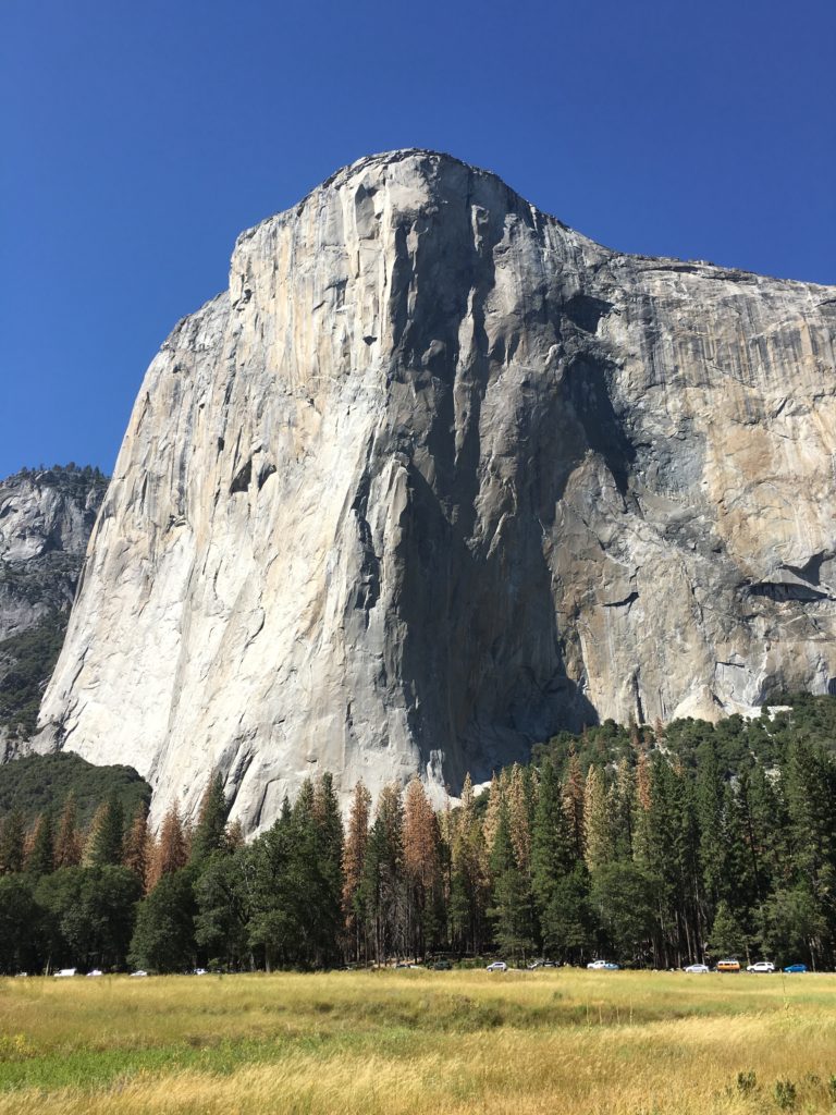
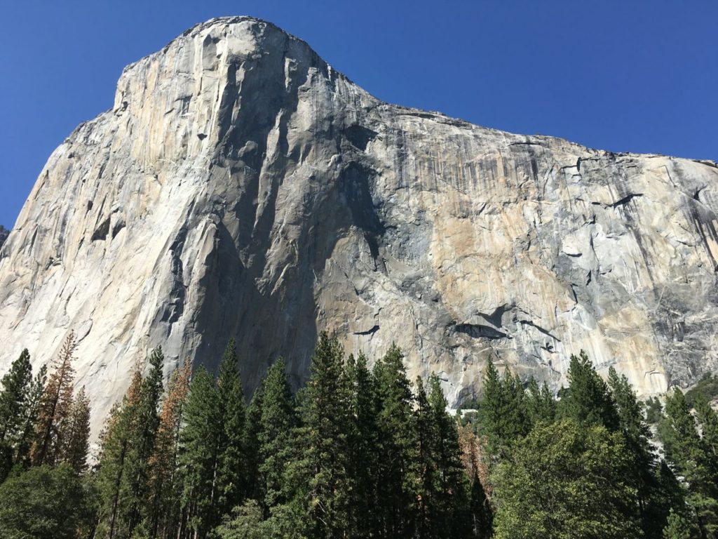
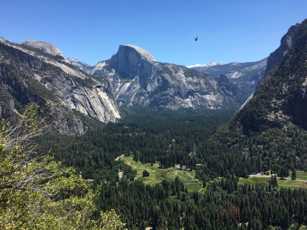
The vastness of Yosemite is difficult for the mind to grasp.  As we stood over the expanse of the valley where we slept below the pines each night, I had the same feeling as when I stand beside the water at home.  Smallness.  The fragility of humanity in perspective to the greatness of the monoliths, the power of the rivers, and the depths carved by glaciers.

I didn’t know it at the time, but we were watching falcons fly through the skies as they dove into the valley below.  My favorite picture from this whole trip is the one where I accidentally captured a falcon in flight.  We saw the birds on several occasions, some flying in pairs in perfect tandem before diving so fast that we lost sight of them as they plummeted.

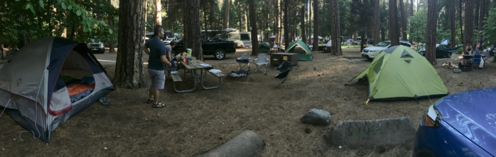
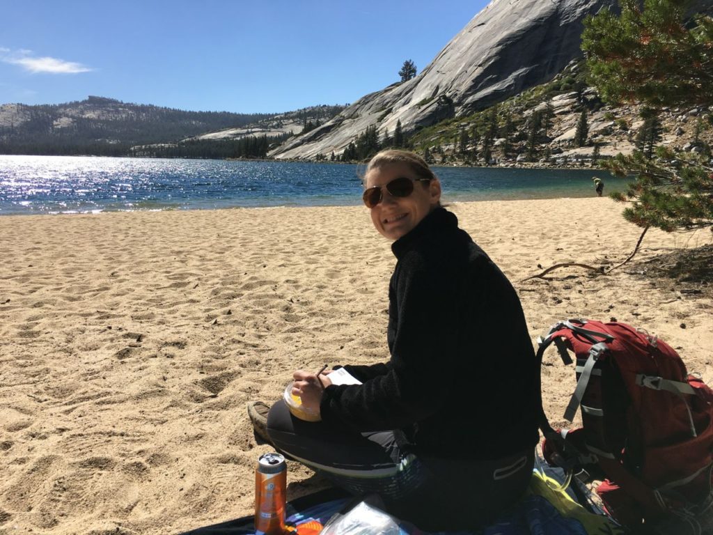
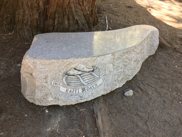
We hiked back down to Camp 4 and refilled our water.  I noticed a memorial in the shade of an immense rock called the Columbia Boulder.  When we got back home I was able to look up some information on Raffi Bedayn.  What an incredible person.  Another hidden treasure we never might have seen if we hadn’t needed water.

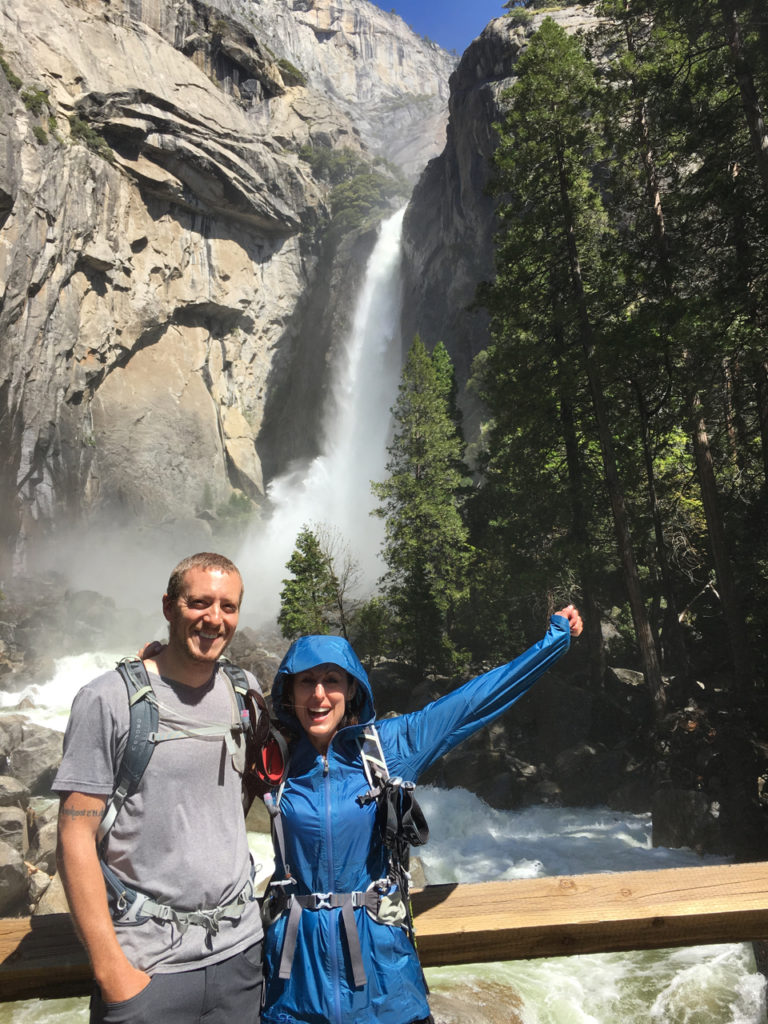
We headed back to lower Yosemite Falls for some misty refreshment and to soak our aching feet in the icy stream at the bottom.

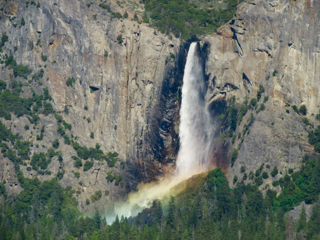
After feeling somewhat revived Alicia, Rob, and I decided we wanted to keep hiking, so we headed up to Sentinel Dome.  On the way there we passed Tunnel View just as the sun was playing color games at the base of Bridalveil Fall.

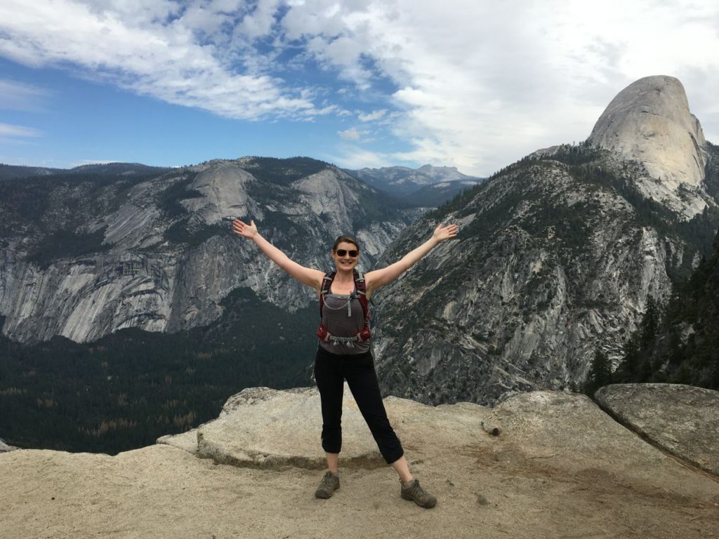
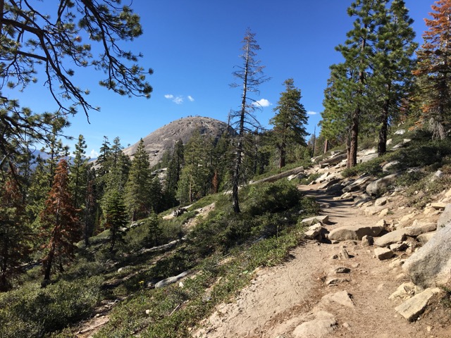
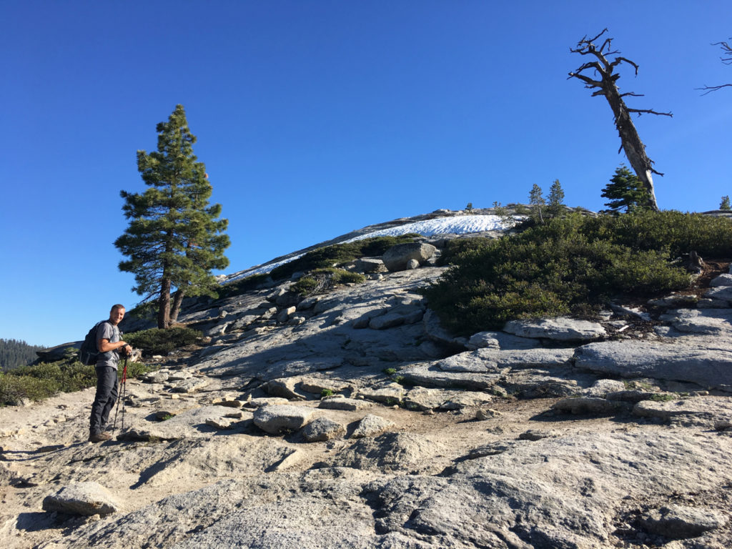
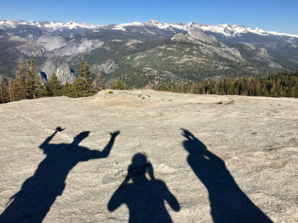
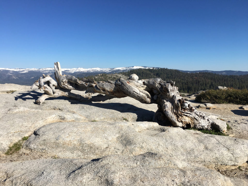
Sentinel Done was a destination for Alicia and I back in September, but we missed a turn-off in the trail coming from Glacier Point, so we never actually reached the dome and walked way past it.  This was a redemption hike for us, and I’m so glad we did the extra couple of miles.  The trail to Sentinel Dome is unimpressive, sandy, boring…about the most exciting thing to see are the tiny lizards darting over sun-warmed rocks.  When we walked up to the back of the dome, again the signage was nonexistent so we weren’t quite sure how to proceed.  To the right, you cross a road and keep going around the side of the dome till you eventually come to a place where you can climb up to the top.  While this was a steep climb, it was by no means treacherous.  There was still snow up there, but the rock was dry and we easily made it to the top.

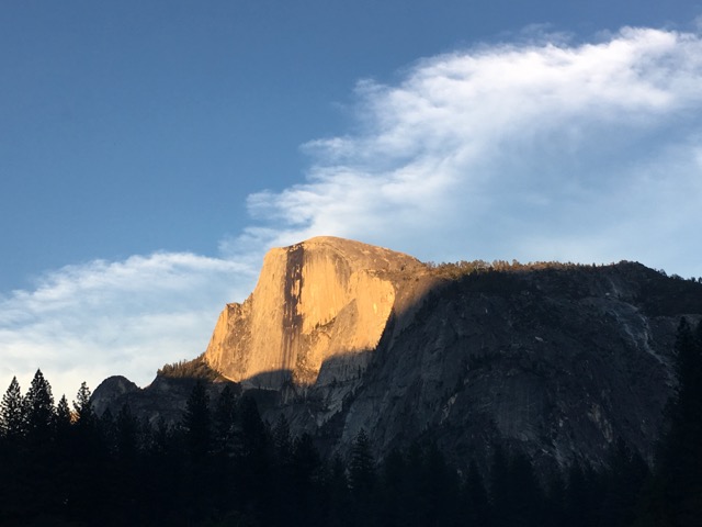
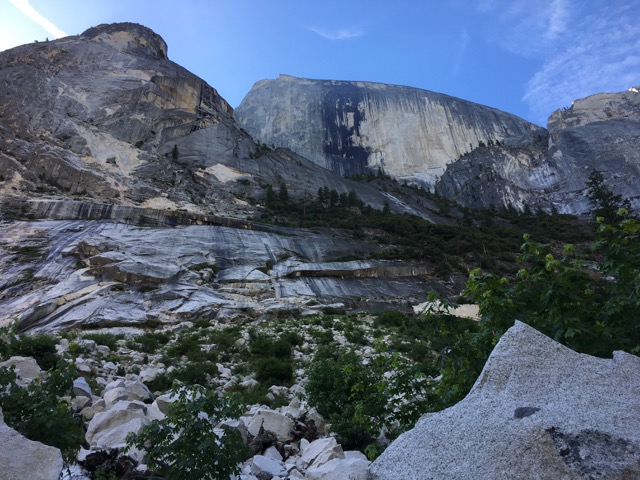
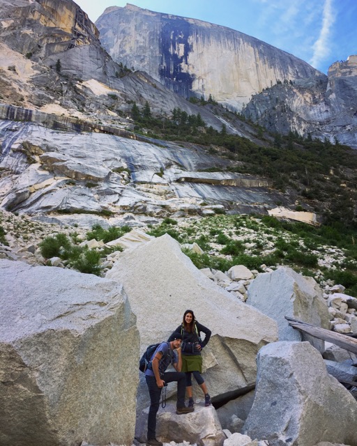
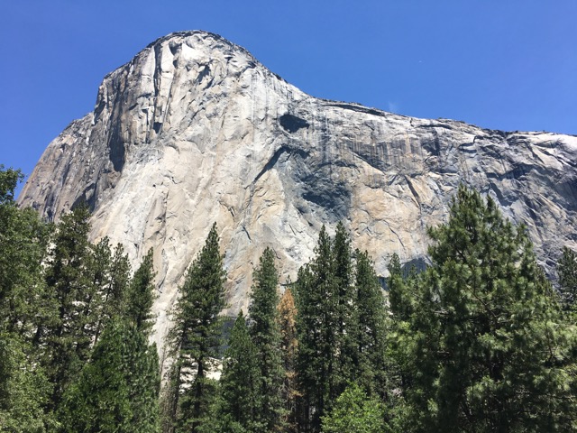
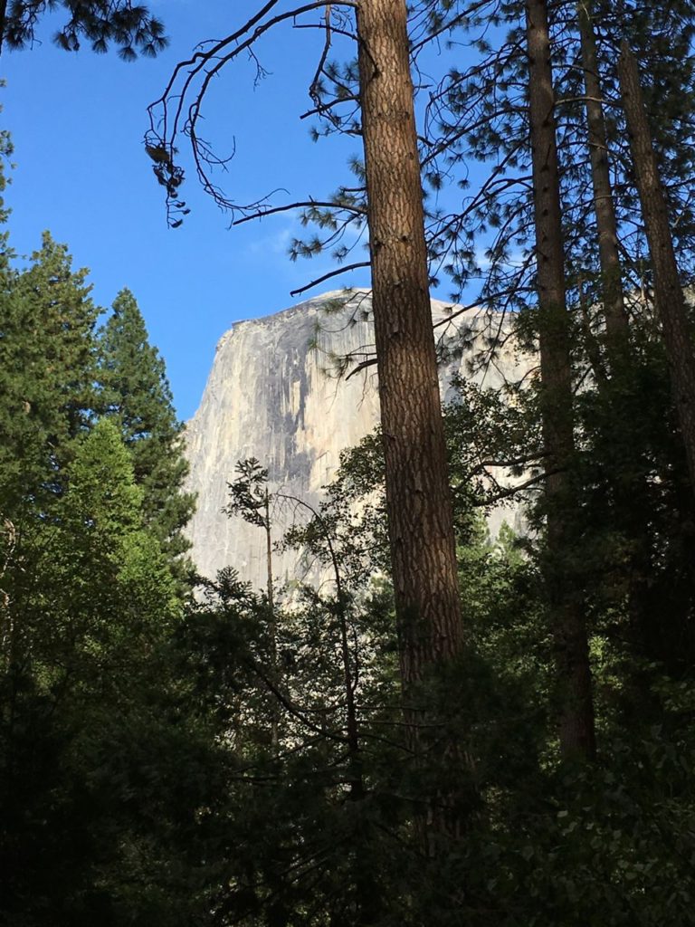
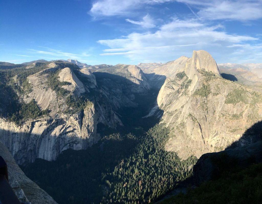
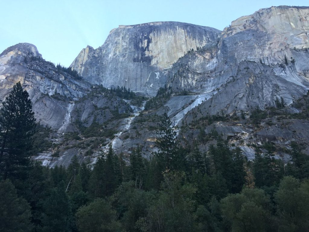
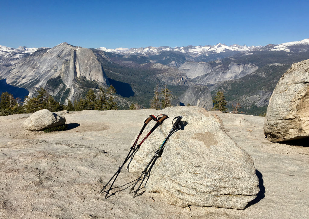
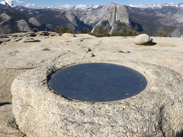
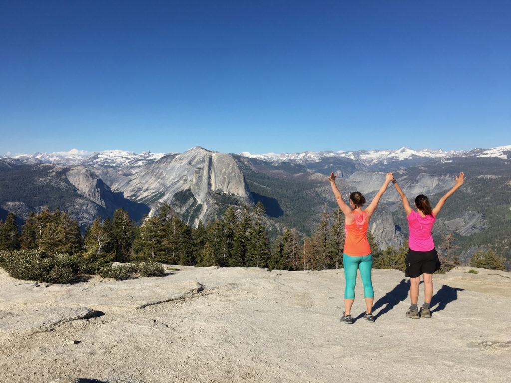
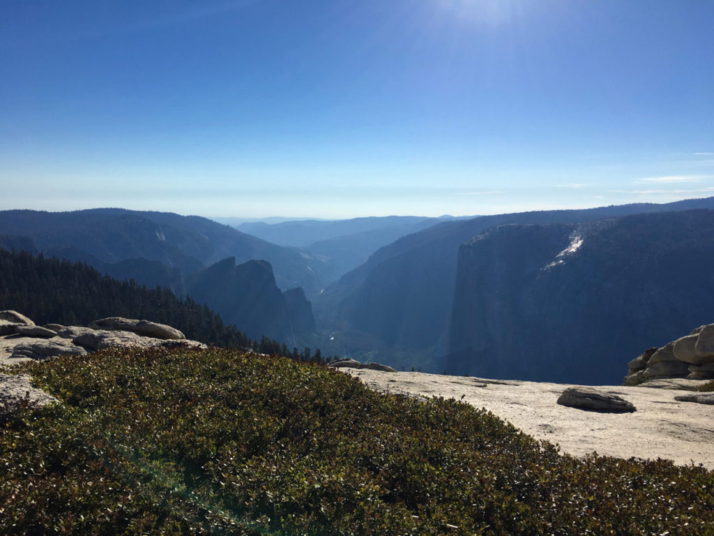
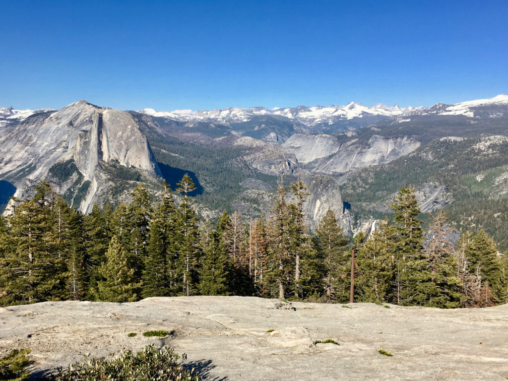
When we crested the dome, I stood there in shock and eventually cried because the scope of breathtaking beauty that exists on top of that oddly shaped rock is something I want to remember forever.  Half Dome’s side faces Sentinel, the snow covered Sierras provide a grand backdrop, Yosemite Falls is on display in full view, and El Capitan looms in the distance on the other side.  It’s the most majestic 360 degree view anyone could hope for.

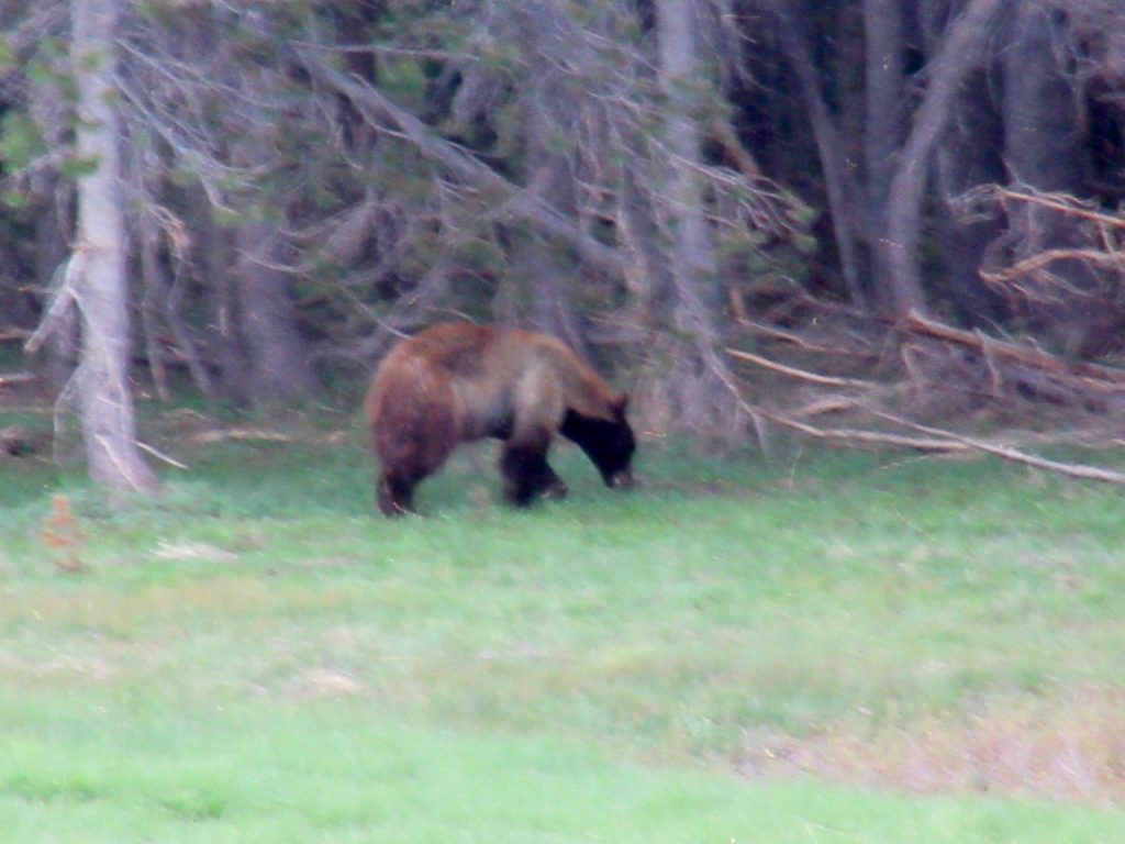
Heading back on Glacier Point Road we passed a traffic jam because there was a huge black bear in a meadow right near the tree line.  This is a terrible picture because I zoomed in a lot and he was moving around, but he was my first brown black bear!

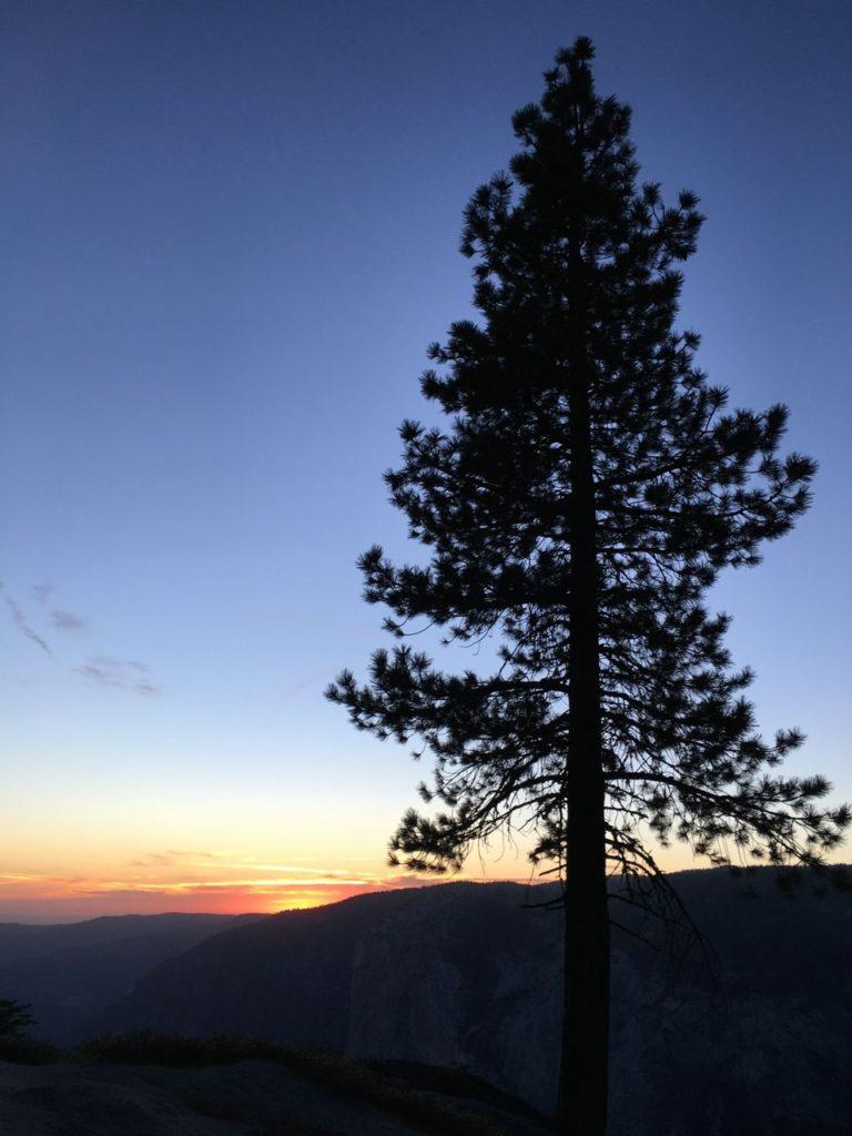
Half Dome bids us good day and good night…

Filed Under: Hiking, Travel Tagged With: Camp 4, Sentinel Dome, Yosemite, Yosemite Falls, Yosemite National Park

Yosemite: Mirror Lake, El Capitan Meadow & Bridalveil Fall

July 7, 2017 by Leah Leave a Comment

If someone had told me I would go to Yosemite twice in the span of a year, I would have thought them overly optimistic.  But thank goodness for friends who love to travel because last September, I went with Alicia and we scouted the place out.  Along for the ride this time were my husband Rob, and friends Solomon, Aidan, and Myra.  The two trips could not have been more different.  In September, California was struggling through a long drought.  Yosemite Falls was dry as a bone and the other waterfalls and streams in the park were at their lowest, some with just wisps of water blowing in the valley winds.  We were also able to travel up Tioga Road to Tuolomne Meadows and spend some time at Tenaya Lake.  In June, however, the tune of the wilderness had changed to one of rushing waters and birdsong, with wildflowers bursting, rivers sprawling out into campgrounds and meadows, and bears munching their way through grasses.  Toiga Road was closed due to the continued plowing of a record snowfall year.

We flew into Oakland, rented a car and drove to Yosemite where we stayed in the North Pines campground.  We had snagged a reservation in an RV-only site, and while I was initially apprehensive about this, the site worked out just fine for tents.  It was a postage stamp of a campsite and we were pretty much on top of our neighbors, but it didn’t matter one bit.  We had made it to Yosemite.  Since we got there later in the afternoon, we pitched our tents and headed over to the Village store to pick up some provisions.  They have everything you could possibly need in the way of food.  For this trip I had packed a lot of dehydrated meals, some which I’d cooked myself and others like Mountain House.  I’d also brought enough bars, jerky, and packs of nuts for all of our day hikes.  The nice thing about the Village Store is they sell cold beer individually, have regulation firewood, and lots of meat options if you prefer not to keep a cooler at your site since space is limited in the bear locker.

The next morning we headed out to Mirror Lake and Happy Isles, a short walk from the North Pines Campground.  This is one of the easiest hikes in the park and is usually choked with people, so early is best. While I wanted to crush every hard trail in the valley, Rob and I were still recovering from a rough 23 mile weekend in the Smokies, which is less than we’d normally do.  Rough because the trails we did were mostly downhill and my body took a beating.  My hips were still sore and I had two heel blisters on each foot, one which was starting to feel painful and possibly infected.  Starting off on the easy trails gave me some time to recover while still getting out. The last time I was at Mirror Lake the ground was dry and we walked across the sand, around the grasses to  the other side.  This time, we could see perfect mirror images of the rocks above.  We continued on the trail to the rock fall below Half Dome, but opted not to go much further since hikers coming back were saying there was a swift stream crossing with nothing beyond it.  Along with the swarms of mosquitoes on this trail, we saw a pair of western tanagers, which are striking yellow birds that have a red head, plus a deer and some steller’s jays.

That same day we decided to take it easy and acclimate to the elevation, so we headed into the valley on the shuttle system and went to the visitors center, then headed to the El Capitan Meadow to see climbers and enjoy the perfect weather.  It’s nearly impossible to see climbers on El Cap with the naked eye.  Being the largest granite monolith in the world and standing as tall as three Empire State Buildings stacked on top of each other, it’s hard to get perspective on how massive the wall is until you see a human attempting to scale it.  I brought binoculars with me and we were able to view different groups of climbers on the various routes.  As rangers set up telescopes and prepared to answer onlookers’ questions, we also watched the climbers through Solo’s badass camera setup.  The week before we stood in this spot, Alex Honnold had achieved the first free solo climb of El Cap (as in he didn’t use a rope).  National Geographic is making a documentary about it and I am freaking excited to see it.  If you’re interested in climbing or want to get a better appreciation for Yosemite’s history Valley Uprising on Netflix is a must-see.

We stopped at Bridalveil Fall on the way back.  This waterfall never dries up, but it does does get down to the point were it merely blows mist off the cliff.  This time around, she was waving in the wind and soaking everyone gathered at her feet.

The rushing river below…

/wp-content/uploads/2017/07/IMG_1299.m4v

That night, Alicia and Myra were arriving late, so we headed out with Solo to get some night shots.  It’s always fun to have a photographer along.  He inspired us to see some different perspectives on the landscapes looming around us. That night we sat next to a river that had a view of Half Dome and another rock face to the right of us.  We could see climbers on both with their headlamps scanning the walls as some of them were descending.  The most enviable of all positions were the climbers camping on the sheer face of Half Dome just underneath the top of the dome.  We saw shooting stars and  listened to the constant roar of the stream, anxious to continue on its way, helping us send our worries about work and home along with it.

Filed Under: Hiking, Travel Tagged With: Alex Honnold, Bridalveil Fall, El Capitan, El Capitan Meadow, Mirror Lake, North Pines Campground, Valley Uprising, Yosemite, Yosemite National Park

Yosemite National Park: Wonders Of The Panorama Trail, Tuolumne Meadows, and El Capitan

September 28, 2016 by Leah Leave a Comment

There are too many  incredible places in this world to see, too many incredible places in our country to see.  And I don’t just want to see them, I want to experience them.  This year marks the centennial of the National Park Service and what a happy birthday it’s been.  This September, one of my best friends and I embarked on a ladies adventure to Yosemite National Park and I came home saying that it’s maybe my favorite place I’ve been to.  The stars seemed to align, literally, for this trip to happen the way it did, and even though it was Labor Day, the busiest weekend of the year at Yosemite, we didn’t feel dampened by the crowds because we timed everything right in terms of being in and out of the valley.  We camped at the North Pines campground after the stress-inducing ordeal of reserving a campsite five months prior, and we had a lovely spot near a stream and a view of Half Dome from our site.

img_0395

The day we arrived at the park, we did some exploring at the Village Store and the Visitor Center before setting up camp.  One thing I didn’t realize about the park is that they have every single thing you could possibly need for your trip: a grocery store, grills, markets, outdoor shops that carry stove fuel, clothing, and gear, a post office (!!!), and some really lovely gift shops, along with a very informative nature center.  The next time I go to the park I’m planning to purchase all food and fuel when I get there to save room/weight in the luggage.  The shuttle system in the valley is also excellent and the best bet is to park your car at your campsite and take the shuttle everywhere.  That’s what we did (except for the day we drove Tioga Pass Road) and we had little trouble getting around.

After we set up camp and had something to eat, we headed up to Glacier Point to take in the views and walk to Sentinel Dome for sunset.  We also stopped at the Tunnel View on the way up there, the quintessential Yosemite postcard vista.

img_0398 img_0429

We found the trail leading to Sentinel Dome, but quickly discovered that signage in Yosemite is a dicey.  They have these old metal signs that are mysteriously absent at junctions in trails, leaving one to scratch their head and wonder in which direction to proceed.  Unfortunately for us, the turnoff for Sentinel Dome wasn’t an obvious one and the sign pointing the way was placed up in the trail, so we walked right past it without even noticing.  As the sun got lower and lower and we walked farther and farther, it became apparent that we needed to take our pictures, eat a quick snack, and head back.

img_0423

We’d actually been on our way to Taft Point without realizing it.  So we still saw a lovely view, but walked a ways in the dark (thank God for headlamps!!!) until we came back to where we’d started at Glacier Point.  As we rounded a bend we ran into a man who invited us to the “star party” that happens every Friday and Saturday night at the Point.  Different Astronomy groups set up high powered telescopes and view the stars from one of the most spectacular vantage points in the whole place!  We were able to see Saturn, a green nebula, the Andromeda Galaxy, the Hercules star cluster, and the Milky Way.  One missed turn in the trail made way for a really cool experience we won’t soon be forgetting.

The next day we woke up early and caught the bus headed to Glacier Point where we would take the Panorama Trail all the way back down to the valley.  There is no shuttle that goes between the valley and the Point so you have to get a one way ticket for $25 that can be booked in advance.  I’m so glad we did this because it not only saved us 32oo feet of elevation climb, but we also ended up with a really knowledgeable bus driver who’d worked at the park for 30 years and told us tons of factoids about its formation, geology, and of course, John Muir.  It was a fascinating way to wake up on the way to a trail!

img_0433

I can’t accurately describe how incredible the Panorama Trail is, but in John Muir’s book The Yosemite it’s one of the things he suggests doing if you only have a day in the park.  You can take the 4 Mile Trail up to Glacier Point, and I’ve heard this is spectacular, but the elevation gain is around 3000 feet before you even start the 9.4 miles that lead back to the valley.  So we started at Glacier Point on a clear day with views as far as the eye could imagine.  You basically traverse the upper edge of the valley and see Half Dome from one side to the other.

img_0447

It was an incredible hike that was mostly downhill, except for a 700 foot elevation gain somewhere in the middle.  Shortly after Illilouette Falls we took the unmarked trail to Panorama Point for a breathtaking view of Half Dome and the valley.  It was really too much for the mind to grasp because you are trying to comprehend massive depth and height all at the same time.  Apparently there used to be a guard rail here at one time, but it fell off and is hanging on the mountain, but we didn’t hang over far enough to see it.  We heard hikers passing the unmarked trail and couldn’t help but feel sorry for them because they were missing the most gorgeous view on the trail.

img_0468 img_0494img_0504

As we continued on we headed to Nevada Falls which was quite a force to be reckoned with in spite of it being at its lowest point in the year.

img_0516 img_0526 img_0530 img_0551

If we’d been smart, we would have just taken the John Muir Trail back to the Valley at this point, but we headed to Vernal Falls, which was meh at the top, choked with foolish people swimming in the Emerald Pool.  Also, we had to take the mist trail from Nevada to Vernal and I kept praying we wouldn’t get injured along the way.  This is an extremely tough walk down “steps” that aren’t really steps that are covered with sand so it’s hard to gain traction.  I can’t stress enough how careful we had to be, and it’s no surprise that people die on this trail each year, and we weren’t even near the part that goes next to the waterfall and is often slippery.  So instead of going down the rest of the Mist Trail we opted to back track to the John Muir Trail and take that down to Happy Isles.

img_0537 img_0563

Again, this was tough because at one point this trail was paved, but now it’s just covered with sand, so I was incredibly thankful to have my trekking poles to at least stop me from slipping in my trail runners.  My knees were aching by the time we reached the bottom, but the satisfaction of seeing the sign where the JMT begins was a moment for me.   I cannot recommend the Panorama Trail highly enough.  If you have the energy and are able, do it.  The views are unmatched.

img_0567

The next day we headed to Tioga Pass Road, which was another heart stopping experience.  The sheer beauty of the Sierras reached deep into my soul, and the peace of Tuolumne Meadows made me realize why so many people prefer the PCT over the AT.  It’s just a different landscape that is more open and humbling.  Since Mariposa Grove is closed for renovation, our best option was the Tuolumne Grove.  We did this first thing in the morning while there was still plenty of parking in the lot and we were so glad we did.  The hike in is all downhill, so be prepared for a decent lung workout on the way back.  The first sight of a giant sequoia just stopped me in my tracks and made me so excited, I still can’t even believe these trees!!!

img_0587 img_0593 img_0624 img_0625

They are the oldest living beings in the world and they are of such width and breadth that even now as I think about how awesome these trees are, I can’t wrap my head around their sheer “bigness.” In the shadow of these trees, standing there like a mere speck on the ground, one gets the sense of humanity’s frailty.  Some of these trees were around before Jesus was.  When I stare up at a tree that has lived through fire, flood, drought, and literally stood the test of time, it makes me feel oh so small and oh so thankful for creation, for the natural world, and places like Yosemite that are doing all they can to preserve these wonders for future generations.  I’ve been told the Mariposa Grove is much more impressive, but this small section of the park is well worth seeing if it’s the only chance you will have to stand amongst the giants.

Next stop was up at Olmstead Point which surprised me because I didn’t realize the role that Frederick Law Olmstead played in the planning of park.  He was such an incredible man whose fingerprints are all over the American landscape, but in urban areas and in the wilderness.  The view from this point is epic and I was kicking myself for not having binoculars because you can actually see the climbers on Half Dome from here.  If you walk the .3 miles to the overlook, you can also see Tenaya Lake from the far side.  Again, the Sierras just grabbed hold of me in this spot.

img_0647 img_0660

We drove past Tenaya Lake and headed straight to the visitor center where we were able to get some info on where to head.  One of the saddest factoids we learned here is that 75% of people who visit Yosemite never go further than 1/4 mile from their car the entire time they are in the park.  This is astounding because I can’t imagine how much you’d miss if you didn’t explore just a bit more.  It made me so glad that we weren’t part of that demographic.  We got some great advice here that I will pass on.  Head on over to Soda Springs and Parson’s Lodge.  There is a parking area where you can park and walk in, then from the lodge it’s .75 miles to the visitor center across the river and a lovely bridge that leads to a trail through the meadow.  The sun was shining, the picket pins were popping their heads up out of the golden grasses, and the little dippers were wading in the stream as trout swam by.  If ever there was a place that personified the word “ideal” this would be it.  We took the trail to the grill where we got some great ice cream cones before heading back to the car.

img_0682 img_0695 img_0700

Tenaya Lake was next on the list, and what a sparkling, cerulean blue oasis.  We sat in the cold wind on a sandy beach with water lapping at the shore as climbers tackled the dome in the distance.  Luckily the water was low enough for us to cross over to the trail that goes around the lake.  Then we caught the shuttle back to our car.  Peace and tranquility own this place.

img_0724 img_0728 img_0732 img_0745 img_0746 img_0747 img_0758

Obviously there is so much to do at Yosemite that it’s hard to do everything, but we sure tried.  The next day we headed down the trail from our campsite to Mirror Lake which was almost completely dried up and was henceforth known as Mirror Puddle.  The view of Half Dome from this vantage point is stunning.  The face stares down at the Puddle and when it is a Lake, the reflection is perfect.  We then headed back to the Happy Isles Nature Center which was a wealth of information and we nerded out on factoids we’d been missing, such as types of tree bark and scat we saw on the trail.

img_0785 img_0791 img_0793

We also headed down to the Majestic Yosemite Hotel which is really the Awahnee, but some name issue has messed everything up at the park.  We had drinks on the veranda and wrote postcards in the shadow of the pines.  We also used an obscene amount of hand soap in the bathroom since it had been quite a long time since we’d used a warm faucet.

img_0797

My parents’ trip to Yosemite overlapped ours by a day, so we met up with them for dinner, but before that I wanted to go stare at El Capitan because it is utterly mesmerizing.  It’s the largest granite monolith in the world and its height is the equivalent of three Empire State Buildings end to end.  There were some climbers on the ground with a telescope so we could so the climbers on the wall.  They answered lots of questions and showed off their muscles for all the ladies.  El Cap…

img_0811

img_0810

Standing in front of Yosemite Falls at dusk.  Totally dry.

img_0822

The morning we left Yosemite, Alicia and I were wondering what we would see that day.  Our campsite was a haven of fun activity.  We saw mama deer walking their babies past.  Over a dozen Merganser ducks swam by in a line through the stream one day.  And on our last day, we were not disappointed…

img_0826

Next year, I plan to go back here with Rob and another friend.  I want to see this place again, to feel the way I felt when I was there, to experience the awe that so rarely infiltrates daily life.  Yosemite is a place of wonder.

Filed Under: Hiking, Travel Tagged With: El Capitan, John Muir, John Muir Trail, Olmstead Point, Panorama Trail, Tenaya Lake, Tioga Pass Road, Tuolomne Grove, Tuolumne Meadows, Yosemite, Yosemite National Park

Copyright © 2025 · Foodie Pro Theme by Shay Bocks · Built on the Genesis Framework · Powered by WordPress