• Skip to primary navigation
  • Skip to main content

Edges Like Sea Glass

By Leah LaRocco

  • Home
  • Blog
    • Thoughts On Life
    • House & Home
    • Gardening
    • Travel
    • Hiking
  • Marking The Miles
  • Contact
  • Subscribe

trees

Hiking The Fiery Gizzard And Surviving…Barely.

October 28, 2014 by Leah Leave a Comment

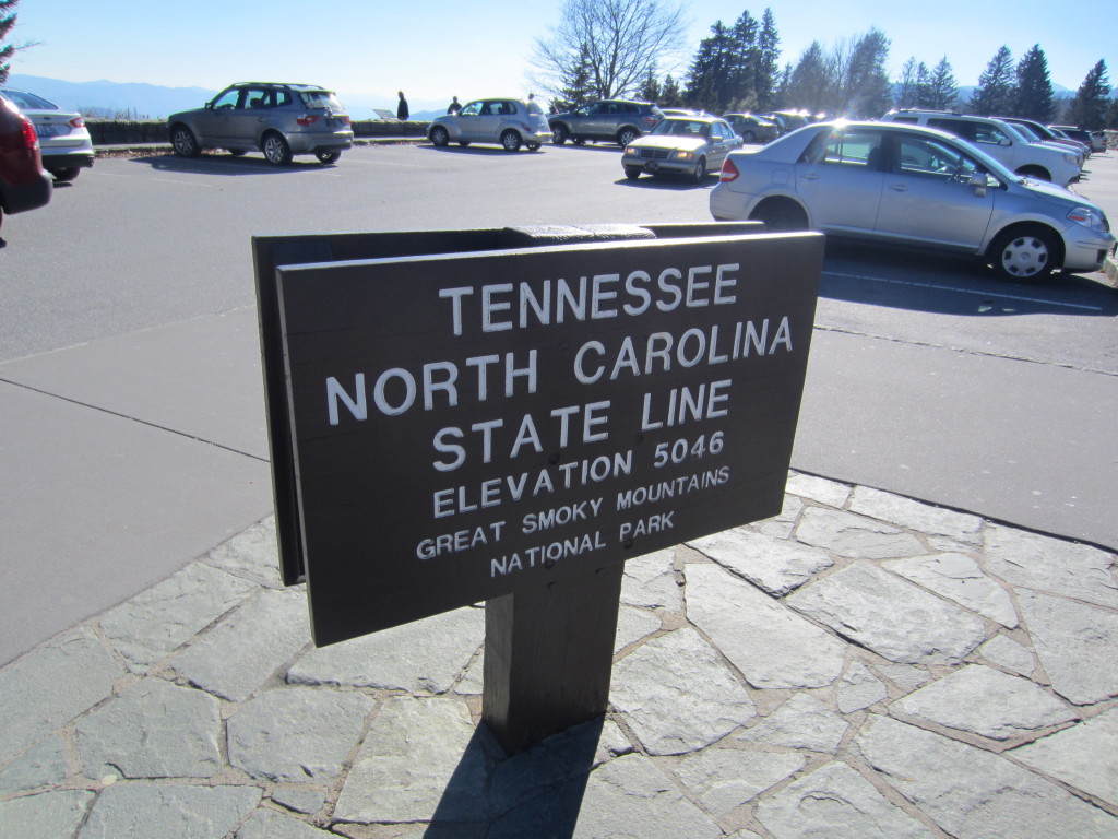
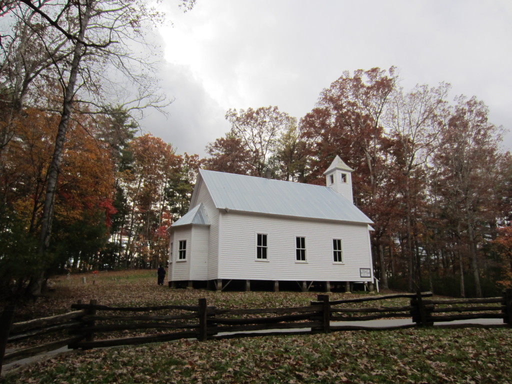
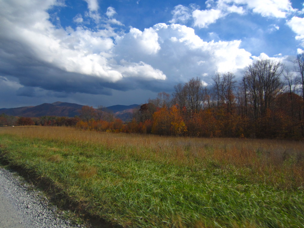
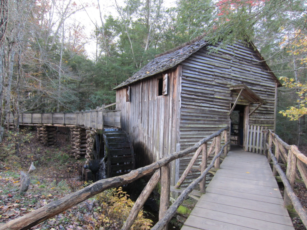
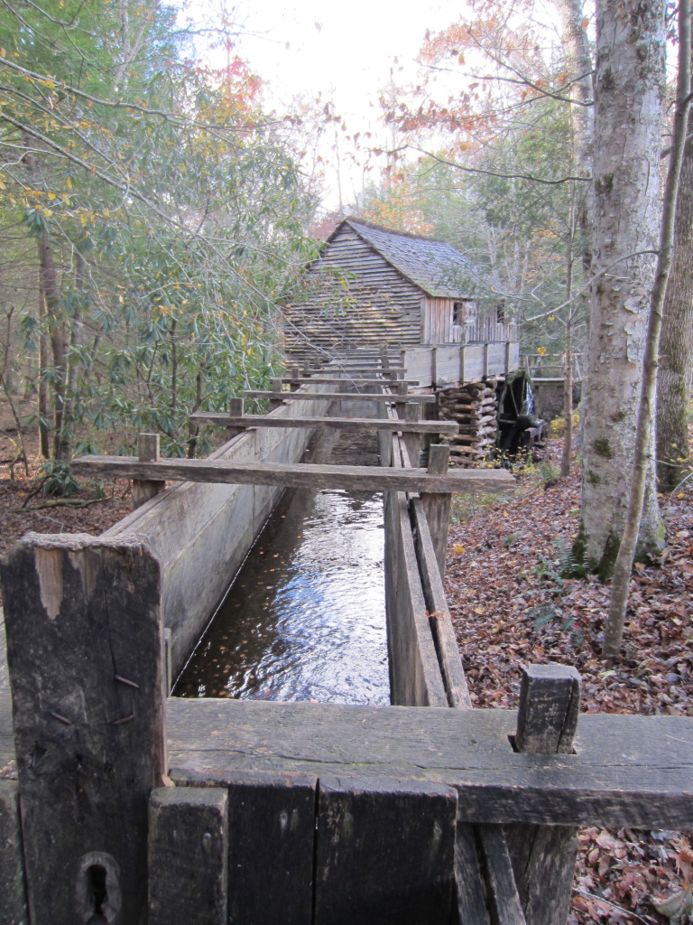
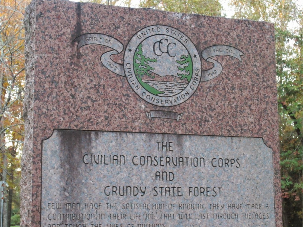
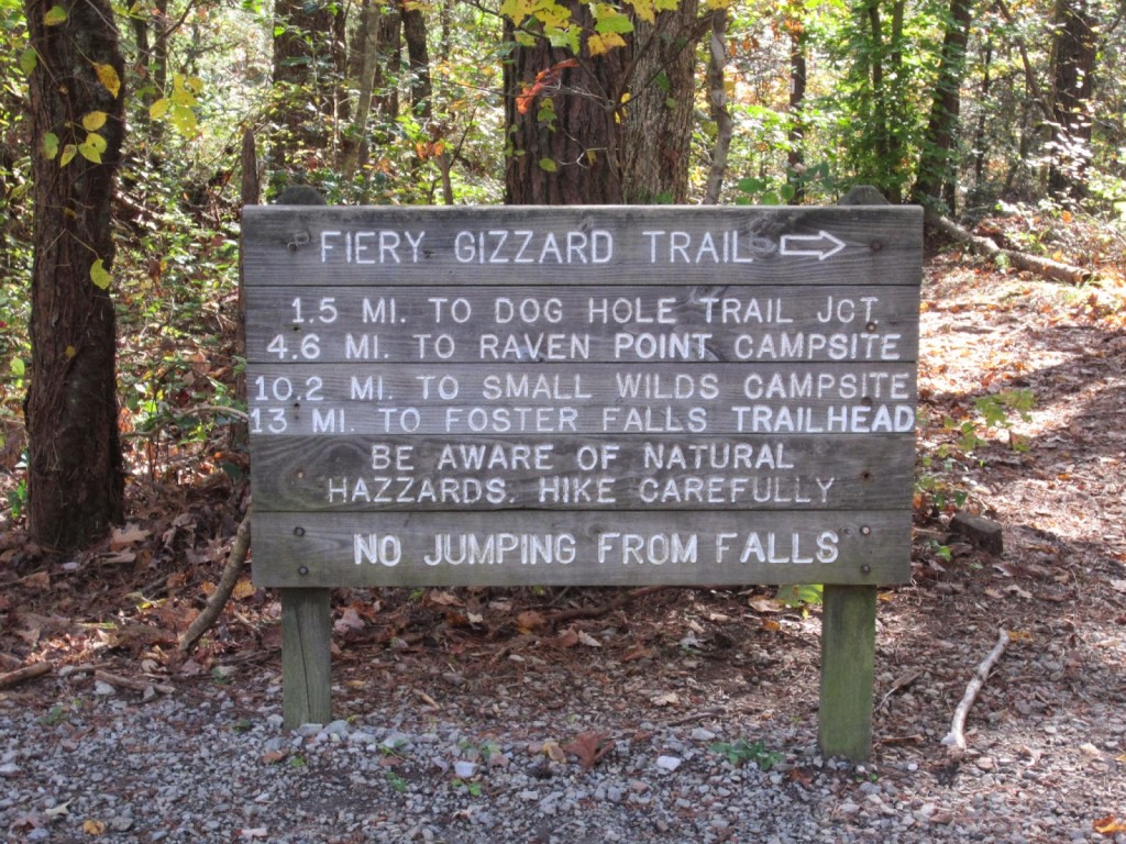
This past weekend, we had a camping adventure with some friends.  We went up to Tracy City, TN and stayed at the CCC campground right next to the Fiery Gizzard Trail.  On Saturday we hiked 11 miles round trip to Raven Point on a trail that has a difficulty rating of 8 out of 10 and is one of the top 25 trails in the US.  Needless to say, we brought a lot of Advil.  Everything hurts, but we had an awesome time and all of us left excited about what our next trip might be…with the caveat that the trail be half as long.

IMG_4218-1 IMG_4207-1

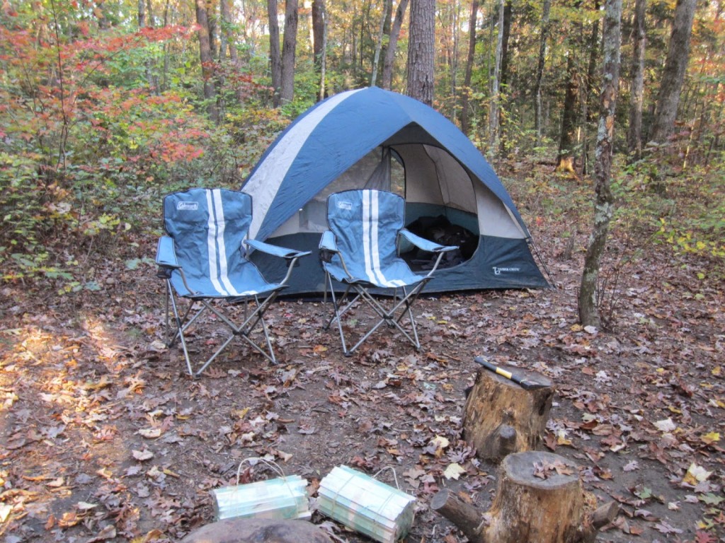
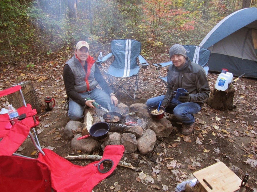
We met Brandon and Shelly up at the CCC campground on Friday night to set up camp with the tents.  We brought plenty of food to cook on the fire.  Thank goodness for the fire!  It was a crazy 45 degrees on Friday night, and while this seems like a piddly, warm temp for all you experienced hikers out there, this was freaking freezing for someone like me who is cold when it’s 80 degrees outside.  I found a 20 degree rated, down Marmot sleeping bag on Sierra Trading Post when they were having a big sale.  Thankfully, the only thing freezing that night was my nose.

IMG_4226-1

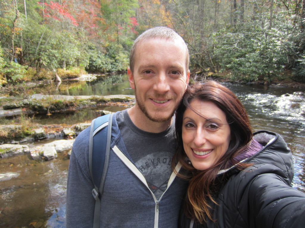
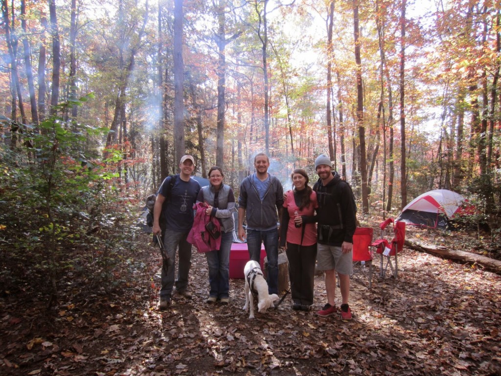
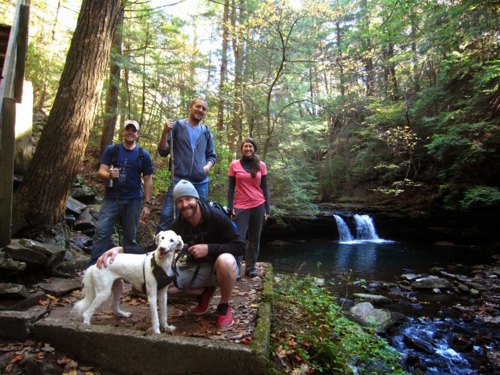
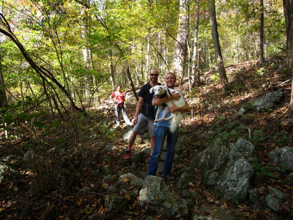
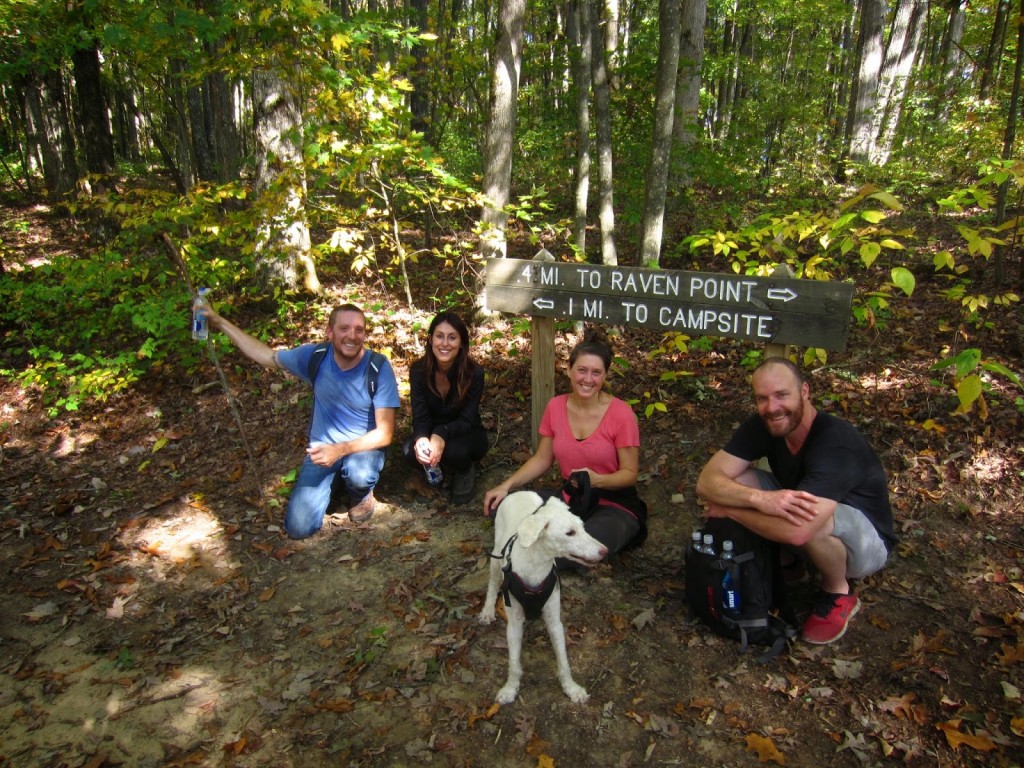
The crew: Brandon, Shelly, Rob, Jessie, Seth, and our mascot, Ben, who was a brave little doggie trooper.

IMG_4228-1

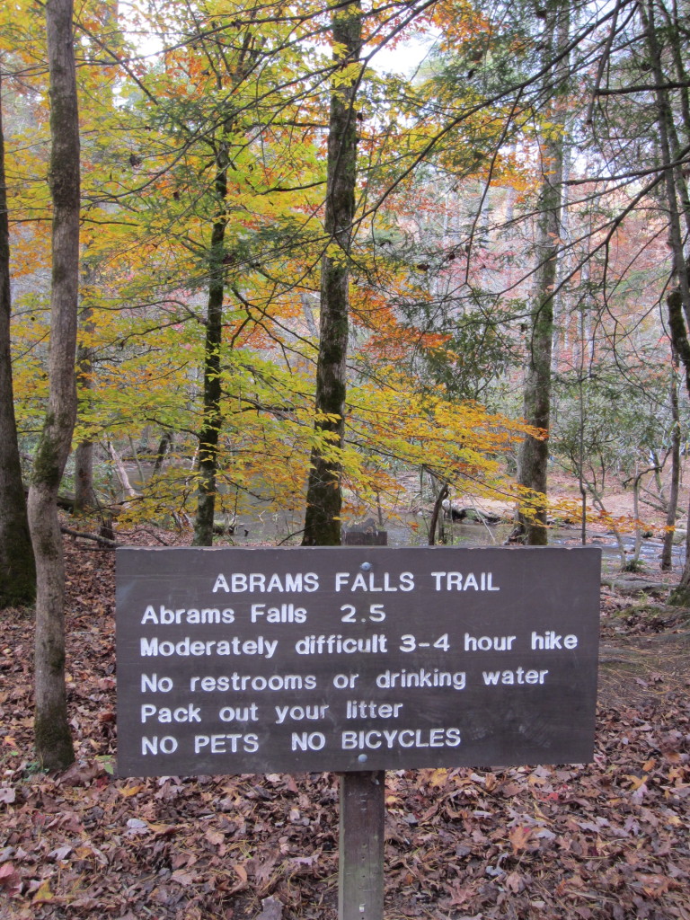
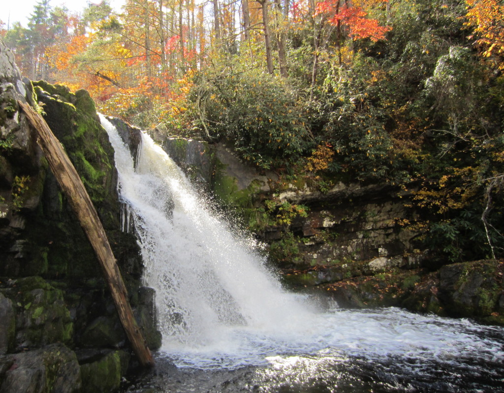
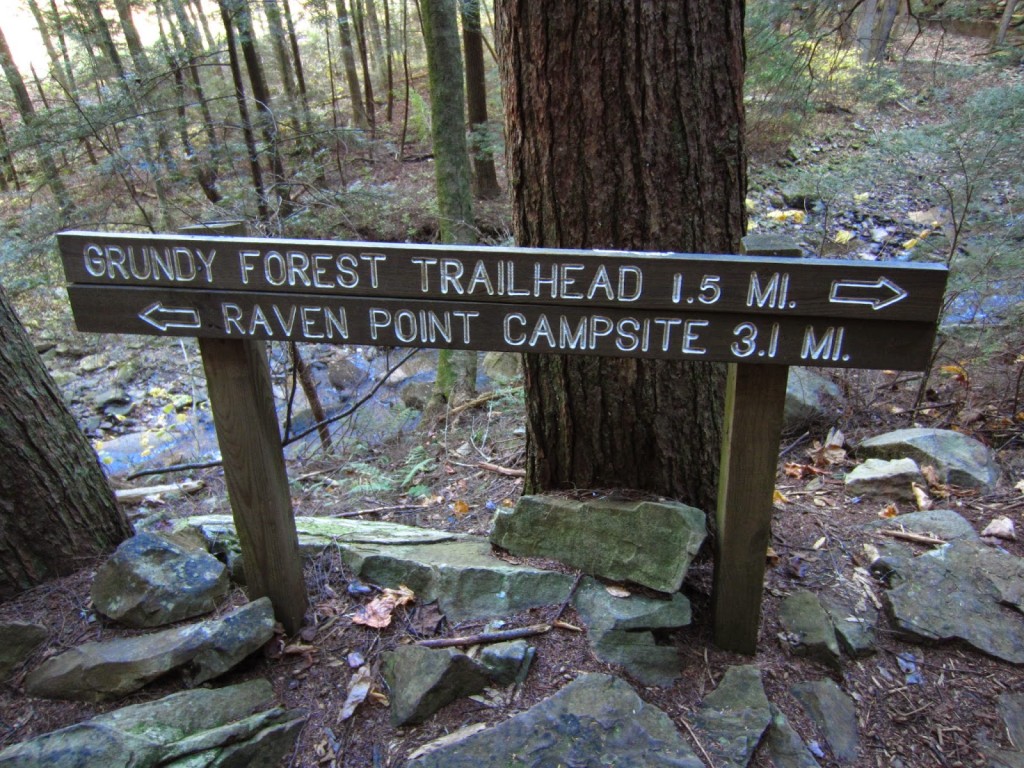
We went up to Raven Point which was .4 miles in the opposite direction from the campsite.  Obviously anyone who hikes to Foster Falls has a death wish or hates themselves a whole lot.  You may think it’s silly that they have to specify not to jump from the falls, but there was a rescue the day we hiked for a guy who had gotten too close to the edge of a waterfall and fallen 30 feet.  Hopefully he ended up being ok.

IMG_4232-1

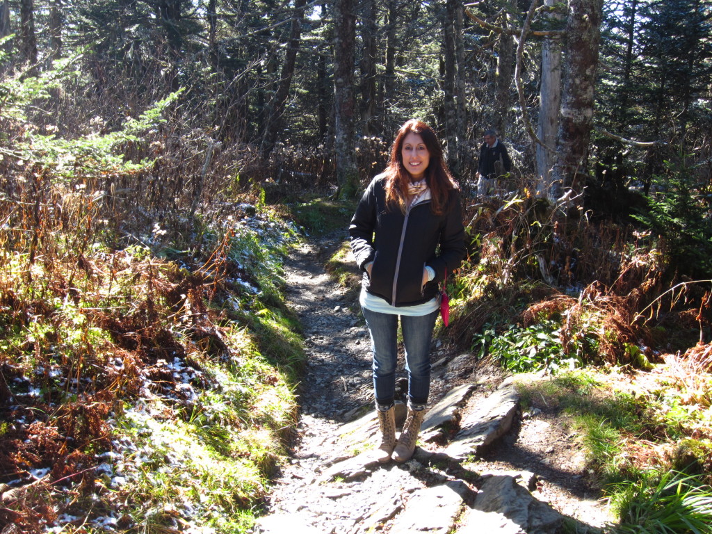
When you first start on the trail you think, “Oh this is so pretty and not hard at all…”  You say this internally, all smug and confident, and you smile for pictures in front of pretty waterfalls…

IMG_4237-1

Even Ben is like, “I’ve got this, you guys.  You humans have nothing on me…”

IMG_4247-1

IMG_4436-1 IMG_4262-1

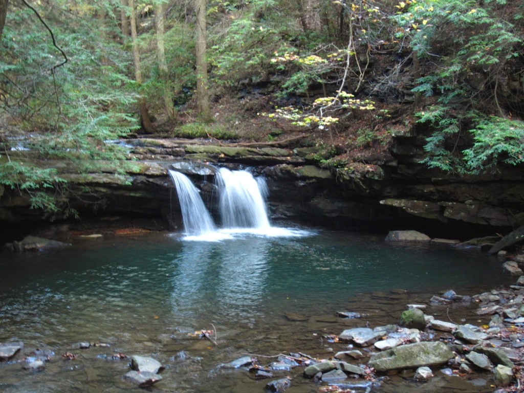
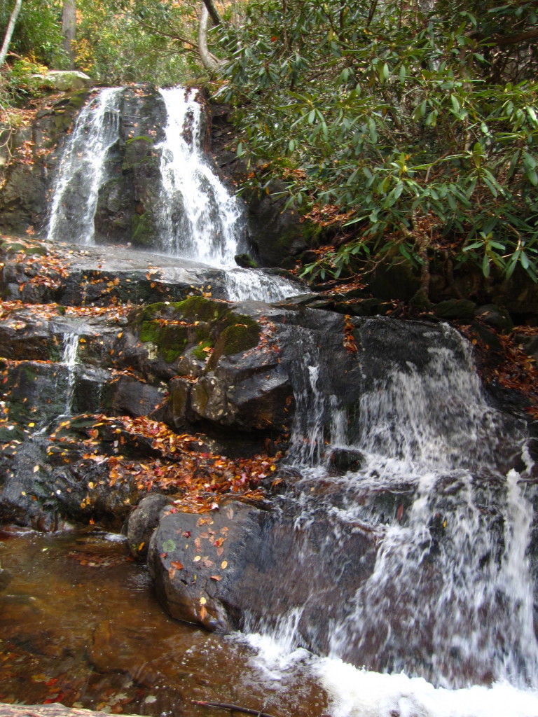
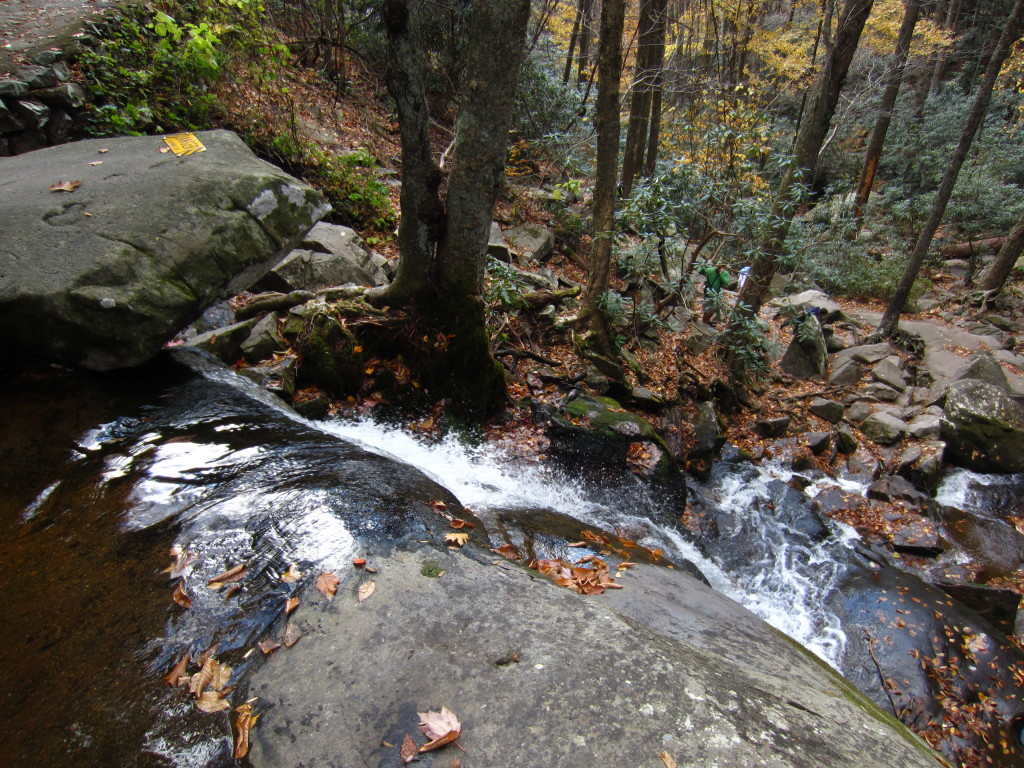
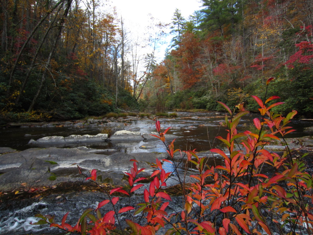
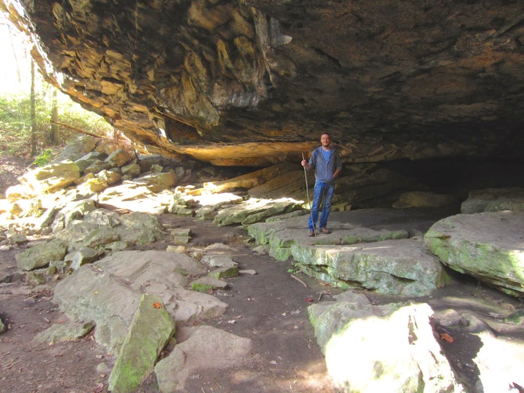
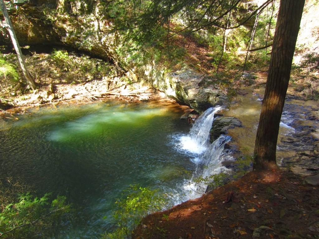
Along the main trail, there are some offshoots where you can see the occasional overlook or waterfall.  One of our first diversions was Sycamore falls, worth the extra 10 minutes for sure.

IMG_4270-1

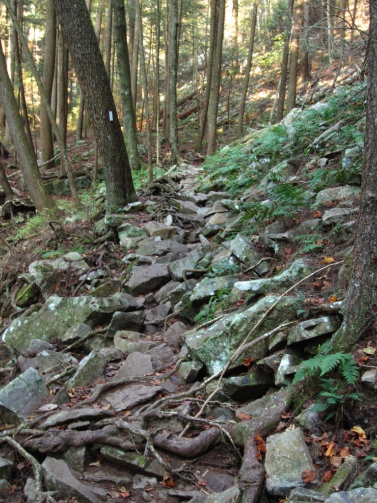
You come to a point in the trail where you have to make a decision that will affect the rest of your day, along with the shape your muscles will be in for the next few days.  The question was: take the hard trail first and the easy trail back? Or, take the easy trail up and tackle the hard part on the return?  We made the right choice, we took the hard way up to Raven Point, enabling us to book it back on the Dog Hole Trail and eventually to our campsite before it got dark in the woods.  I cannot imagine the predicament we would have been in had we been going downhill across rocky trails as the light was fading.

IMG_4276-1

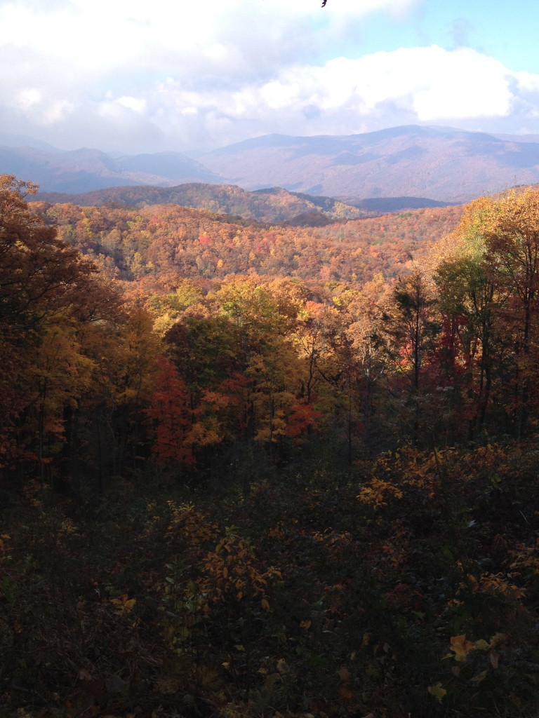
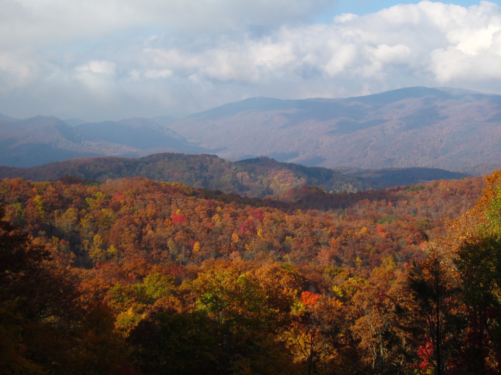
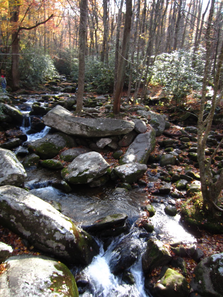
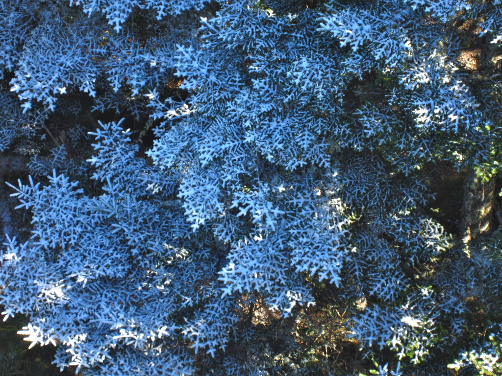
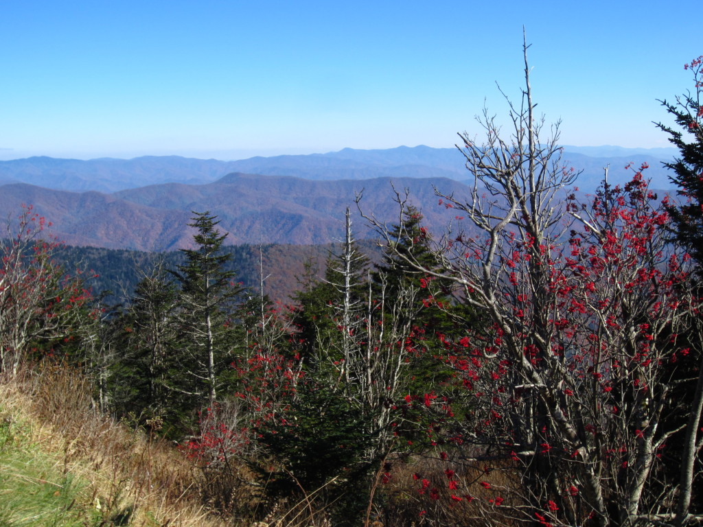
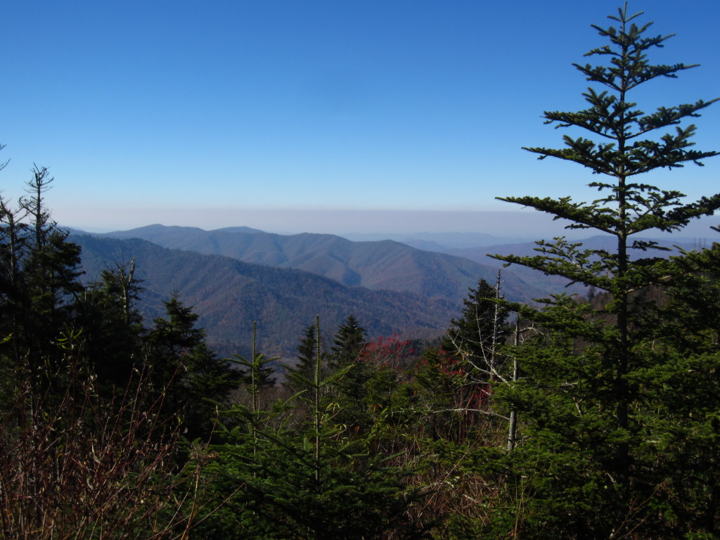
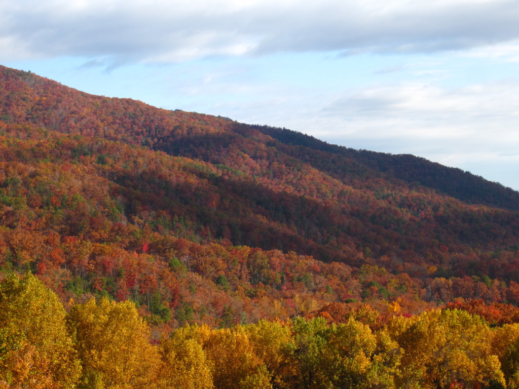
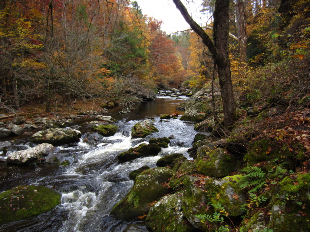
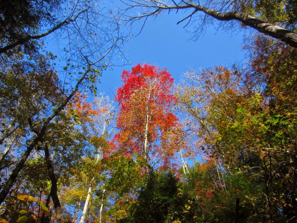
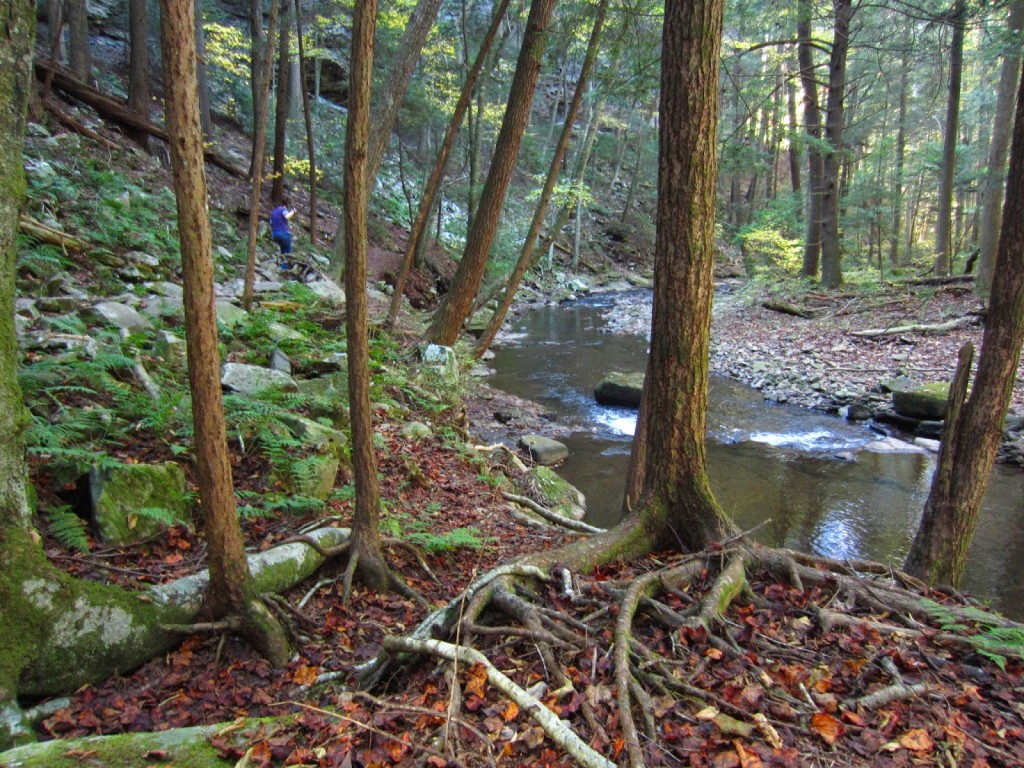
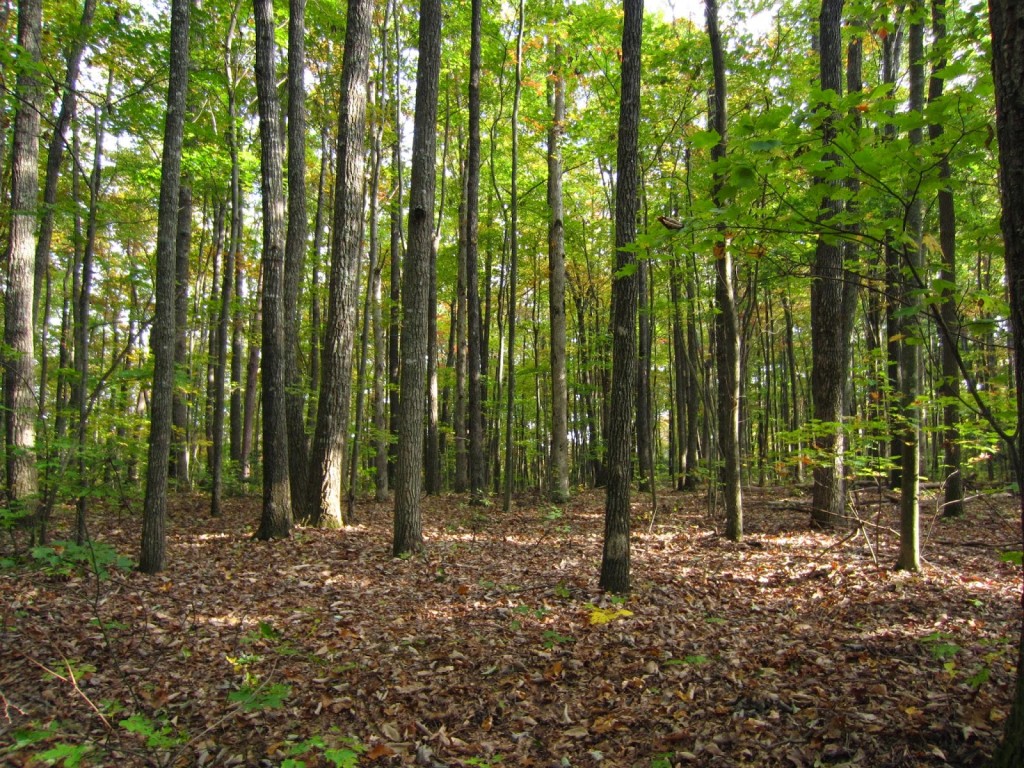
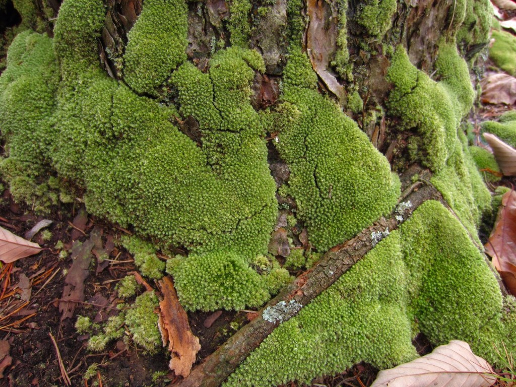
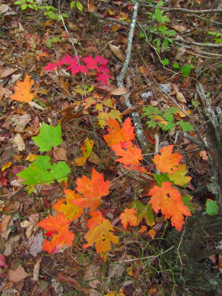
The sights along the way are stunningly gorgeous.  We hiked next to a river for much of the way, through forest green and colored, carpeted with mosses, ferns, and freshly fallen autumn colors.  The smell was damp moss, rotting leaves, foaming currents, clear and crisp.

IMG_4274-1 IMG_4285

If you are thinking about bringing your dog on this adventure, think carefully.  We had no idea what to expect as to the actual difficulty, but Ben needed to be carried in places where the boulders and rocks were impassible for him.  Thankfully, he made it out safely and was such a little trooper.  He had a couple of bloody paw pads, but all in all, he’s in good shape and was able to handle the hike surprisingly well.

IMG_4300

Almost there!  Following the very steep ascent, we felt like we were going to die.  You don’t just get to the top and suddenly see the Point (pun intended).  No.  You have to hike another .4 miles in, which at this stage just makes you want to scream nasty, mean things at the people who created this bloody mess of a trail.  But press on we did.

IMG_4308

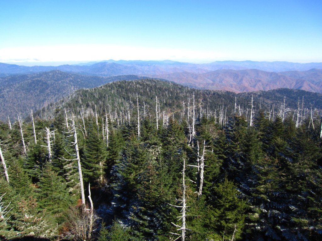
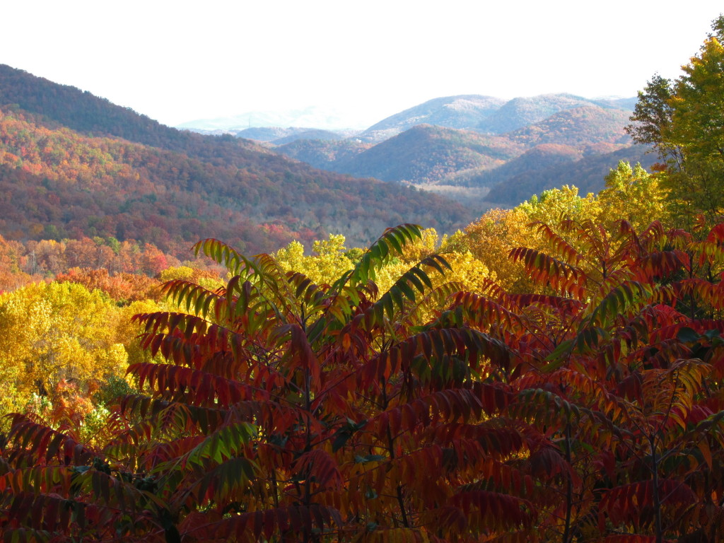
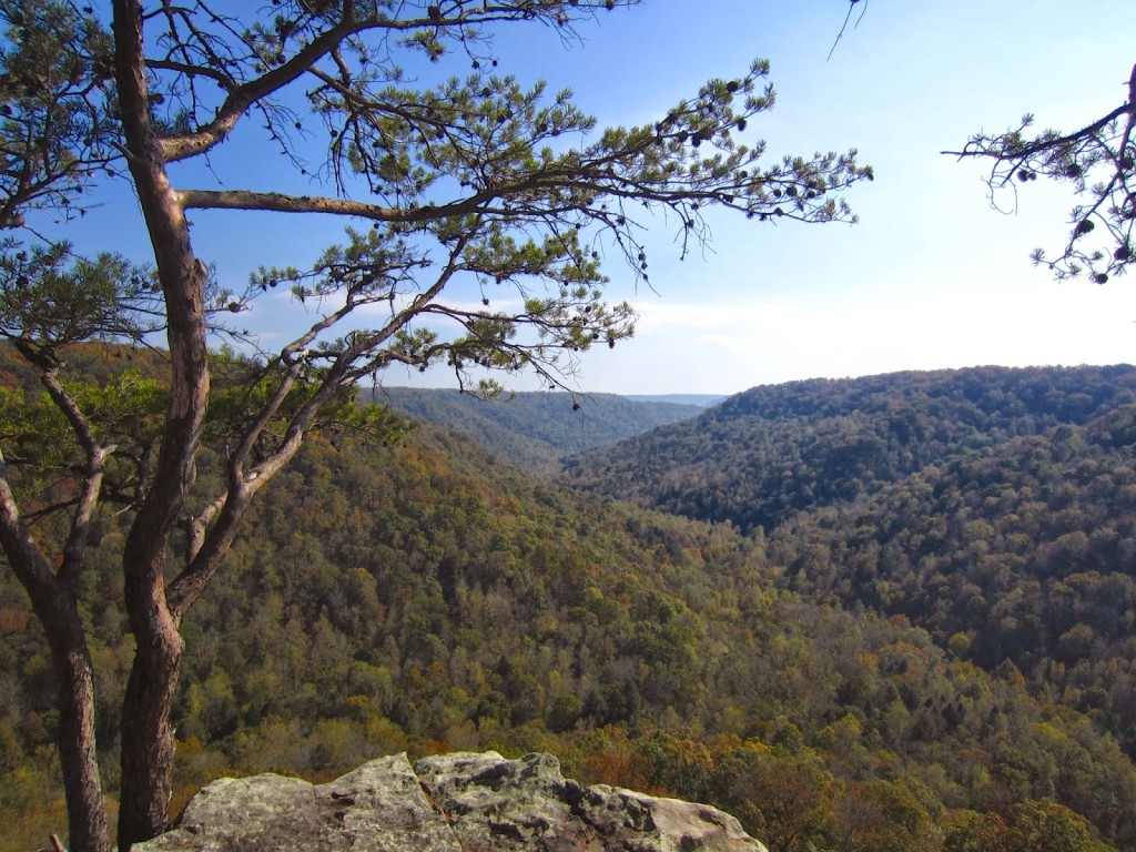
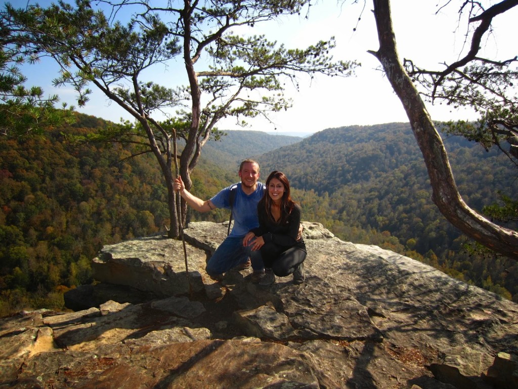
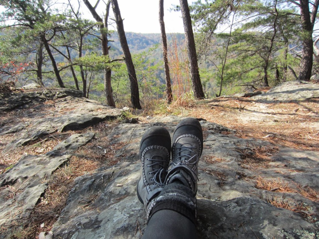
Aaaaaahhhhh, a view for miles.  Past peak, but still lovely.  The point was breezy, warm, and sunny with lots of places for us to sit and say thankful prayers for reaching the top.  There were no heart attacks or broken bones.

IMG_4314 IMG_4327

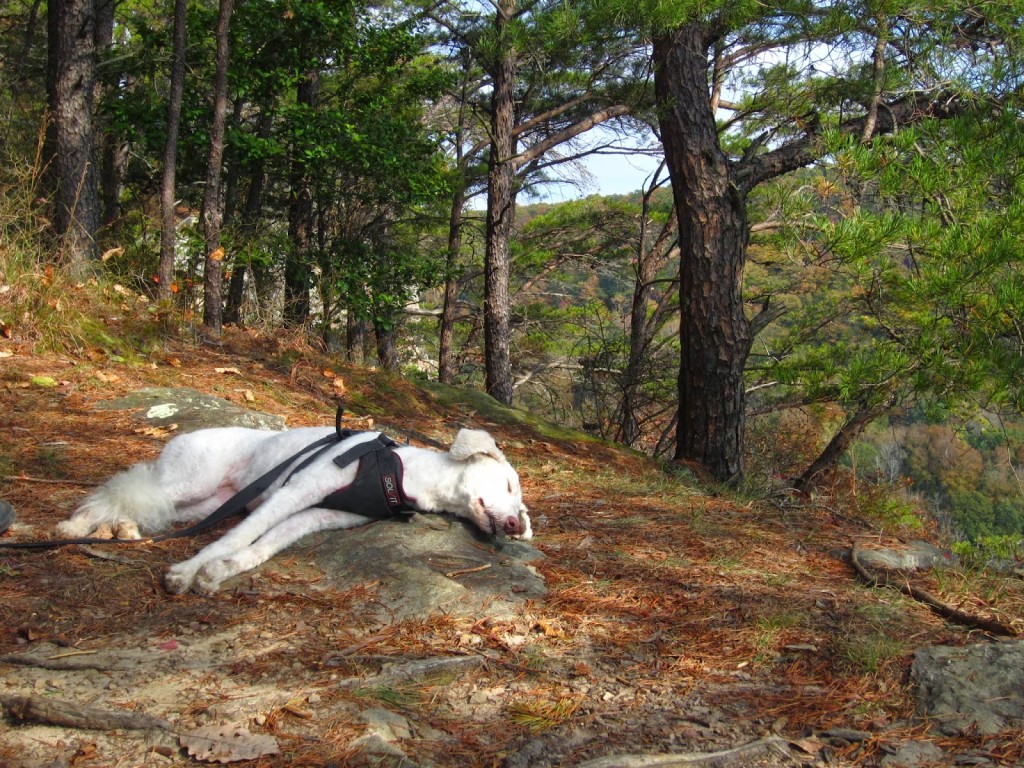
It’s a little hard to describe how we all felt when we reached the Point, but Ben captures it perfectly in this picture.  He had a lovely snooze while we all refueled with food and water, taking it all in.

IMG_4362

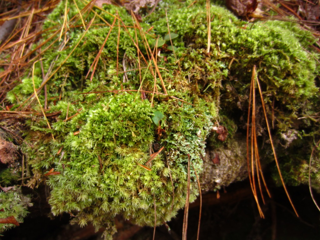
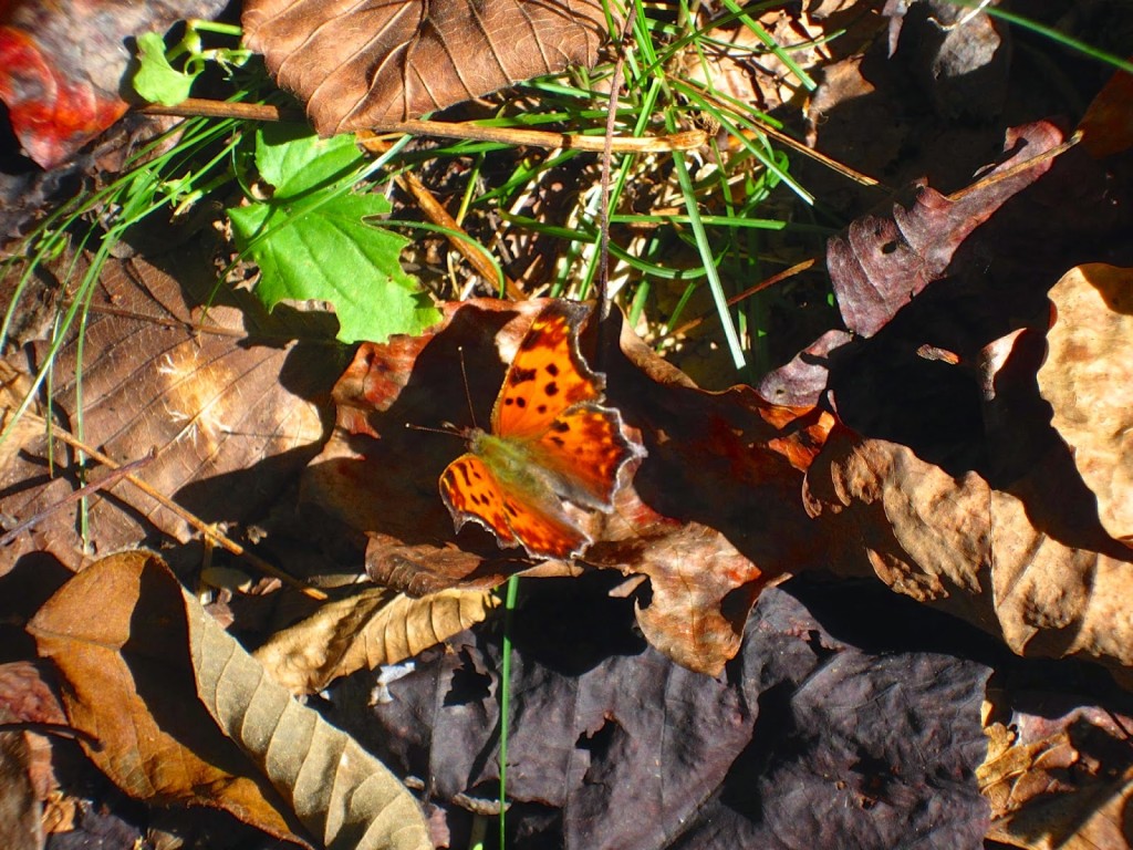
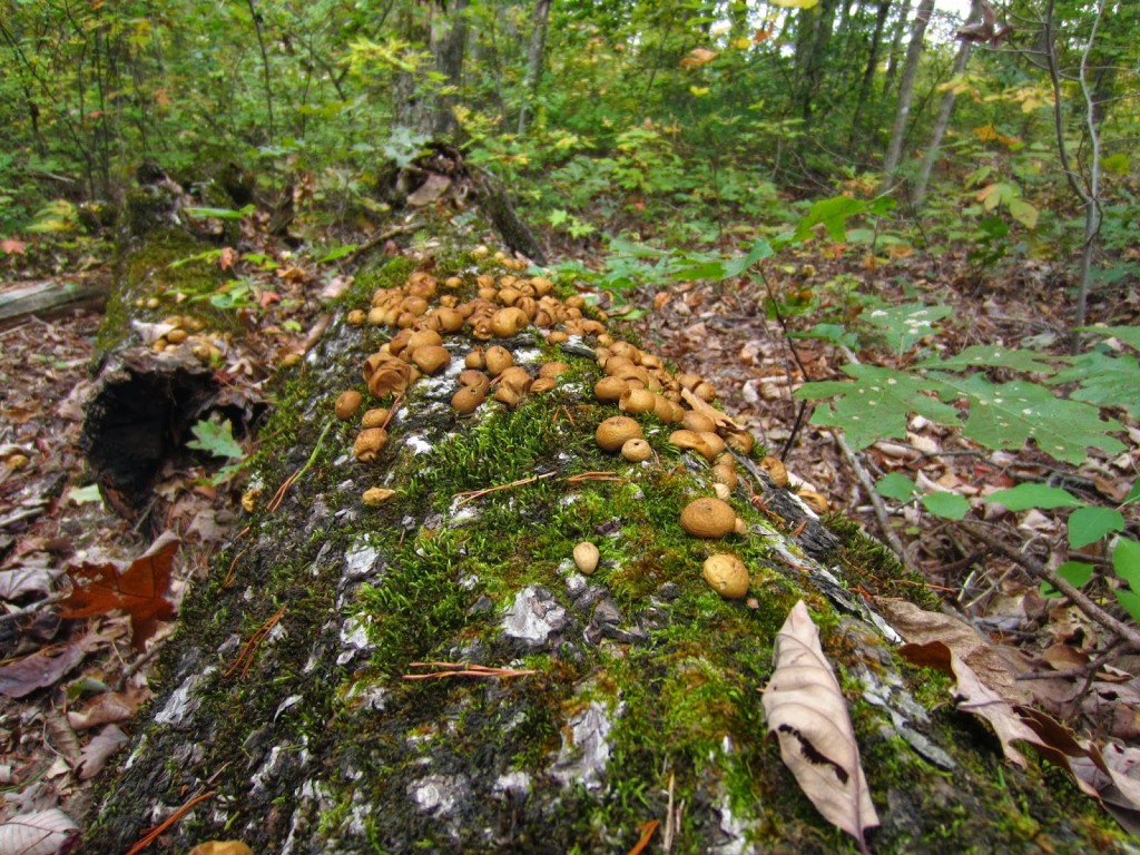
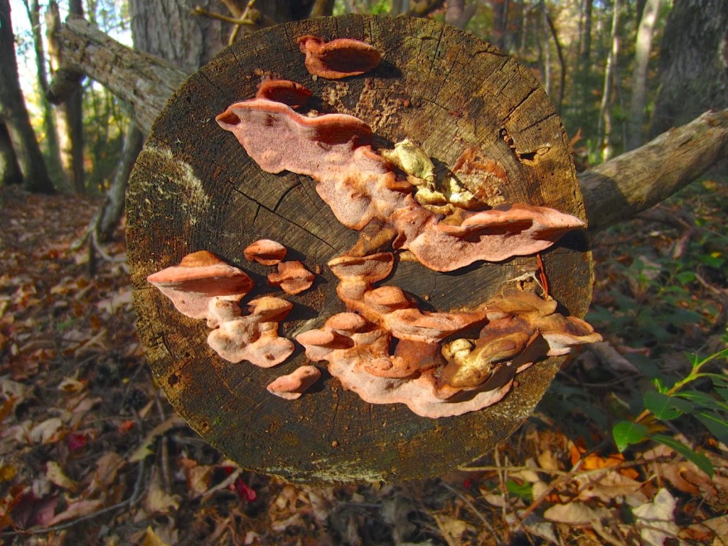
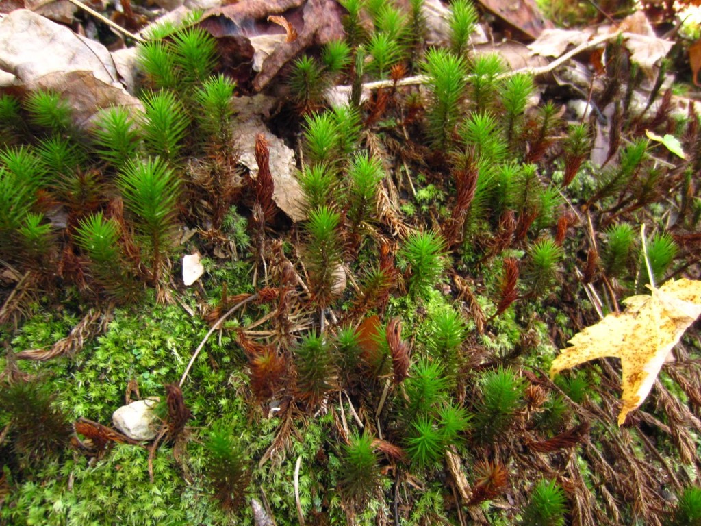
The flora and fauna on the way back down was just as beautiful as when we were heading up.  The mosses and fungi we passed were so gorgeous, they deserve a blog of their own.

IMG_4368 IMG_4372 IMG_4381 IMG_4304 IMG_4364 IMG_4367

Ok, so you’ve heard about the trail, but lets get to the practical side of things.  What do you need to do this safely?  The group sat around the fire after surviving this trail and talked about things we wish we had known before tackling this adventure.  The result was the following list:

  • Hiking boots – Please don’t wear sneakers to hike this trail.  Hiking boots are ugly, let’s be honest.  I looked all over the freaking city to find a pair that were both comfortable and not as ugly, but I’m beyond thankful that I had them.  I bought the J-41 Srina, made by Jeep.  They had fantastic tread so I could handle the rocks easily, but they also offered some ankle support, which is crucial on this trail.  These are not heavy duty boots.  They are great for day hikes, but I’m not sure how they’d hold up over the long term on a backpacking trip.  They are more flexible than heavier hiking boots like Keens, and they were much more comfortable than most of the ones I’d tried on.  I didn’t have any blisters or issues with these shoes and I might even buy another pair to keep as a backup.

IMG_4353

  • Duct tape and superglue –  These are listed in lieu of bringing an extra pair of hiking boots.  We dubbed this trail the “Sole Taker” because the possibility of you actually losing your sole on this trip is pretty high.  Due to the ankle bending, rock strewn, boulder laden trails, you need some serious shoes to tackle the Gizzard.  We passed one woman halfway in who had lost the soles off both of her shoes.  Later on in the day, the same thing happened to Jessie with her Asolo hiking boots that had only been worn a few times.  After we finished the trail, a ranger told us that was actually quite common.  Be prepared, people!!!
  • Moleskin – If you are prone to blisters, or wearing hiking boots you don’t wear too often or haven’t fully broken in, this is a must.
  • Walking stick or pole – This is purely based on personal preference.  I think I would have had balance issues and felt encumbered by a walking stick, but for Shelly, they were lifesavers and helped her navigate some of the rockiest portions of the trail.  Rob also felt like it was useful when going uphill.
  • High protein food for energy – We brought cut peppers, hummus, and high protein granola bars with us.  These got us through the day and we didn’t feel like we were starving.  They gave us the energy we needed to keep going.  Others in the group had jerky, salami, cheese, etc.  Basically, bring food that is fuel.  Every time we stopped to eat, we felt like we had renewed energy.
  • Water – Obviously, this is a must.  If you don’t want to bring 4 bottles of heavy water, bring a camping water filter.  There is a gorgeous river that runs along the Fiery Gizzard trail which could be a good water supply with the proper filtering equipment.  Otherwise, pack plenty of water, it is essential.
  • Camera – I have a small Canon Powershot Elph that I love bringing on trips like this.  Phone cameras are great, but batteries should be conserved in case of emergency.
  • PStyle – For women who camp, this is a must!!! This little plastic contraption enables you to pee while standing.  I was beyond thankful that I’d spent the money and brought this silly thing along.  It was totally worth having and made what could have been an awkward situation pretty easy.  Otherwise you could “monkey pole” where you hold onto a sapling, lean back and hope you don’t pee all over yourself.  You can find one here.  You’re welcome.
  • Moisture wicking everything – Before we left on this trip I bought a North Face base layer at TJ Maxx that was moisture wicking.  Even though there were parts of the day when I was really sweating, my shirt never felt soaked and I stayed quite comfortable.  I also wore wool socks, Smartwool is best (I’ve also seen these at TJ Maxx), and my feet weren’t swampy or damp.  If we were doing this in summer, I’d buy moisture wicking t-shirts or tank tops.  The right clothing makes a world of difference in comfort level when you’re sweating your way up a trail.
  • Backpack – If you’re planning to do the entire loop in a day and not camping up a Raven’s Point, a regular old backpack works.  Make sure there are plenty of pockets and straps to carry what you need.  If you can find one that has chest and waist straps, that might help eliminate some of the weight on the shoulders.
  • Ace bandage – Although it’s never nice to think of being hurt on a trail, this is one of those things that is lightweight and easy to throw in a bag.  If you end up needing it, you will thank your lucky stars that you have it.  This trail is brutal on the knees, ankles, and hips.  On the way down, there is one hill that is a knee jerker for sure and there are countless sections of the trail where you walk on nothing but rocks.  Bring first aid in case something unplanned happens.
IMG_4389

Gear resources that won’t break the bank:
Steep and Cheap – a flash sale website for outdoor gear.  We got two North Face packs that retail for $169 for $59.99 each.  Total steal!
Back Country – all kinds of gear with the occasional sale and often cheaper prices than REI, etc.
Sierra Trading Post – same as the above.
TJ Maxx – head to the store and check the active section.  They had North Face base layers, Columbia fleece, Smartwool socks, and Avalanche cold gear when I went.  I got everything I needed for this trip in terms of clothes at great discount prices.

Filed Under: Hiking, Tennessee Tagged With: Asolo, Back Country, Fiery Gizzard, hiking, J-41 Srina, North Face, PStyle, Raven Point, Sierra Trading Post, Steep and Cheap, Tennessee, TJ Maxx, Travel, trees

Getting Outside Again: Spring Stretches Her Muscles

March 17, 2014 by Leah Leave a Comment

The edges of winter are softening here in Tennessee and spring is starting to show off in small ways, like early daffodils and the first blush of pink cherry trees.

IMG_5340-1

Yesterday it was 65 degrees so I started cleaning up the flower beds and pruning the purple plum trees, a task I thoroughly hate.  I have to keep the plum trees pruned because in the spring when we get prolific rain, the branches are not able to hold themselves up with the weight of wet leaves.  The trees are rather tall, but not too tall that I can’t reach most of branches when on a ladder.  But being on a ladder in the middle of a tree on tiptoe, reaching for branches in the centermost part of the tree is not my idea of a good time.  The result is that the plums look like they were given a $5 haircut at a strip mall salon.  At least they will be in bloom shortly and the embarrassment won’t last for long.

Cleaning up the flowers beds, another unenjoyable task, at least yields some reward because I get to see what the perennials have been up to under all the dead leaves.  The fall seedum is already popping up.

IMG_5337

Many of the bulbs are getting ready to put on a show.

IMG_5331

Black tulips purchased on Long Island.  Outsmarted the squirrels by covering the freshly planted bulbs with dead leaves.  It worked!

IMG_5332

The allium I planted last year have nearly doubled in size.

IMG_5333

Dianthus which remained in lovely evergreen mounds that are full of buds already!

IMG_5336

And then we get to the good stuff…the vegetable garden!  Last weekend, Rob and I got bags of manure and compost, along with some lime, and re-tilled the plot.

IMG_5315

The soil looks really good, and now it’s just a matter of planning the whole thing out.  I planted beets and asparagus.

IMG_5343

I’ve always wanted to try asparagus, but you have to be really patient and committed with these  plants.  Normally it takes 3 years to get a crop.  I purchased 2 year old roots, so we’ll see how they look next year, otherwise I’ll give them another year before starting to harvest.  It’s asparagus season now and tonight I pan seared a bunch for dinner.  I cannot wait to be able to run out to the garden and bring dinner inside!

Other crops this year include snow peas, beans, three different types of squash, and some onions.  All the seeds were ordered from Baker Creek Heirloom Seed Co.

IMG_5283

Aside from making the garden larger this year, I switched up my hoses.  This might not seem like a big deal, but I’ve read several articles about the use of lead in watering hoses and immediately found cause for concern.  If you are planning to water a vegetable gardening filled with food you will be eating, drinking water safe hoses are the way to go.  I got two 50 ft. drinking water safe hoses at Costco for $14.97 apiece, which is well worth the money for the peace of mind that no lead is leeching into the plants we plan to harvest from.

Another issue I had last  year was the immense problem of crab grass around the garden area.  The density of the grass caused many headaches with the lawn mower and was a total nightmare to deal with since it was also being unintentionally watered by the vegetable garden sprinkler.  I went to Home Depot to get some crabgrass preventer and had a bit of sticker shock.  That stuff is pricey!  The only kind they had in the store was the Scotts version, which a bit of research on my iPhone revealed that the main ingredient has been proven in multiple studies to be carcinogenic.  Well, crap.  Obviously that stuff is not going anywhere near my garden or my lawn.  I did some more research when I got home and the most effective natural product for crabgrass prevention seems to be corn gluten meal.  The biggest challenge will be finding that around here, but I’m going to see what I can come up with.

This week marks the beginning of spring, and while it’s still too early to plant the main veggie seeds, spring always brings the hope of new life.  Small, dead shoots sprouting tender leaves and flower buds remind us that even in the bleakest of times, beauty lies beneath the surface waiting to burst forth.

Filed Under: Gardening Tagged With: gardening, trees, yard work

Great Smoky Mountains National Park: The Top Of The World At Clingman’s Dome

November 5, 2013 by Leah Leave a Comment

For our our second day in GSMNP, we decided to do the Roaring Fork Motor Nature Trail before heading into the main part of the park.  It’s a six mile loop just outside of town that you can drive through for lovely views of mountains and rocky streams.

IMG_4703 IMG_3218 IMG_3221

The thing about this motor trail that I didn’t realize is that to see any of the falls you always see in pictures promoting this trail, you have to hike to them.  Be not lulled into the phrase “motor trail” or you will be sorely disappointed that it’s just a very narrow paved driveway through the woods.  As pretty as the woods were, I thought we’d see more.  The speed limit is 10 mph I think, and if you are a New Yorker who gets behind someone who actually drives the 10 mph, you will go mad.

After we ditched the motor trail, we headed straight back into the park for a quick hike to Laurel Falls, as recommended by the nice old man at the visitors center.  Let’s be honest, the Laurel Falls trail is not for anyone who enjoys hiking.  The entire trail is paved.  The people who hike this trail don’t want to hike, they want to throw trash in the woods and let their children careen off the trail, screaming and yelling and throwing Cheetos.  Rob actually started picking up bits of trash on the way back, that’s how bad it was.  In fact, we sped past one poor sod of a dad pushing a double wide stroller up the damn path.  A DOUBLE WIDE!!!!  The trail was quite uphill, so I don’t know how he didn’t perish in the act.

When we got to the falls, it was totally crowded.  There were signs everywhere warning people to be careful because other humans had died from falling, but people still climbed all over the slippery rocks and we actually watched one guy take a nice tumble on some slippery leaves.  The falls themselves were pretty.  I mean, nothing to write home about or anything, especially with the yellow “danger” signs everywhere, but pretty nonetheless.

IMG_3237 IMG_3240

The blatant disrespect people have for nature when they are right smack dab in the middle of it is astounding to me.  If you’re coming to this park and really like to hike on a real trail with less traffic, avoid Laurel Falls.

Ok, onto the next gem in the park that we thoroughly enjoyed, Clingman’s Dome.  This is the highest point in the park and in Tennessee.  If you feel like you could stand to lose a bit of cellulite on the thighs, this is the trail for you.

IMG_3249

So you drive to the top of the mountain and think it’s going to be a merry little walk to an observation tower.  No.  It’s a brutal incline that will have your legs hating you for days.  But honestly, it was worth every painful step.  The view on the way up is lovely and is worth admiring for minutes at a time every ten feet or so, this way you can catch your breath.  When you get to the top of the hill, you still have an icy winding ramp to navigate up to the tower.  People were hanging on for dear life.  One kind man decided to tell me “that side is slippery” while I was in the middle of sliding my way up.  Oh, thank you, I hadn’t noticed.

IMG_3260

When you get to the tower, your breath is stolen by the view.  360 degrees of rolling mountains and Fraser firs.

IMG_3265 IMG_3268 IMG_3270

It was like an ocean of mountains.  The horizon stretched into infinity and layers upon layers of smoky blue mountains reached to the edges of the earth.

We slid back down the ramp and came upon a sign for the Appalachian Trail.  Someday I want to hike this trail…well, a decent part of the trail.  I mean, let’s not get crazy.  As awesome as it would be to pull a “Bill Bryson” and write a book about it, there really isn’t anyone at this point who can improve upon A Walk In The Woods.  Rob and I walked onto the trail a bit.  It was very exciting.  There is something incredible about the Appalachian Trail that demands respect and inspires awe.  The trail stretches 2,180 miles from Georgia to Maine, and to see this small piece of it in the middle of these magnificent mountains was really thrilling.  Of course if I am ever going to really have a go at this I need to hit REI for some real shoes and leave the Betsey Johnson boots at home.

IMG_3279 IMG_3278

We took one last look at the view and began our descent on fumes.  The gas light came on just as we were heading down, so we tried to coast a bit.

IMG_3284

There was one more stop we wanted to make at the Newfoundland Gap overlook at the state line.  At this stop there were plaques explaining how the Smokies got their name.  Apparently the vegetation lets off a smoky blue gas into the atmosphere.  Over the years, pollution has contributed to the haze one can see over the range, and as nice as a perfectly clear day would be, it was much more mysterious to see the blue peaks in the distance.

IMG_3295 IMG_3291

We didn’t see a black bear.  I was dying to see a bear.  Everywhere we went we overheard people talking about seeing bears and showing friends their cell phone pics of the bear that was 6 feet away from them.  I can’t complain though.  We had such a lovely time in the mountains and it was beyond refreshing to get out of town and feel like we were in another world for a while.  Hopefully someday we’ll come back here and explore some more of the trails.  After all, there are 800 miles of them.

Filed Under: Hiking, Tennessee, Travel Tagged With: hiking, Tennessee, Travel, trees

Great Smoky Mountains National Park: Getting Out Of Tackytown And Into The Woods

November 4, 2013 by Leah Leave a Comment

 Rob’s birthday is coming up and I wanted to make a memory as opposed to struggling to find him a gift he might not use, so I thought it would be fun if we went up to Great Smoky Mountains National Park to go hiking and see some Tennessee fall color.  On Friday night we arrived in Gatlinburg.  The first time I was here was in my freshman year of college and I remembered it as being the most horrendously tacky place on earth.  My memory had erased the worst part of getting to Gatlinburg: going through the armpit of the tourist industry, Pigeon Forge.  I think the place is disgusting.  It is the antithesis of everything beautiful and true, the worst kind of tourist consumerism.  Pigeon Forge is a highway of neon lights advertising psychic readings, every embarrassingly “country” show you can imagine, cowboy boot outlets, mini golf palaces, and as Rob so aptly put it, the place looks like a carnival got stuck there.  When we arrived in Gatlinburg, the scene changed a bit.The town grew smaller, the neon lights grew slightly dimmer, and signs for the parkway began to appear, along with the brown and white signs I have grown to love that signal you are in the middle of government protected nature.  We took a walk through town at around 11pm just to see what there was and since we were some of the only people out, it seemed rather tame.  During the daytime when the tourists emerge, it’s pretty much my personal traveling nightmare.  The people who frequent the town of Gatlinburg are not the earthy types you normally find in towns that border national parks.  The clientele is more that of a traveler barely energetic enough to make it from one Ripley’s Believe It Or Not attraction to the next fudge shop prior to buying an airbrushed t-shirt.

When you get out of town, the parkway leads you straight into the park, and Rob and I were enamored with the fall color and the pristine woods.  All of it seemed even more glorious after leaving the stifling confines of a town that seems an affront to the nature that surrounds it.  We stopped at the Sugarlands Visitor Center to get a map, some directions, and a plan for the day.  We decided to drive through Cades Cove and hike to Abrams Falls.

IMG_3048

I’ve never been to Cades Cove, but a friend said I had to see it and I’m so glad she did.  The 50 minute drive to the Cove loop was an adventure in itself.  There are lots of pull-offs where you can stop and meander along the rambling river that wends its way next to the road.

IMG_3052 IMG_3056 IMG_3067

The water was rushing in chilly currents through the forest, carrying bits of gold, red, and fiery yellow leaves with it.   Green moss blinked out from the tree roots and blanketed the river rocks.

IMG_3143

Every bend had me saying, “ooh, that’s pretty” to the point where “pretty” just sounded inane because every part of what we were seeing was simply gorgeous.  There were parts of the road where the sunlight lit the trees on fire, showcasing the brilliance of the golden leaves that were so prevalent throughout the hills.  As soon as we entered the scenic loop around Cades Cove we found ourselves in a bumper to bumper line of cars that wended its 11 mile way through an outdoor museum of sorts paying homage to the simple pioneer life of the families who lived in this portion of Appalachia.

IMG_3080

Some pre-Thanksgiving turkeys having a snack in field.  No big deal.

IMG_3086

IMG_3087

Rustic log cabins dotted the cove, along with simple churches that spoke to a time when church buildings consisted of 4 bare walls and rough hewn wooden pews.  The sound systems in today’s churches would have blown the minds of the people who once worshiped here.  The simplicity of this way of life, the self-sustaining culture that dwelt here spoke deeply to me as we drove through.  This is a simplicity I have never known.

IMG_3088 IMG_3100 IMG_3102 IMG_3104 IMG_3107 IMG_3120

Halfway through the loop, we stopped at the Abrams Falls trail head for a 5 mile waterfall hike.  Up and down the rocky trail we walked, through rainbows of fall colors, breathing in the crisp air of the river beside us.

IMG_3129 IMG_3140 IMG_3144 IMG_3158

The trail was a moderate one and we enjoyed the entire walk.  Once at the falls, we were able to sit and eat some apples, watch a rainbow trout, and listen to the rushing water plummet over the rocks into a deep pool below.

IMG_3167

Heading back we threw our backs into the uphill climb and made the entire round trip in exactly 3 hours.  Perfect timing!  Plenty of time left to check out the Cades Cove visitors center and historic grist mill.

IMG_3186 IMG_3200 IMG_3202 IMG_3210

The colors of the trees stood out even deeper as the light started to fade.  We crawled along at a snail’s pace out of the cove, passing more cabins, imagining more empty fields swaying with wheat, rye, and cotton.  Coming back into Gatlinburg town was a bit of a shock to the system after being surrounded by such pure beauty the entire day, but we already had a plan for the next day that included more waterfalls.

Filed Under: Hiking, Tennessee, Travel Tagged With: Abrams Falls, Cades Cove, Great Smoky Mountain National Park, GSMNP, hiking, Tennessee, Travel, trees

Next Page »

Copyright © 2025 · Foodie Pro Theme by Shay Bocks · Built on the Genesis Framework · Powered by WordPress