• Skip to primary navigation
  • Skip to main content

Edges Like Sea Glass

By Leah LaRocco

  • Home
  • Blog
    • Thoughts On Life
    • House & Home
    • Gardening
    • Travel
    • Hiking
  • Marking The Miles
  • Contact
  • Subscribe

GSMNP

GSMNP: Winter Hikes In Misty Mountains

March 15, 2016 by Leah Leave a Comment

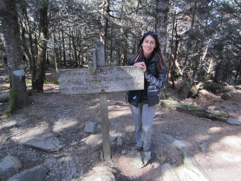
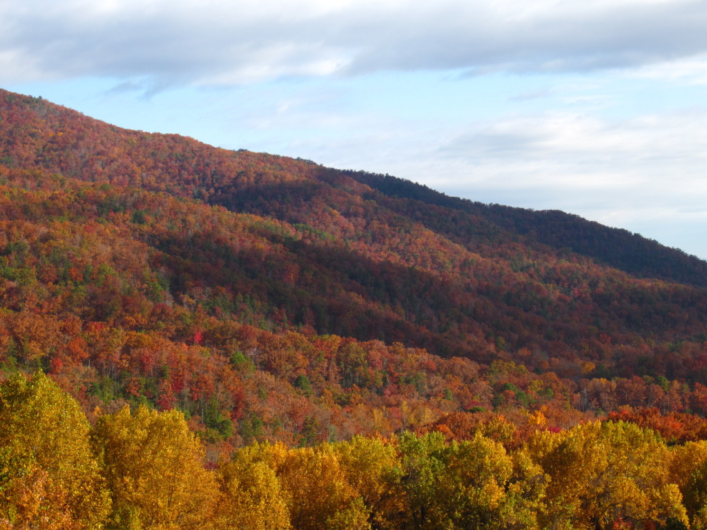
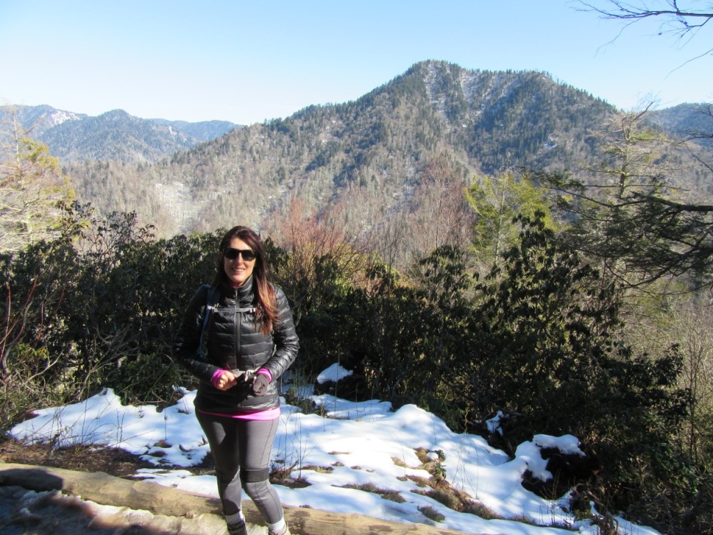
As the weather warms up and I’m starting to sweat on my daily walks, I keep thinking back to a month ago when Rob and I headed to the Smokies again for some more winter hiking.  Hiking in the winter has some serious advantages.  There are less people, the views are unobscured by leaves on the trees, it’s a less sweaty endeavor, and there is a greater sense of peace because it feels like nature is truly asleep.  Due to bad weather in the forecast, we weren’t sure how much we’d actually be able to get into the woods, so the first day there was a mix of sun and clouds with a high of 61 degrees and we headed straight for Chimney Tops.

IMG_1240 IMG_0079

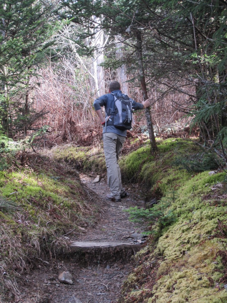
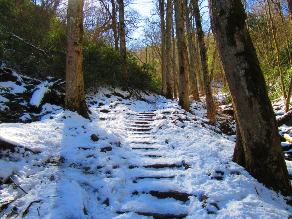
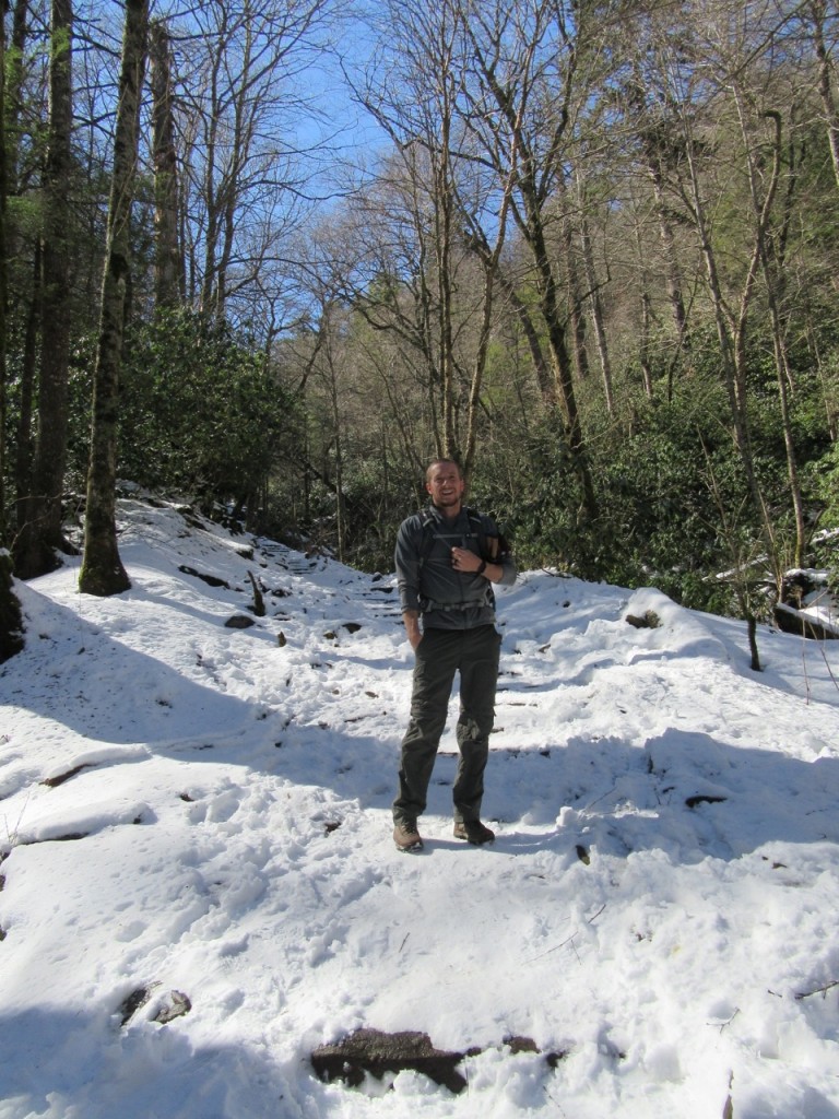
We brought a pair of trekking poles and some yaktrax for our shoes because I knew there could be ice on the trails at this time of year.  Sure enough, we weren’t halfway up that trail before we were encountering a snow covered, slippery mess.  We watched one man walk up 6 steps and slide right back down again.

IMG_0032

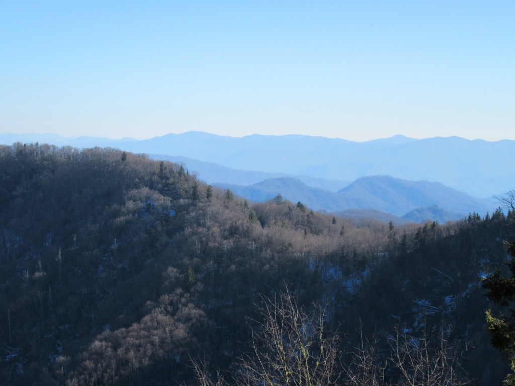
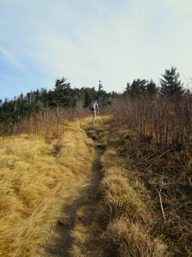
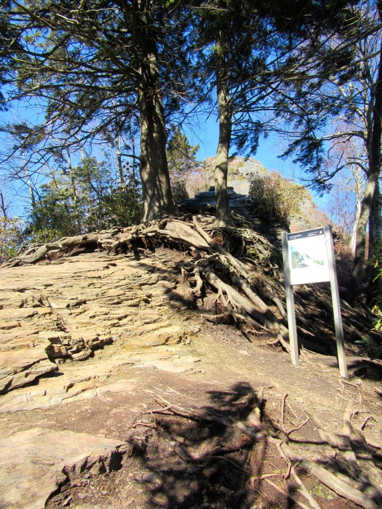
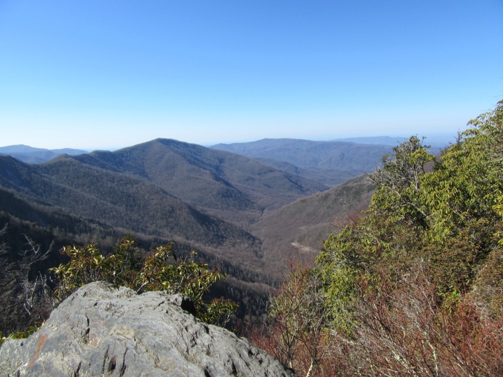
Chimney Tops isn’t rated as a difficult trail due to it’s short length of 3.8 miles RT, but the last mile gains over 900 feet in elevation, so between struggling up icy steps and sloshing through pudding-like mud, we felt like we were going to die by the time we reached the rocks at the top.  One guy we met said he’d made fun of people with “hiking sticks” on the way up, but that we could probably set up a lemonade stand by the side of the trail and sell them at a premium.  Once again, trekking poles saved the day.  The wind was blowing hard, but Rob decided to climb to the summit.

IMG_0023IMG_0041 IMG_0056

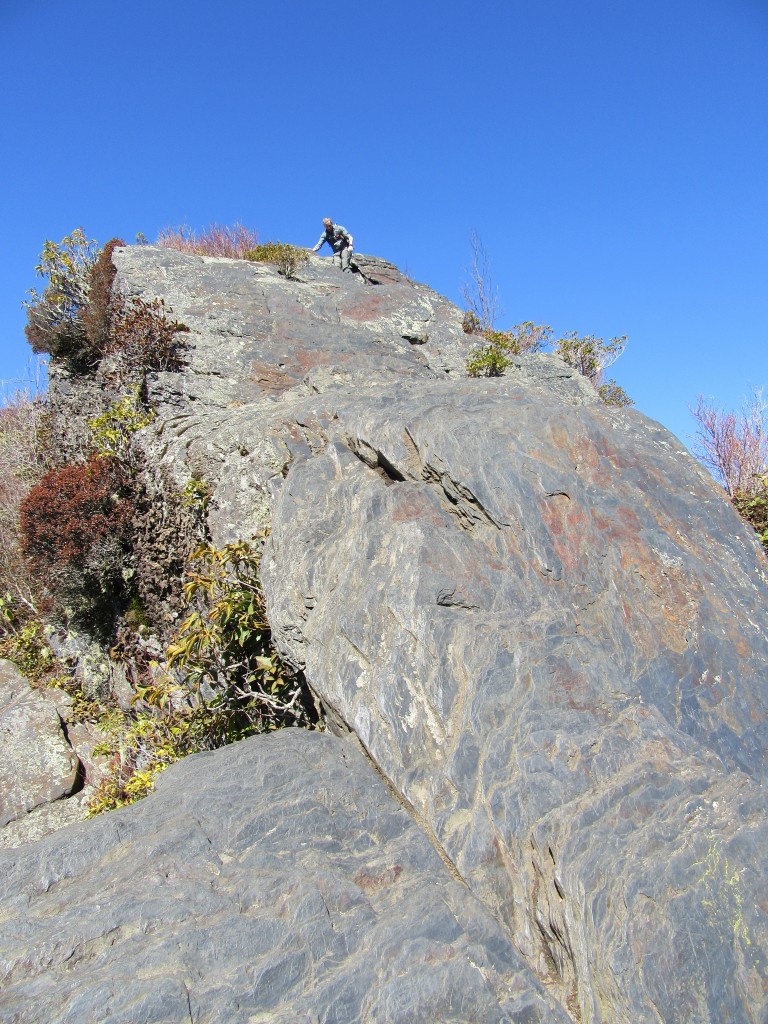
This was the view looking back down from where we climbed up (it’s a lot farther than it looks).  At one point, I asked Rob to take a picture of me climbing up these rocks because who doesn’t want to post some picture of themselves climbing up a mountain like a freaking superhero?  This was maybe the worst thing I’ve ever asked him to do.  It looked like nothing more than a giant ass climbing clumsily up a pile of rocks.  So much for trying to look adventurous!

IMG_0043

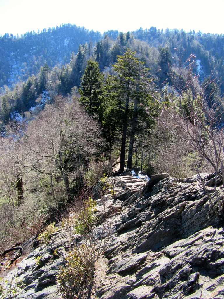
If the wind hadn’t been blowing so strongly, I would have attempted the rest of the climb, but instead I sat there peacefully, holding on to everything in my possession with a death grip so it wouldn’t blow away, while feeling like I’d just landed on top of the world.  I can never, ever get enough of this.

IMG_0046IMG_0060

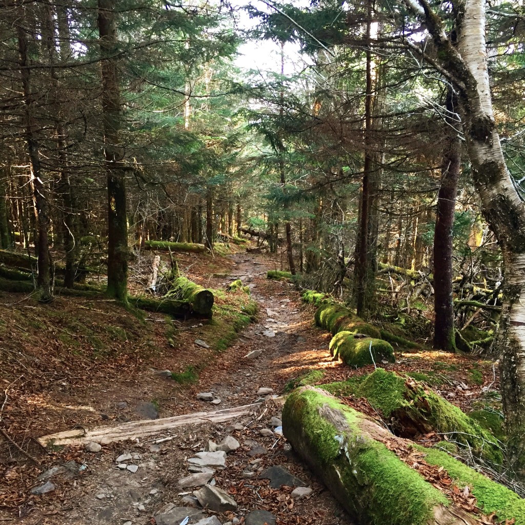
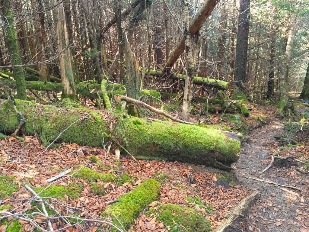
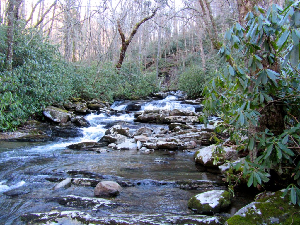
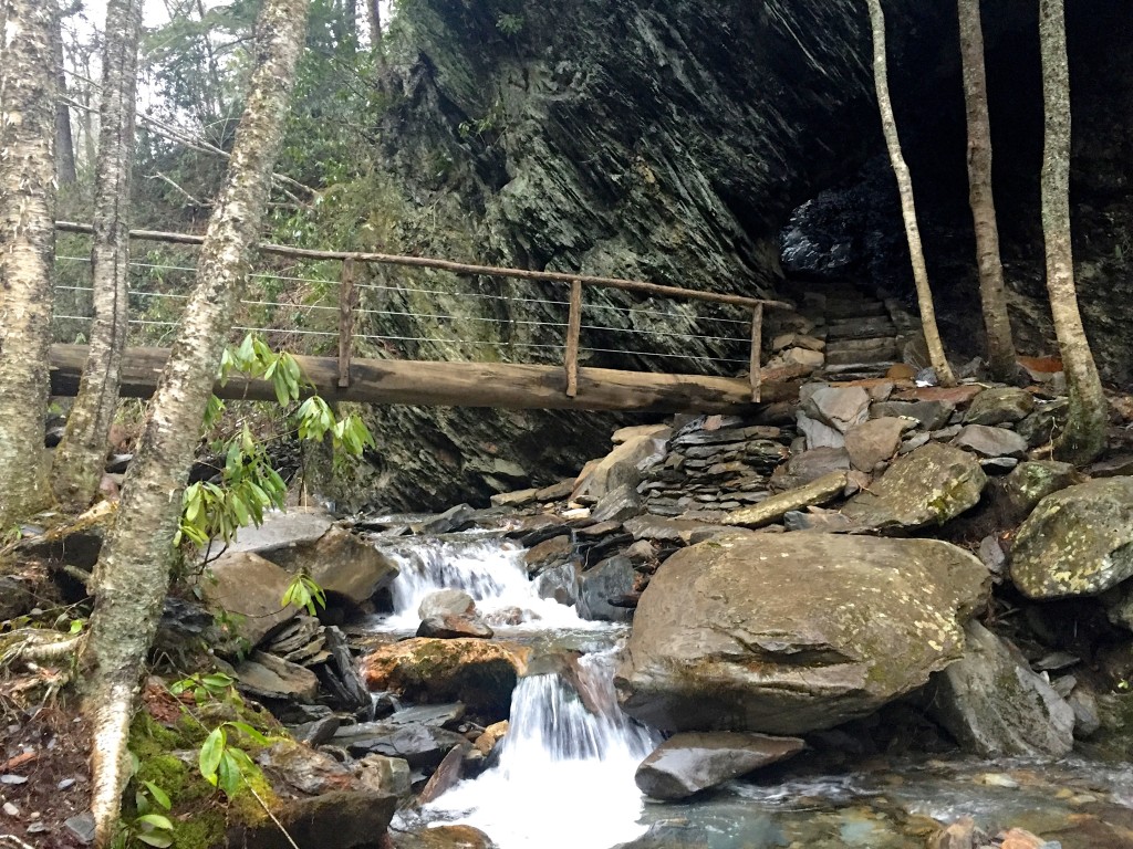
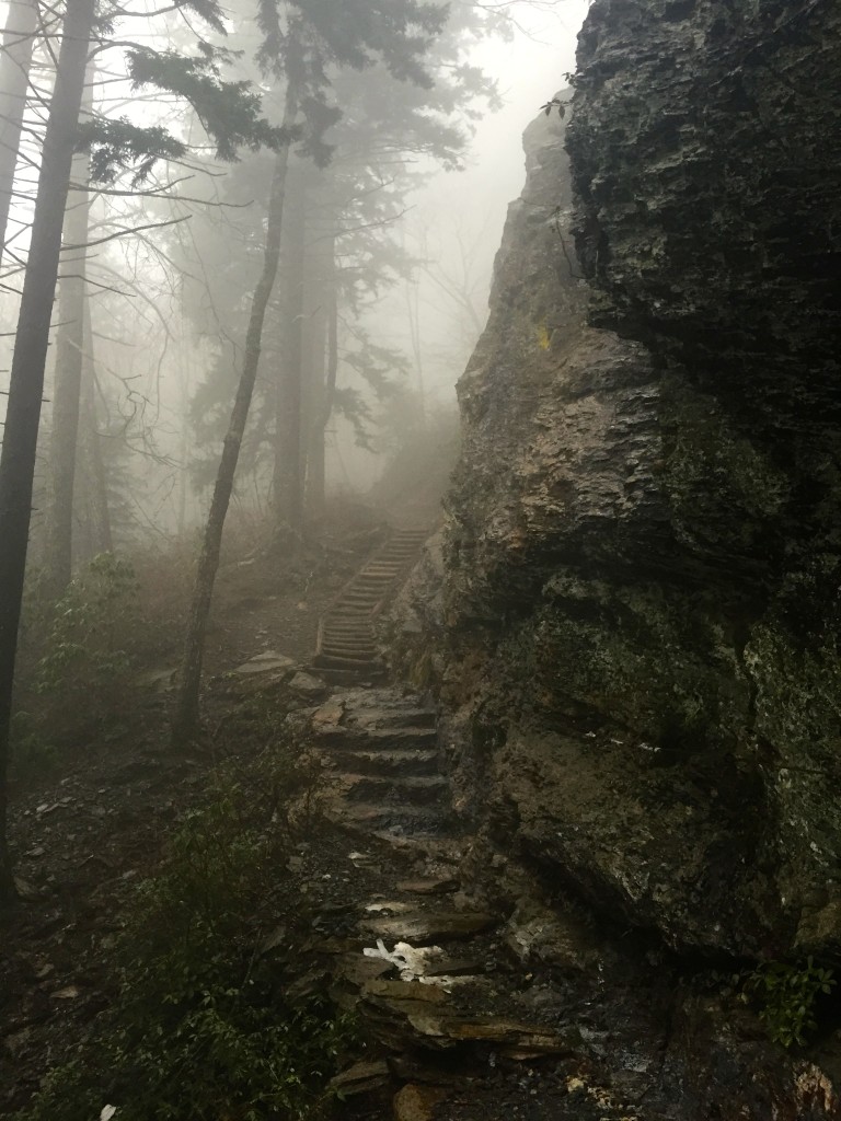
The next day held the almost certain threat of rain, so after an early breakfast we packed up, put on our rain shells, and headed up to the Alum Cave trail to see how far we could get.  We walked beside a river through a rhododendron covered forest before coming to Arch Rock.  We crossed the stream and headed up the steps which curved around the inside of the rock to the trail on the opposite side.  The walls of the rock were covered in ice and the water from the river sounded like thunder.

IMG_1311

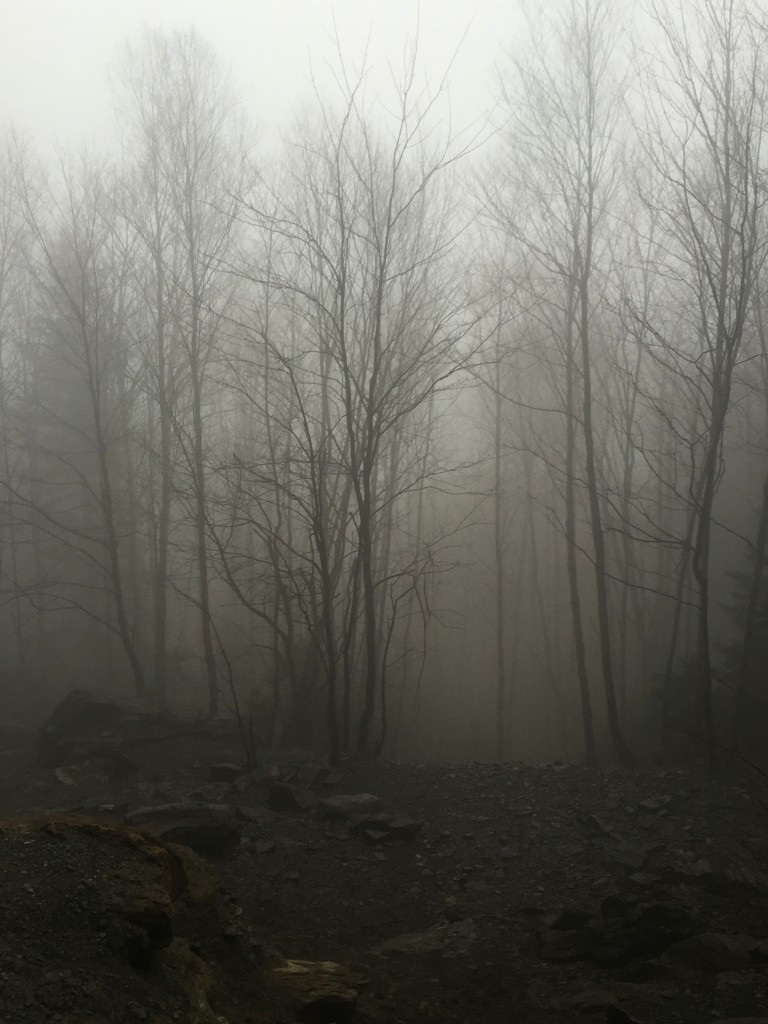
As we climbed in elevation on the trail it became apparent that we were hiking up into a cloud, a literal fluffy cloud, like you see from a plane window and always wonder if it could actually be possible to pull a Mary Poppins and just hang out there for a while.  I’ve never been in this kind of fog in the woods.  It felt like the trees were holding secrets as we noisily tromped through.

IMG_1266 IMG_1267

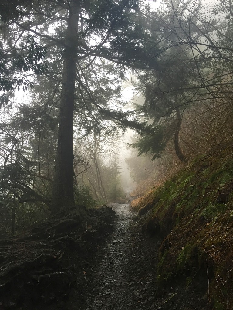
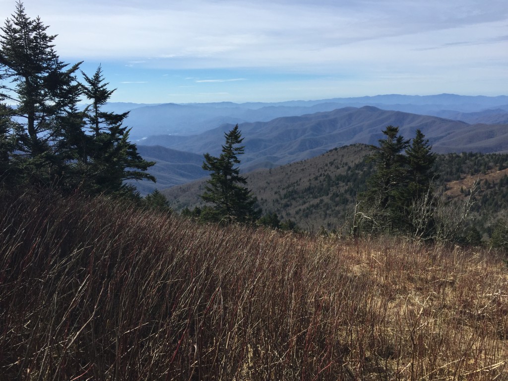
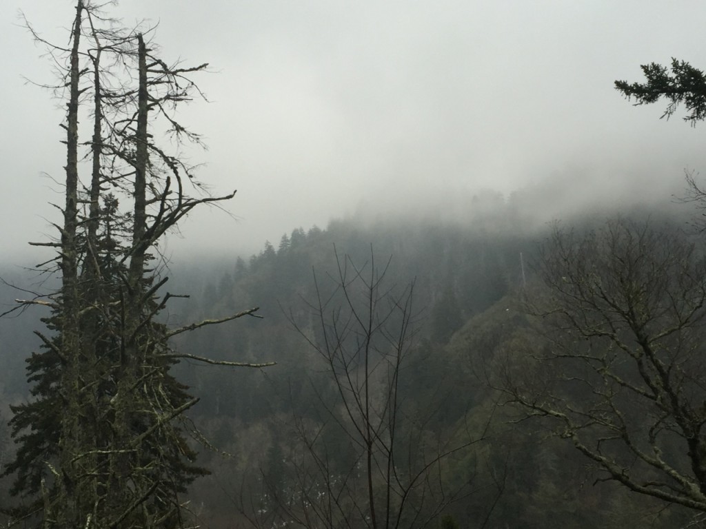
Every time we came to some sort of overlook, we simply had to imagine the view.  Everything was obscured by clouds and mist, a true Smoky Mountain experience.

IMG_1258

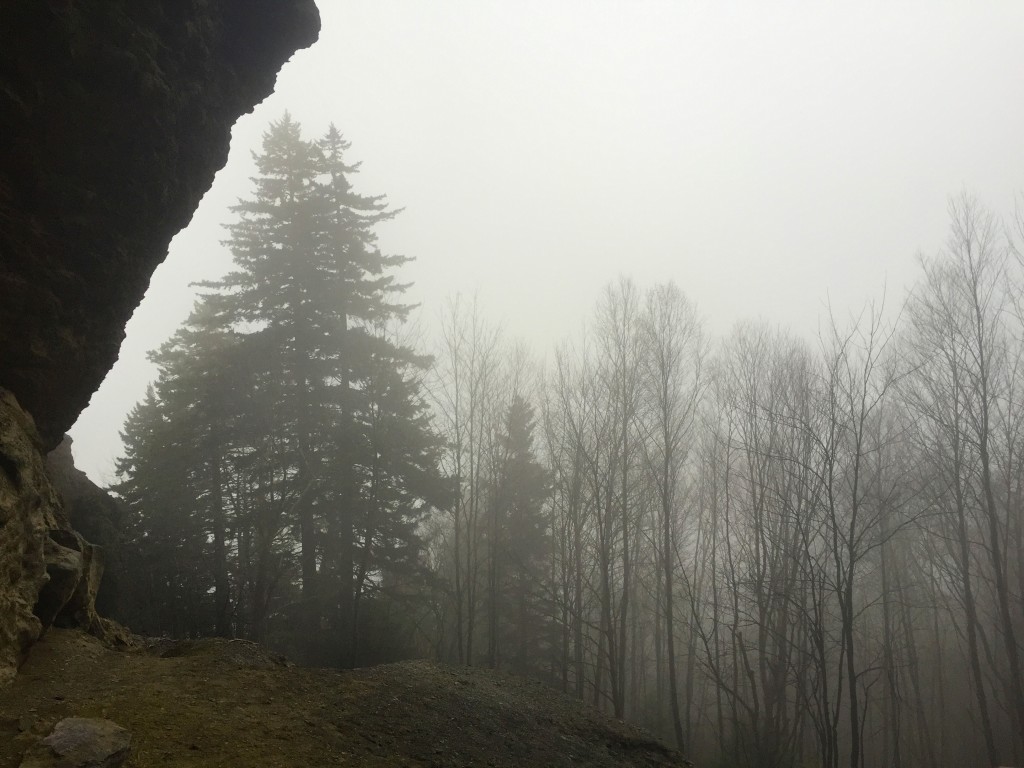
When we got to the cave, we climbed up the sand and stood under the dry overhang, looking out at the trees.  Everything was enchanted by fog.  Some would say the trip wasn’t worth it, but one thing that always amazes me about that woods is that they change as much as the ocean.  Every day there is something new to see and experience, whether it be wildlife, views, waterfalls, mist, rain, or brilliant sunshine.  I wouldn’t have traded this day for anything.

IMG_1271 IMG_1284

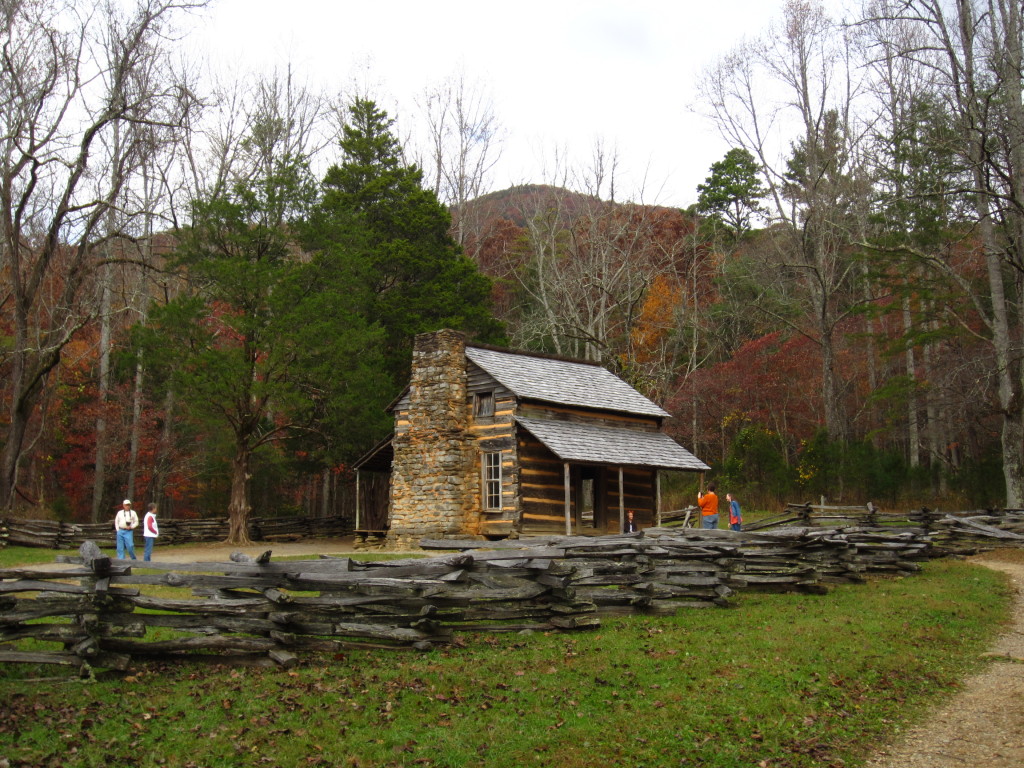
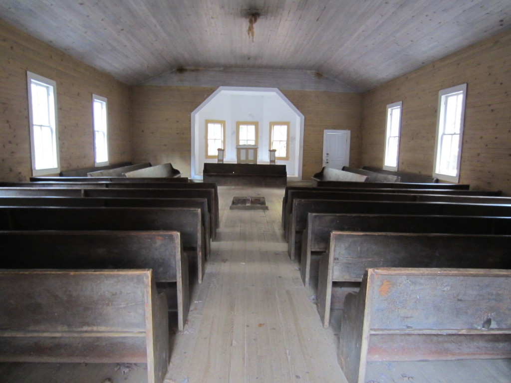
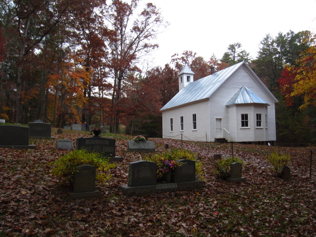
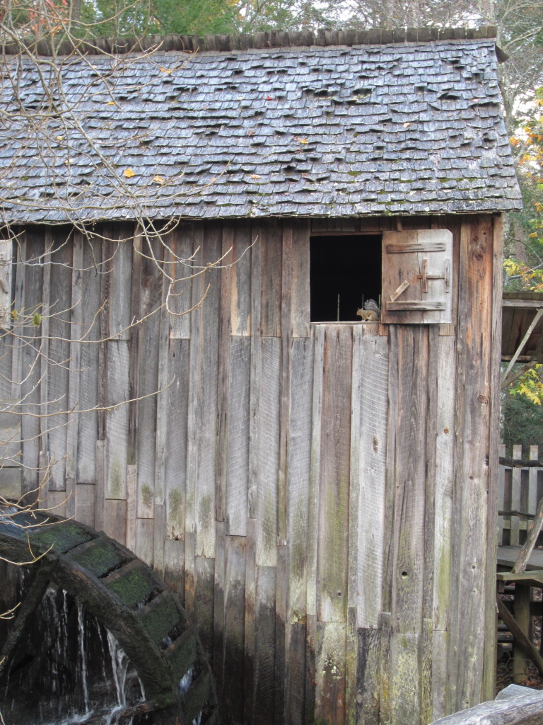
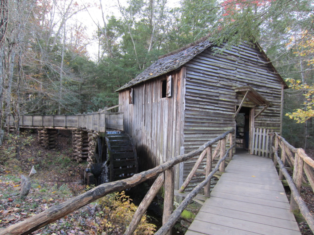
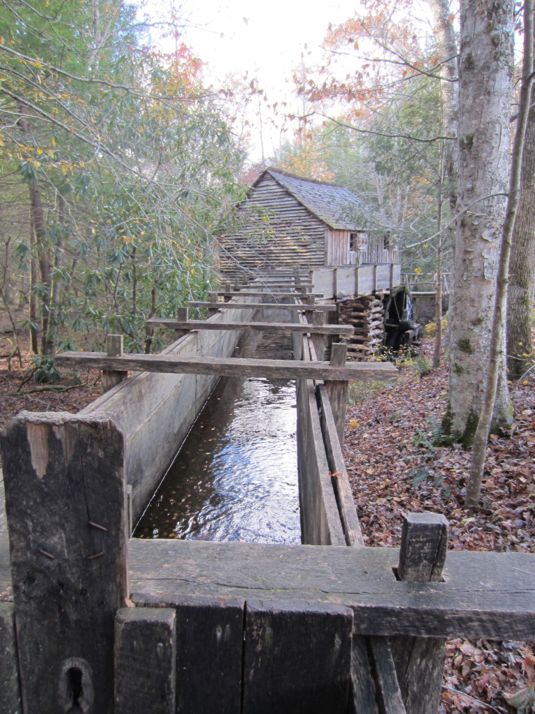
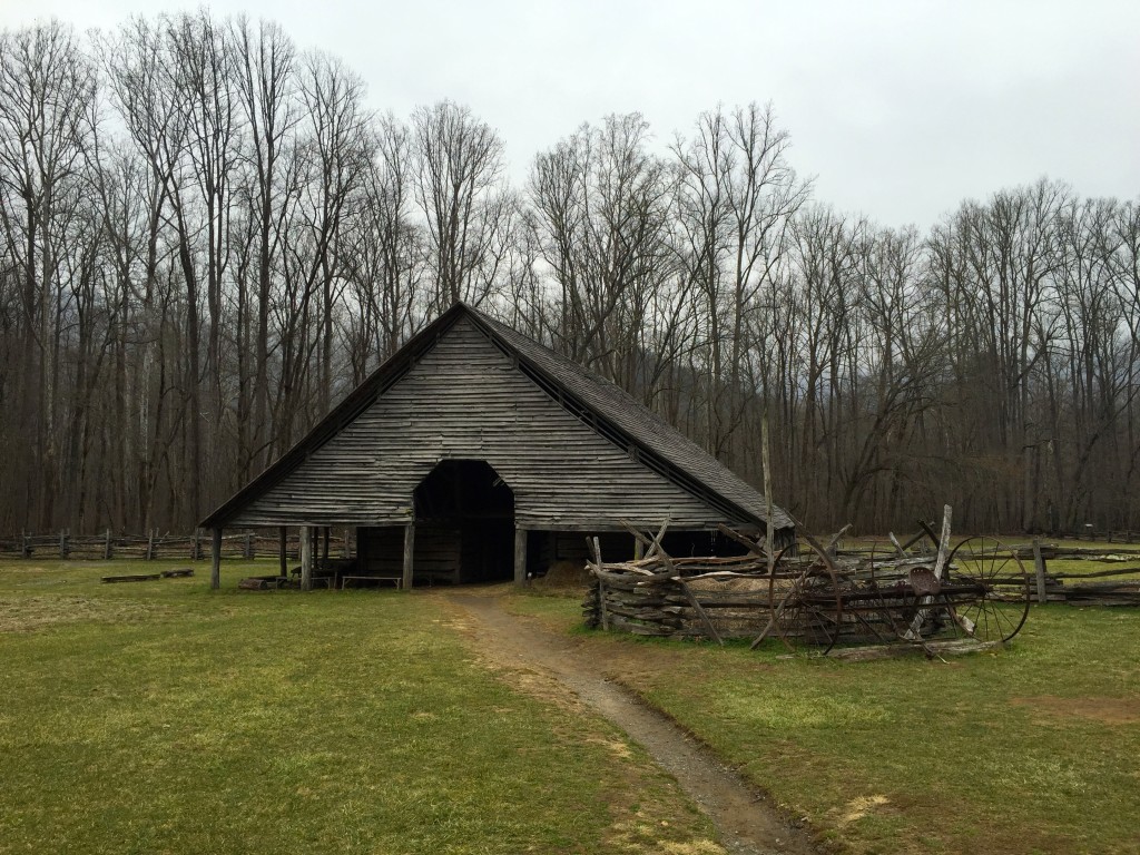
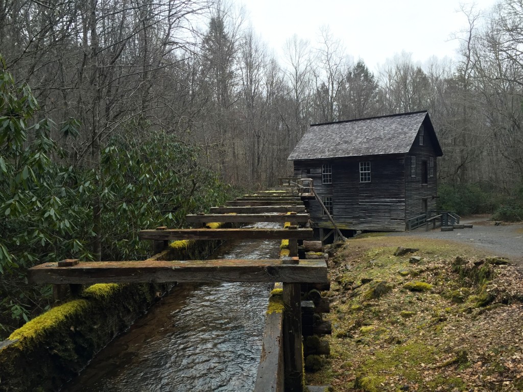
We headed back down the trail, making serious use of our trekking poles.  Mine kept me from falling several times and I’m pretty sure we both would have been in bad shape without them.  We made it back to the car with a good amount of time left in the day, so we took Newfound Gap Road straight across the park to the Oconaluftee Visitor Center which also houses a pioneer museum replete with old buildings, gardens, and an orchard, plus Mingus Mill just down the road.  I’m always blown away by the life the early settlers carved out for themselves in the rugged landscape within these mountains.

IMG_1343IMG_1354

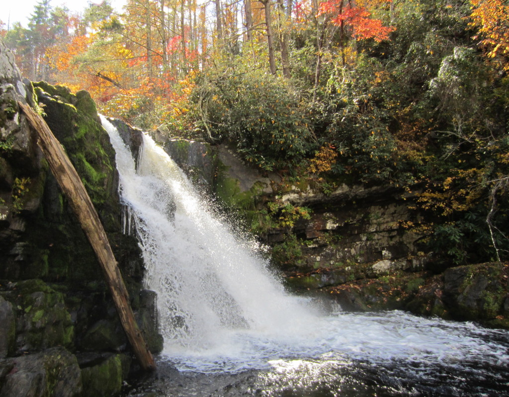
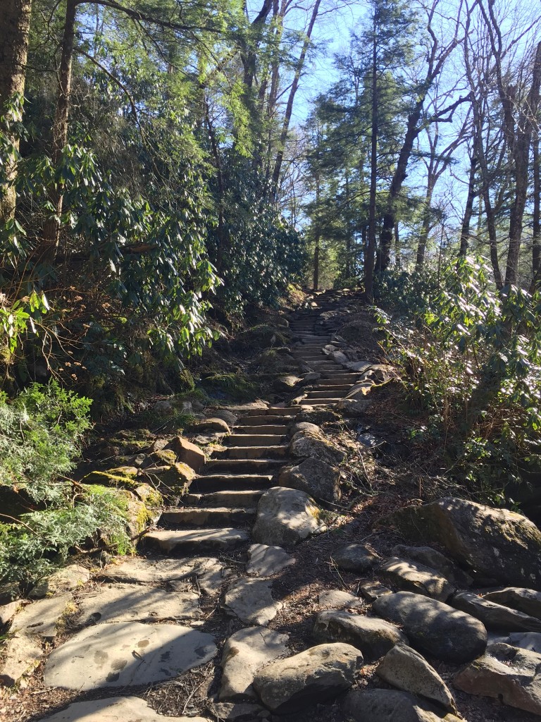
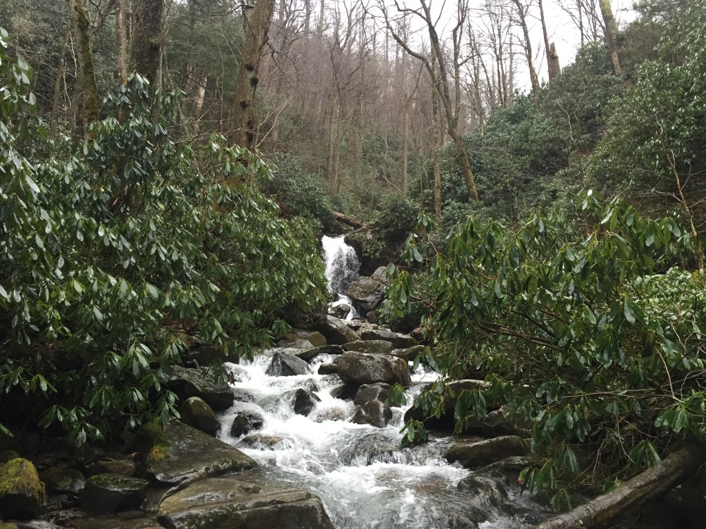
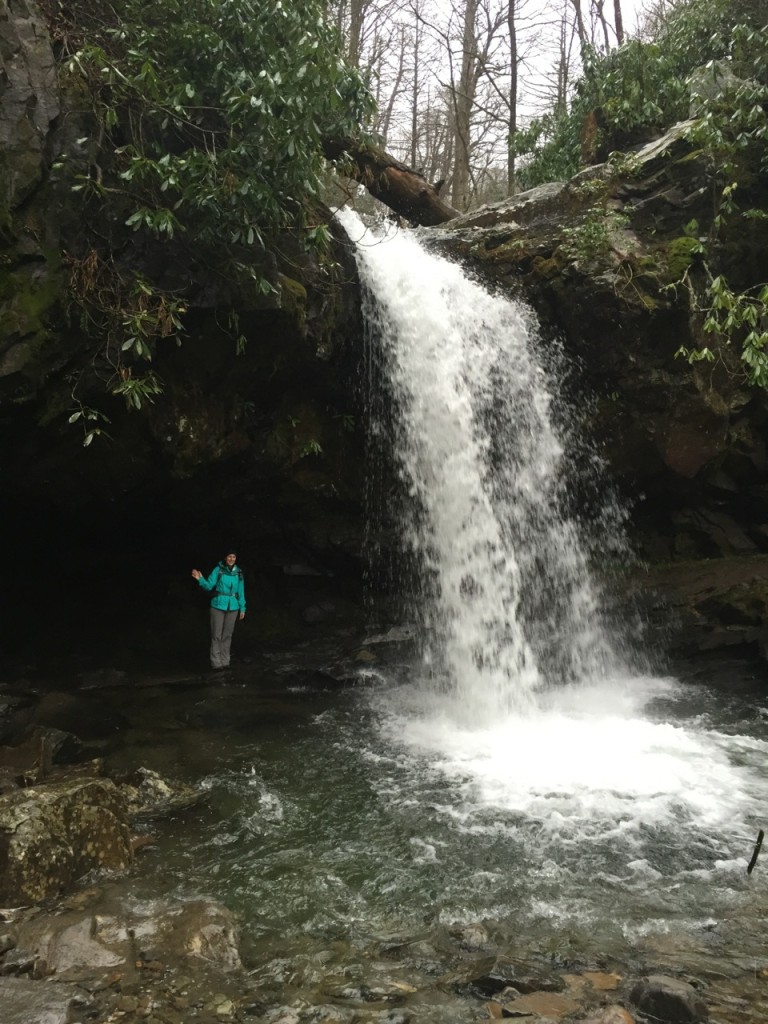
Every once in a while, a volunteer at a visitor center will give a bit of hiking advice that’s worth taking, so when we were told that the 7 mile round trip hike to Grotto Falls was a sure bet, we decided to head there the next morning.  The Roaring Fork Motor Nature Trail is closed in the winter, but the Rainbow Falls trailhead is still accessible, so we started there and took the Trillium Gap trail all the way to Grotto Falls.  This was really the perfect time of year to do this particular hike because the wooded trail goes right along the motor trail and I don’t think the experience would have been as enjoyable with bumper to bumper cars meandering past the entire time.  We didn’t pass a soul on the first 3.5 miles to the falls and we had one of the most popular waterfalls in the entire park to ourselves as rain started to come down.

IMG_1396 IMG_1384

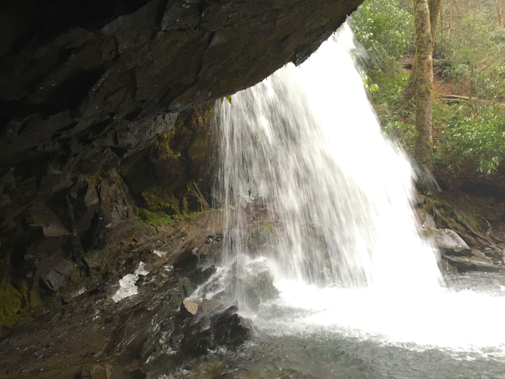
Grotto Falls is the only waterfall in the park that you can walk behind.  In fact, the trail actually goes behind the falls, so if you are getting to Mount LeConte this way, you’ll have to duck beneath Grotto Falls.

IMG_1391

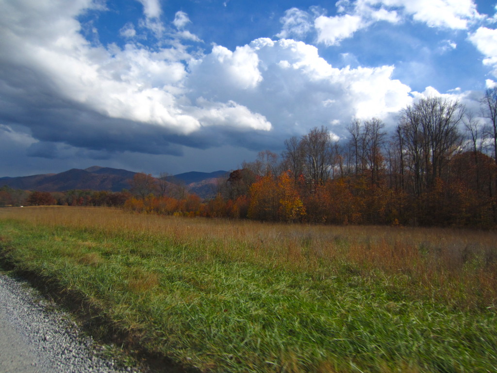
As we made our way back to the trailhead it started to rain on us and we hiked through a steady downpour, eventually ending up totally soaked in spite of rain shells and water repellent pants.  Thankfully the day was warm and the heat from our exertion kept us from getting cold.  As soon as we got back to our room, we changed into warm, dry things and headed right back out to drive through Cades Cove and see it in the mist.

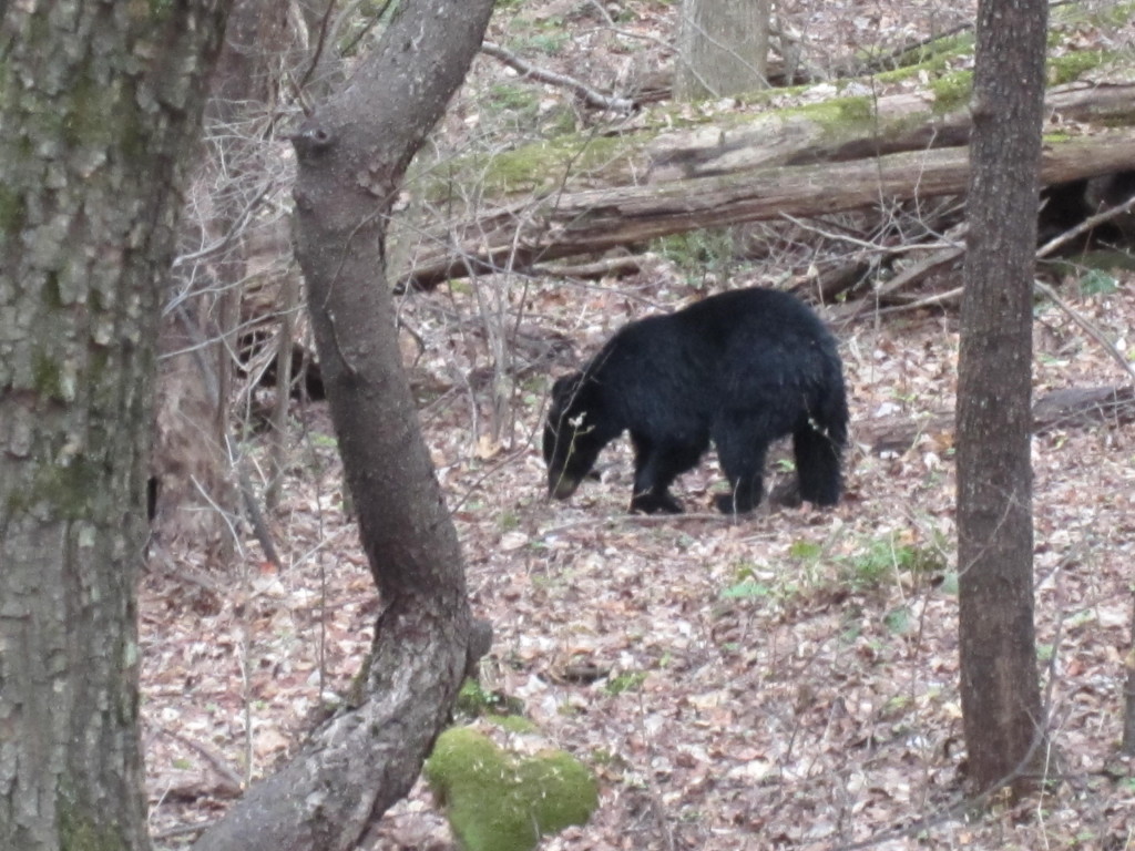
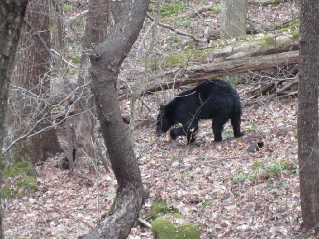
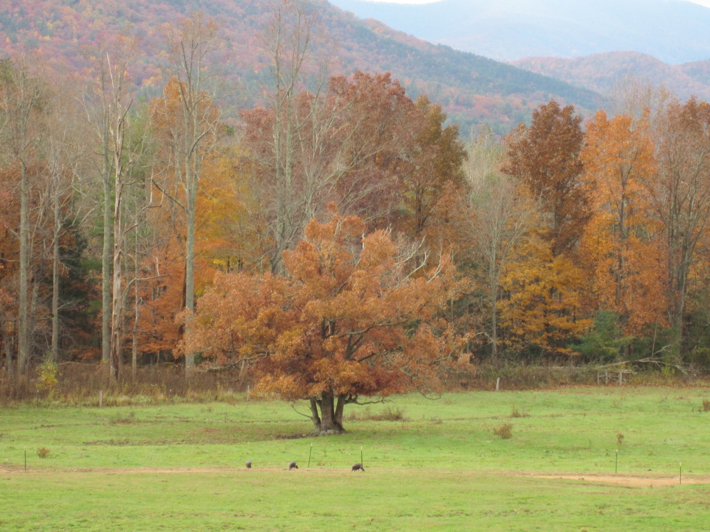
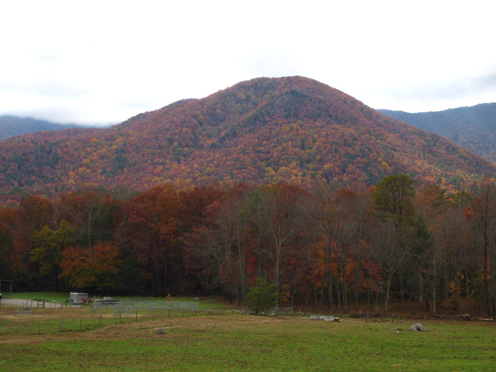
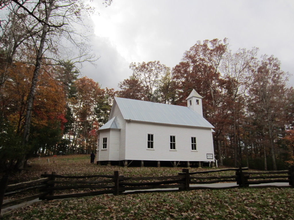
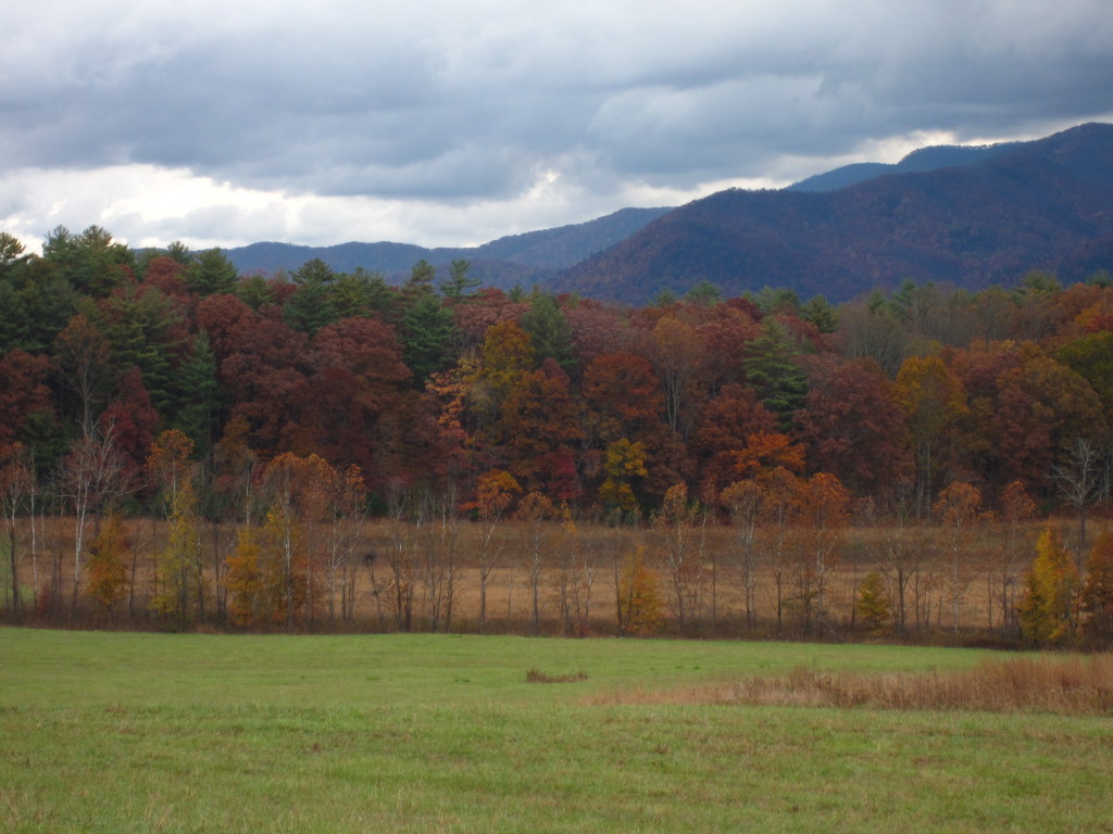
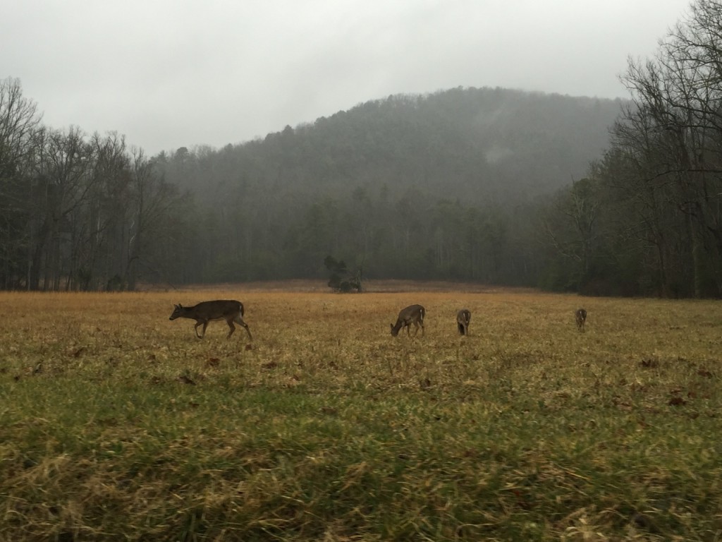
Cades Cove is an 11 mile loop that goes through a preserved pioneer community in the mountains.  It’s one of the most popular places in the park to see Black Bears (or so the NPS website says), so every time we’ve gone it’s been a bumper to bumper, ire-inducing affair where you want to kill every gas guzzling SUV driver who goes 5 mph (LITERALLY) through the woods, stopping to view every moving blade of grass and every falling leaf.  The area is beautiful, but my blood pressure and stress level cause obscene amounts of swearing and hatred toward my fellow man.  This time, however, was a different affair entirely.  The optimum time to experience Cades Cove is on a rainy Sunday afternoon in winter.  We were able to maintain a steady speed throughout the drive and it was enjoyable and peaceful in every way.  We saw lots of turkeys and deer, reveling in the peace of the park at this time of year.

IMG_1398

Even though the weather was miserable at points, it didn’t diminish the beauty of the mountains or the fun we had in seeing things in a different light.  Gatlinburg was as disgusting as it always is.  A grossly high percentage of stores in this little hell hole on the edge of paradise display confederate flag products in their windows: t-shirts, underwear, bikinis, beach towels, purses, you name it, it comes in some form of racist merchandise.  In fact, if you like your racism with a pat of butter and a dollop of cream on top, you can even shop at the Paula Deen store in town.  If you wonder where all the people voting for Trump go to vacation and play, it’s in Gatlinburg.  I have a love/hate relationship with this town.  I love the NOC outfitter store and I am really coming to adore Great Smoky Mountains National Park.  Gatlinburg is the gateway to that incredible place, so the people who started this town most likely never envisioned it becoming the tourist trap that it is today.  Unless we want to stay more than 30 minutes away in a more secluded spot, Gatlinburg is our easy access point to the trails we want to hike.  I’m going back at least two more times this year and I absolutely can’t wait to see rhododendrons blooming and try some new hikes.

Until next time when the leaves are on the trees…

IMG_0096

Filed Under: Hiking, Tennessee, Travel Tagged With: Alum Cave, Chimey Tops, Great Smoky Mountains National Park, Grotto Falls, GSMNP, Oconaluftee Visitor Center

The Best Views In GSMNP: Charlies Bunion

December 1, 2015 by Leah 1 Comment

Coming back to real life after vacation is such a drag, like a shoot me, I wish I had some moonshine right now kind of drag.  But muddle through we must…until the next vacation…which is on Thursday, thank God, or I would have to find something high to jump off of.  We’re heading to Long Island for some soul medicine known as salty air, prescribed by the Almighty as an antidote to the occasional drudgery of daily life.  Also, December is depressingly busy.  Happy busy (maybe?), but just too much happening.  I didn’t even realize it until we got home last night and I opened up my circa 1992 Hallmark, fit-in-your-purse calendar to look at the month and nearly had a heart attack.  All those tiny squares fill up so quickly and then people get mad because you have too much going on and have to draw the line at some things.

For the two more days that we’re in town prior to salty air inhalation, I’m thinking about the mountains and trying to remember all the emotions felt while standing on top of the world, looking out at an endless sea of peaks on Charlies Bunion.  This outcropping of rock has a weird name because it looks like a bunion on the side of a hill, but the views…THE VIEWS!!

A friend recommended this hike to me because it’s her favorite hike in Great Smoky Mountains National Park.  Then, I watched two park volunteers get dewy eyed when talking about the trail and the sights from Charlies Bunion.  “You should really do that hike, you have to see the views from there, it’s incredible.”  The trail to get to Charlies Bunion starts out at the Newfound Gap parking lot and goes directly along the Appalachian Trail.  We’d hiked on the AT the day before and I was convinced it couldn’t get any better, but it does.  I’ll add myself to the list of people utterly enchanted by everything having to do with this trail.

We came upon another shelter, the Icewater Spring shelter, which had a lovely view of the mountains.  Still sparse, but quite a nice place to spend the night.

Thankfully the pricey trekking poles saved our knees.  We got one pair and each had a pole, but I noticed a difference in how my knees felt, as in I could still walk to the bathroom to take some Advil at the end of the day.  If I had pulled 18 tendons in my legs, it would have been worth it to see what we saw on Charlies Bunion.  We had it to ourselves for a few minutes to just silently take in the breadth of what we were seeing and to climb carefully up onto the rock for a picture without falling to our deaths.

When we finally tore ourselves from the bunion, we headed back along the trail to an offshoot called the jumpoff which included a steep uphill .3 mile climb to a whole different perspective of the mountain sea.  In fact, we could see Charlie’s Bunion from where we were and we traversed a mountain like the Von Trapp family, people.  Rob couldn’t see the bunion because he’s going blind at 40, but the neon shirts of the people standing on the rock to get pictures where we’d been standing an hour before showed up against the backdrop of leafless trees. 

In short, a magical respite from the usual pace of life to an altogether different daily challenge of tackling nature.  I hope we can get back there soon to experience even more places in the park, but what a lucky blessing to be able to see what we saw and feel so teeny in the middle of it all.

Filed Under: Hiking, Tennessee, Travel Tagged With: GSMNP, hiking, Tennessee, Travel

GSMNP: Hiking 0.025% On The AT

November 28, 2015 by Leah Leave a Comment

You guys, I’m in Gatlinburg, the armpit of Tennessee, also known as the Vegas of the South, also known as the grossest place on earth, also known as the white trash capitol of the world, also known as air-brushed t-shirt heaven…shoot me.  The thing is, people actually come here to just spend time in this town.  What is wrong with them?!  We are staying in this town solely for its proximity to Great Smoky Mountain National Park.  We wake up early, eat breakfast before the crowds arrive, and head into nature as fast as we can to avoid all the insane crazy idiots who vacation here.  Then we hike, come back into this hell hole of abysmalness to eat dinner, and head to the three distilleries in town that give you free moonshine tastings…which brings me to my current state of drunkenness while writing this blog.  Moonshine is awesome, how was this stuff ever illegal?!  You sidle up to a sticky counter where a very enthusiastic, pimply youth who doesn’t get enough attention at home yells at you and tells you to drink more free liquor.  In fact, we discovered you can get totally drunk for $3 in Gatlinburg, $1 tip for each distillery.  Old Smoky Moonshine is gross and way too sweet, don’t go there.  The Davy Crockett place is much much better.  But the Sugarland distillery takes the cake as far as moonshine goes, but get there before 9 pm or you’ll only get 4 samples, and please, who can get drunk on that?  The best thing is that they give you tastings in communion cups!!!  Like, the old school plastic cups you drink grape juice out of in church, so you feel like this is some kind of holy sacrament Jesus approves of because everyone in the South is a Christian and loves Jesus, so obviously, moonshine.

Today, was maybe the best day of my life, except for being born and marrying Rob, because I got to hike a teensy tiny, not even worth mentioning how short it was, portion of the Appalachian Trail.  In fact I just did the math because I’m a nerd and we hiked 0.025% of the entire trail.  Holy cow, I’m a section hiker.  Tomorrow we’ll hike another 0.04%, so look out, world.  We went up to Clingman’s Dome and walked up that God awful concrete hill till we came to the Appalachian Trail and took an immediate left to head to the Double Spring Gap Shelter, which was 2.7 miles from the Dome.  This is probably, most definitely the most beautiful stretch of trail I’ve ever been on, plus it holds the distinction of being the highest point on the AT.

IMG_5431

IMG_0461

IMG_0464

IMG_0496

IMG_0469

We hiked down to the shelter, which was actually nicer than I was expecting, I mean…primitive, but still nice.

IMG_5445

Where thru-hikers get cozy

IMG_5442

There are SO many rules when hiking through a national park…

IMG_5443

What lonely, depressed hikers read on the trail

IMG_5444

Two thru-hikers were just packing up and getting ready to leave, so I got to pepper these nice young, bearded men with questions before they set off on the continuation of their journey.  While chewing on a mouthful of Clif Bar I learned that they’ve been on the trail for 5 1/2 months and started in Maine.  They are taking illegal amounts of aspirin to deal with the day to day body aches involved with this journey. It was recommended that we quit our jobs and hike this trail and not wait till we’re retired because our bodies will crumble and decay if we do this when we’re old.  Apparently there was an older man who was attempting the 100 mile wilderness at the same time they were and ended up quitting, which, duh, that’s like the hardest portion of the entire trail, so I think that guy was just dumb to start out there.  They were wearing these cool knee supports they found in a hiker box, which I need to order from Amazon immediately because my knees hate me right now.  They also said that going back to normal life is going to be really hard after this, but that if they don’t end up getting jobs that’s ok because there’s always the Pacific Crest Trail and the Continental Divide Trail to tackle.  Yes, they plan to aim for the Triple Crown.  A few days ago they saw some bears on the trail, but the other night it was only 14 degrees and they were really cold trying to sleep.  They packed up and headed on down toward Springer Mountain and became our new heroes.

Want to know what tired day hikers look like on the AT?  Like this.  

IMG_5454

We had to stop several times on the way back up so we didn’t die.

IMG_5453

We finished up our snacks, checked out the bear cables at the shelter, and headed back the way we came, which was ALL uphill…no big deal.  We climbed and sweated our way back up to Clingman’s Dome and decided to avoid the lookout altogether because it was crawling with people, so we stopped at the information center and talked to these two badass women who were volunteers and have hiked all over these mountains.  They were amazing and if I could have taken them out for coffee and some moonshine, I would have.  We headed back down the mountain and saw a bear, which I was dying to see, but was thinking there’s no way we could get that lucky, to see TWO bears in one year, but we did.  Here is our second black bear this year.  We crouched down by the side of the road and we watched him forage for acorns without being scared out of our minds because he wasn’t 6 feet away from us, like in Colorado.  This guy was a safe distance and we watched in peaceful awe of the adorableness that is a bear butt.  Bear butts are almost as amazing as cat’s paws.

IMG_5468

IMG_5473

I’m really sore.  Rob is really sore. We went to the Nantahla Outdoor Center (NOC) at the end of town on our way back and were nearly talked into buying a pair of nice trekking poles for $100 smackeroos.  We declined…then as the night wore on and we drank more moonshine, we felt more and more sore.  In fact, my knees and my glutes are so sore, I could die.  I hiked up a mountain using my ass, people.  We thought about those trekking poles and debated the pros and cons, I’m not kidding, we did, even made a list like adulty people.  Finally, we ran to the NOC, arriving 3 minutes before they closed to buy a pair of trekking poles that cost as much as the dress I’m wearing to the GRAMMYs this year.

Tomorrow, we hike to Charlies Bunion, also along the AT, which boasts some of the prettiest views you can see in the park…with trekking poles.

Filed Under: Hiking, Tennessee, Travel Tagged With: Appalachian Trail, GSMNP, hiking, Tennessee, Travel

Great Smoky Mountains National Park: Getting Out Of Tackytown And Into The Woods

November 4, 2013 by Leah Leave a Comment

 Rob’s birthday is coming up and I wanted to make a memory as opposed to struggling to find him a gift he might not use, so I thought it would be fun if we went up to Great Smoky Mountains National Park to go hiking and see some Tennessee fall color.  On Friday night we arrived in Gatlinburg.  The first time I was here was in my freshman year of college and I remembered it as being the most horrendously tacky place on earth.  My memory had erased the worst part of getting to Gatlinburg: going through the armpit of the tourist industry, Pigeon Forge.  I think the place is disgusting.  It is the antithesis of everything beautiful and true, the worst kind of tourist consumerism.  Pigeon Forge is a highway of neon lights advertising psychic readings, every embarrassingly “country” show you can imagine, cowboy boot outlets, mini golf palaces, and as Rob so aptly put it, the place looks like a carnival got stuck there.  When we arrived in Gatlinburg, the scene changed a bit.The town grew smaller, the neon lights grew slightly dimmer, and signs for the parkway began to appear, along with the brown and white signs I have grown to love that signal you are in the middle of government protected nature.  We took a walk through town at around 11pm just to see what there was and since we were some of the only people out, it seemed rather tame.  During the daytime when the tourists emerge, it’s pretty much my personal traveling nightmare.  The people who frequent the town of Gatlinburg are not the earthy types you normally find in towns that border national parks.  The clientele is more that of a traveler barely energetic enough to make it from one Ripley’s Believe It Or Not attraction to the next fudge shop prior to buying an airbrushed t-shirt.

When you get out of town, the parkway leads you straight into the park, and Rob and I were enamored with the fall color and the pristine woods.  All of it seemed even more glorious after leaving the stifling confines of a town that seems an affront to the nature that surrounds it.  We stopped at the Sugarlands Visitor Center to get a map, some directions, and a plan for the day.  We decided to drive through Cades Cove and hike to Abrams Falls.

IMG_3048

I’ve never been to Cades Cove, but a friend said I had to see it and I’m so glad she did.  The 50 minute drive to the Cove loop was an adventure in itself.  There are lots of pull-offs where you can stop and meander along the rambling river that wends its way next to the road.

IMG_3052 IMG_3056 IMG_3067

The water was rushing in chilly currents through the forest, carrying bits of gold, red, and fiery yellow leaves with it.   Green moss blinked out from the tree roots and blanketed the river rocks.

IMG_3143

Every bend had me saying, “ooh, that’s pretty” to the point where “pretty” just sounded inane because every part of what we were seeing was simply gorgeous.  There were parts of the road where the sunlight lit the trees on fire, showcasing the brilliance of the golden leaves that were so prevalent throughout the hills.  As soon as we entered the scenic loop around Cades Cove we found ourselves in a bumper to bumper line of cars that wended its 11 mile way through an outdoor museum of sorts paying homage to the simple pioneer life of the families who lived in this portion of Appalachia.

IMG_3080

Some pre-Thanksgiving turkeys having a snack in field.  No big deal.

IMG_3086

IMG_3087

Rustic log cabins dotted the cove, along with simple churches that spoke to a time when church buildings consisted of 4 bare walls and rough hewn wooden pews.  The sound systems in today’s churches would have blown the minds of the people who once worshiped here.  The simplicity of this way of life, the self-sustaining culture that dwelt here spoke deeply to me as we drove through.  This is a simplicity I have never known.

IMG_3088 IMG_3100 IMG_3102 IMG_3104 IMG_3107 IMG_3120

Halfway through the loop, we stopped at the Abrams Falls trail head for a 5 mile waterfall hike.  Up and down the rocky trail we walked, through rainbows of fall colors, breathing in the crisp air of the river beside us.

IMG_3129 IMG_3140 IMG_3144 IMG_3158

The trail was a moderate one and we enjoyed the entire walk.  Once at the falls, we were able to sit and eat some apples, watch a rainbow trout, and listen to the rushing water plummet over the rocks into a deep pool below.

IMG_3167

Heading back we threw our backs into the uphill climb and made the entire round trip in exactly 3 hours.  Perfect timing!  Plenty of time left to check out the Cades Cove visitors center and historic grist mill.

IMG_3186 IMG_3200 IMG_3202 IMG_3210

The colors of the trees stood out even deeper as the light started to fade.  We crawled along at a snail’s pace out of the cove, passing more cabins, imagining more empty fields swaying with wheat, rye, and cotton.  Coming back into Gatlinburg town was a bit of a shock to the system after being surrounded by such pure beauty the entire day, but we already had a plan for the next day that included more waterfalls.

Filed Under: Hiking, Tennessee, Travel Tagged With: Abrams Falls, Cades Cove, Great Smoky Mountain National Park, GSMNP, hiking, Tennessee, Travel, trees

Copyright © 2025 · Foodie Pro Theme by Shay Bocks · Built on the Genesis Framework · Powered by WordPress