• Skip to primary navigation
  • Skip to main content

Edges Like Sea Glass

By Leah LaRocco

  • Home
  • Blog
    • Thoughts On Life
    • House & Home
    • Gardening
    • Travel
    • Hiking
  • Marking The Miles
  • Contact
  • Subscribe

Great Smoky Mountains National Park

Gregory Bald & Andrews Bald: Blossoms and Bears

June 17, 2016 by Leah Leave a Comment

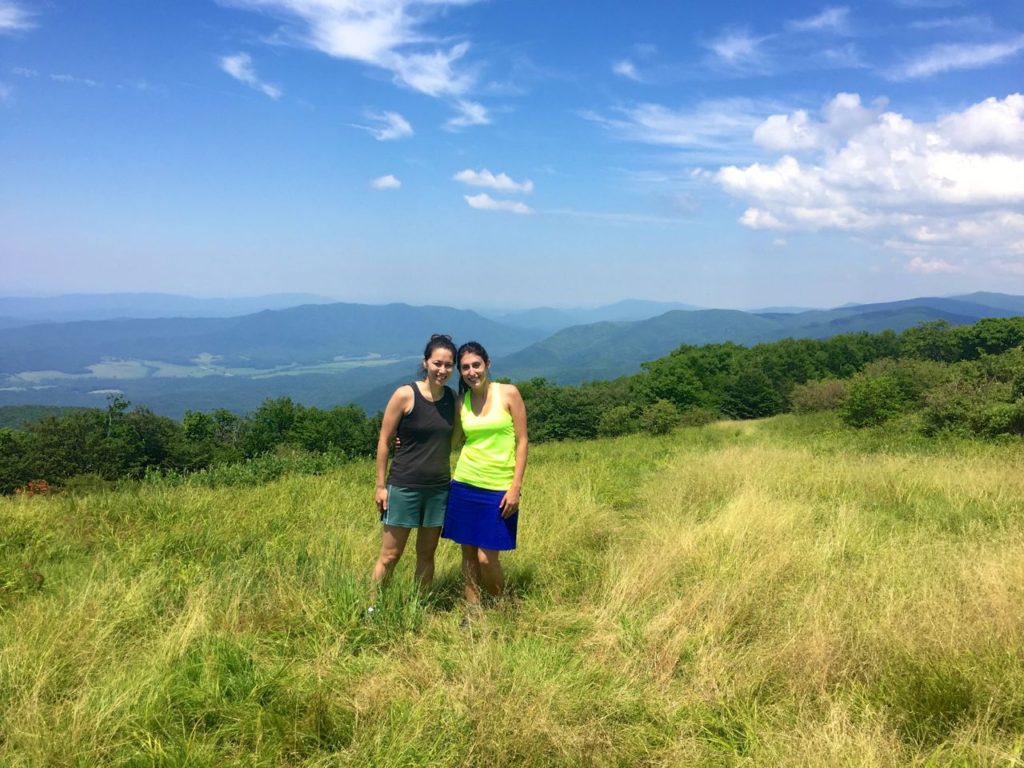
This past weekend a good friend from college and I headed out to the Smokies to hike on some of the mountains known for their flame azaleas and rhododendrons.  The second weekend of June this year seemed to be a bit early for the flame azaleas, but we lucked out and were able to see some bushes that were in full, glorious bloom.

The first hike we decided to tackle was Gregory Bald.  During the time when Lisa and I were planning this trip, I saw lots of articles about how Gregory Bald is the best kept secret of the Smokies, how it’s the best place anywhere in the world to see flame azaleas, how it’s a must-see for adventurers who want views without the crowds…on and on.  It was this description that clinched it for me though.  The thing is, I completely agree with all those descriptions.  Yes, the bald itself is incredible and I’ve never been in an environment like that before, part meadow, part blooming brushy hedge.  However, the trail made me want to kill myself.

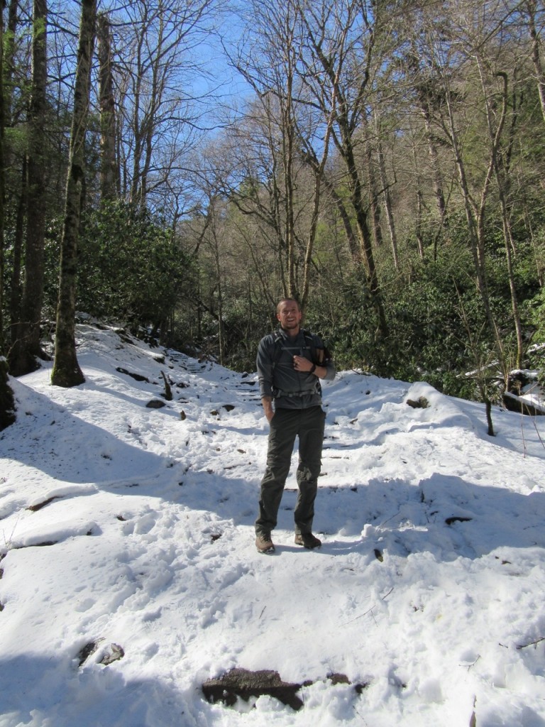
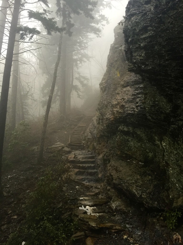
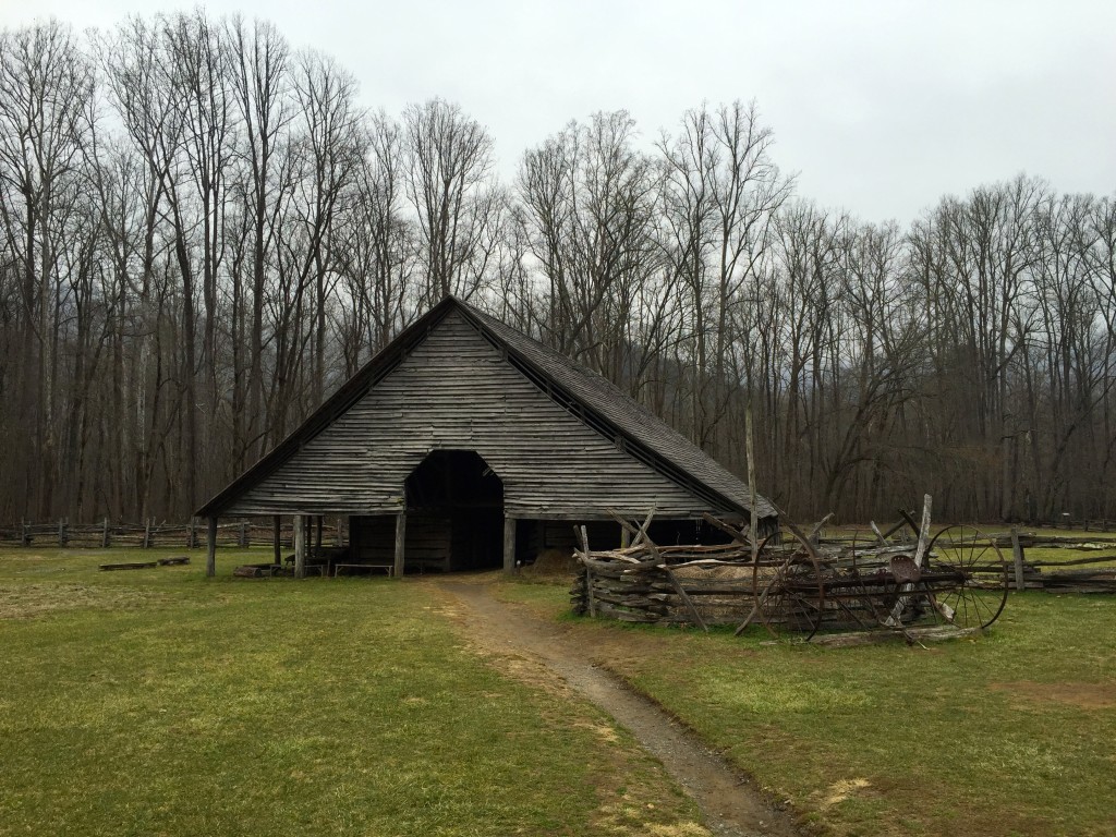
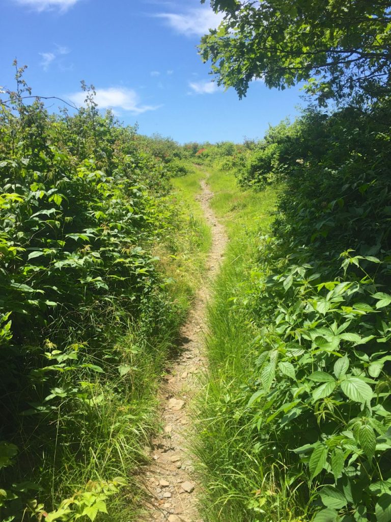
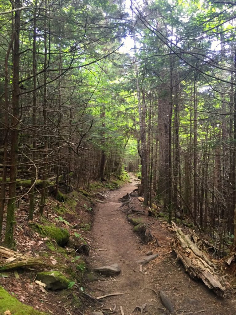
This is how the trail looked the entire way until we got to the top.  Not terribly interesting forest with little air movement.  Agh!

IMG_2260

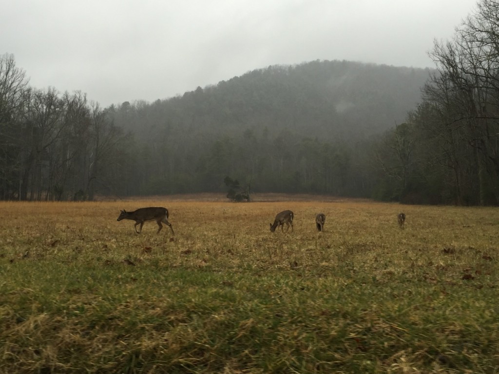
Maybe it was the fact that we’d had a little too much moonshine in Gatlinburg the night before, or maybe it was the lady problems we were both having, or maybe it was that we didn’t get the best night’s sleep in the dingy old hotel where we stayed, or maybe it was the giant biscuit we both ate for breakfast…all of these things combined in such a way that we felt really tired the morning we decided to do this hike.  We got up pretty early and headed to the Cades Cove loop in an effort to beat the traffic only to discover that on Wednesdays and Saturdays Cades Cove doesn’t open to cars until 10 am.  So we sat around and looked at the trail riding horses, waiting with hordes of people for the road to open.  One hour later, after a visitor center stop and a bumpy dirt road, we were at the trailhead.

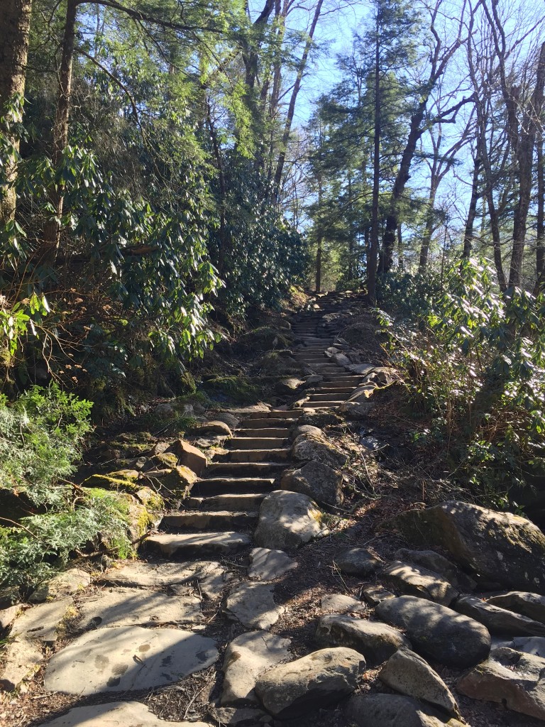
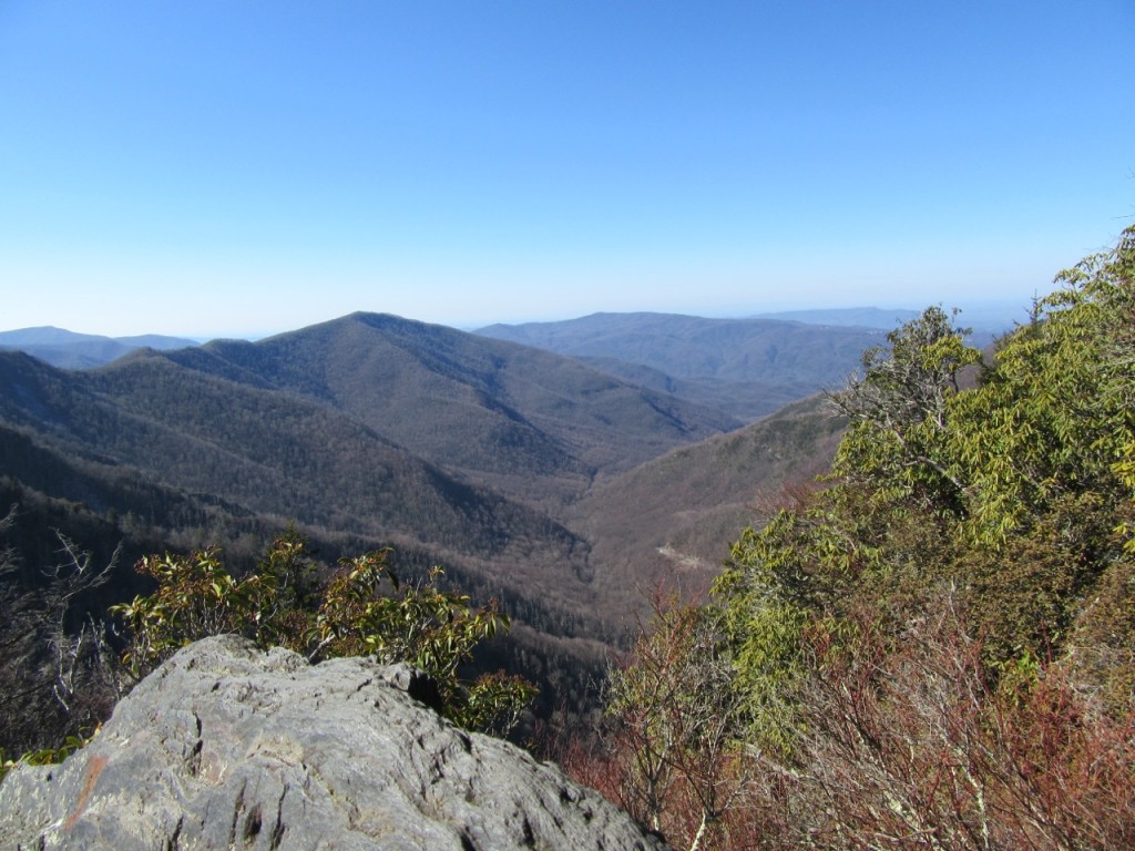
Once we had our gear strapped on, the ascent began.  5.5 miles up to the top with no downhill breaks whatsoever.  We struggled 3,020 feet up the mountain through a sometimes-boring deciduous forest where at points there was zero air movement and sweat poured out of our gross, tired bodies.  There were many stops along the way to catch our breath, grab a snack, drink some water, and then determinedly trudge on, ever thinking we were close because there wasn’t one damn sign or marker on that whole trail until you were .6 miles from the bald.  Which, at least we knew we were .6 miles away, but hell, it seemed like we were surely closer than that.

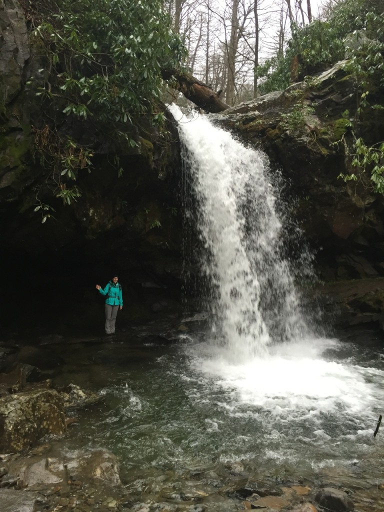
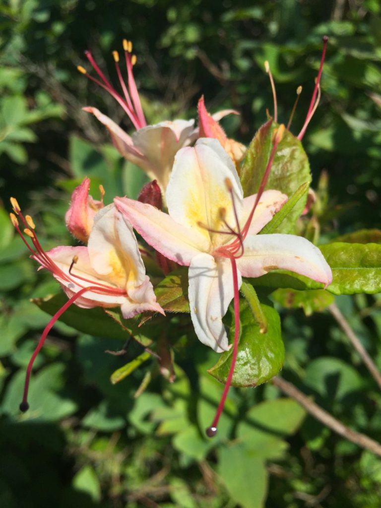
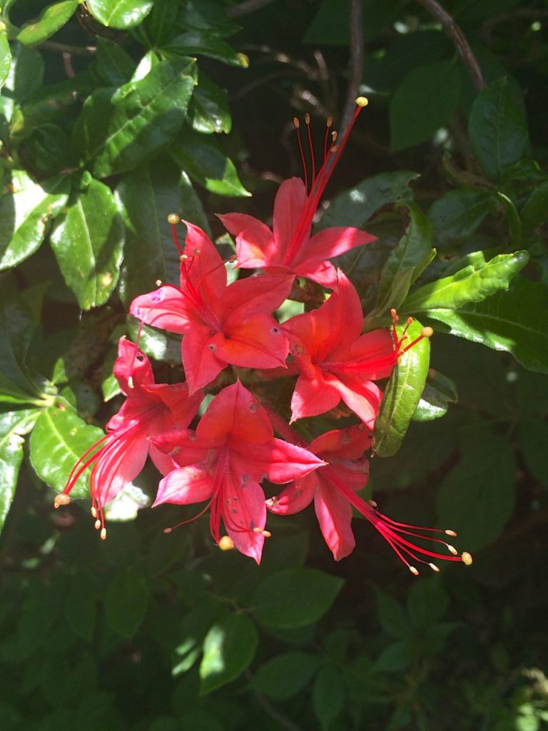
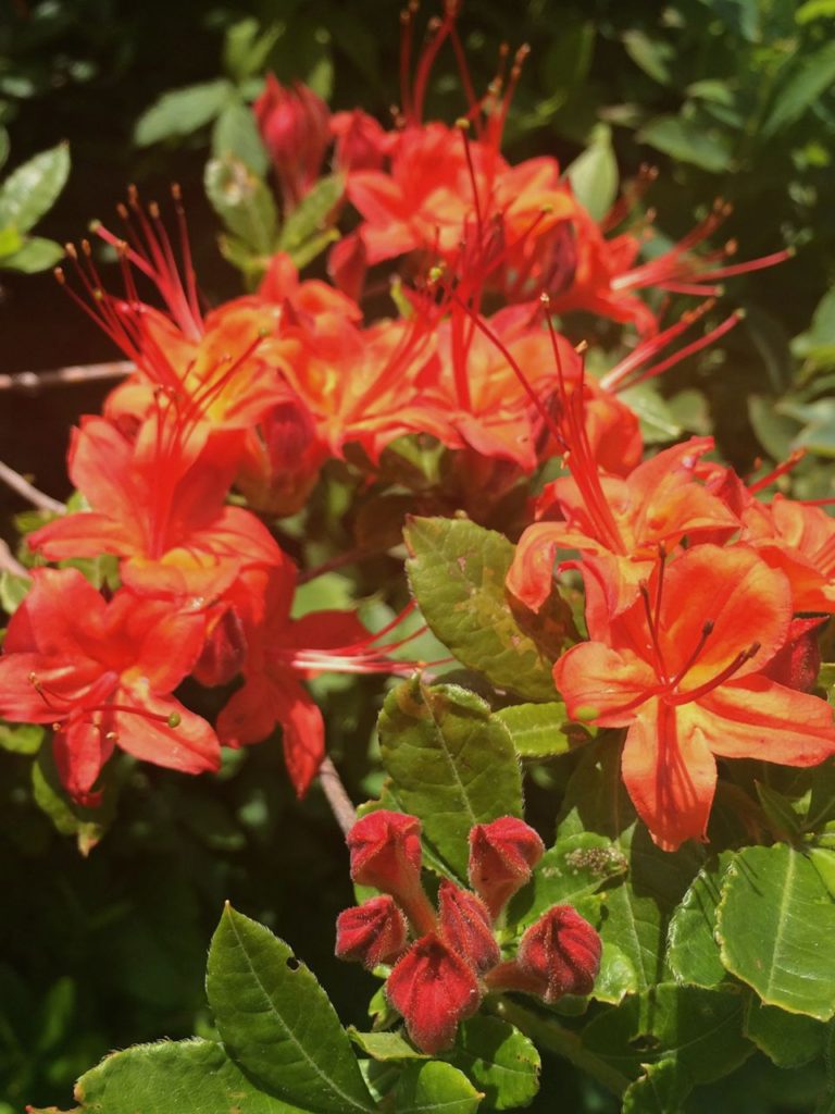
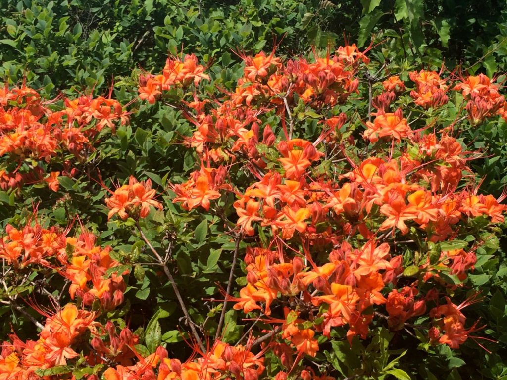
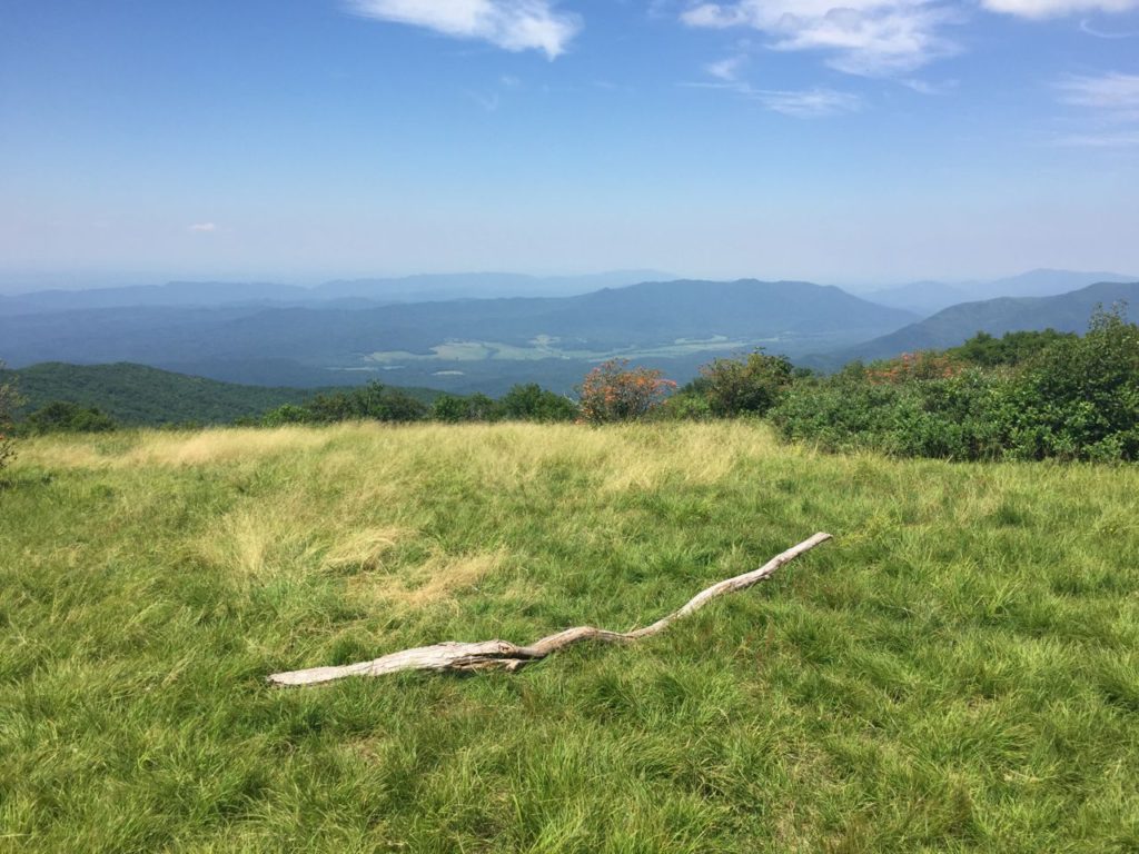
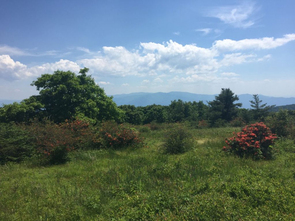
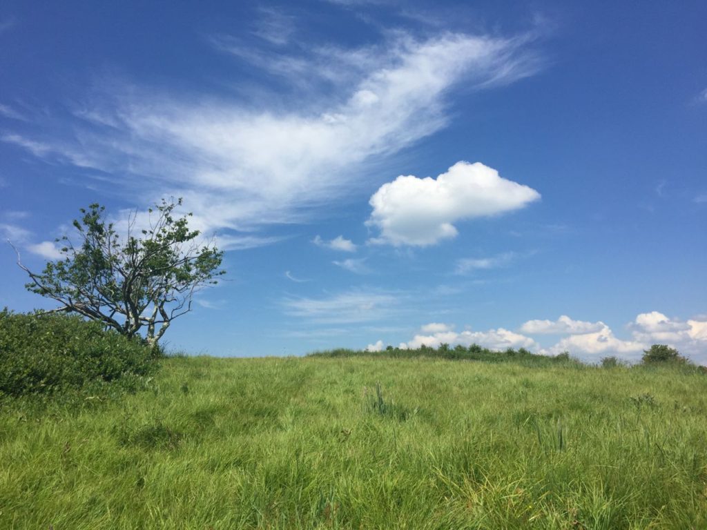
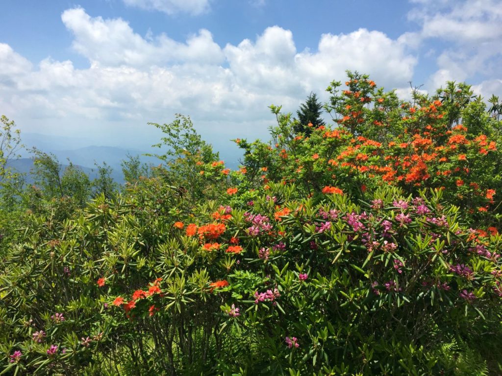
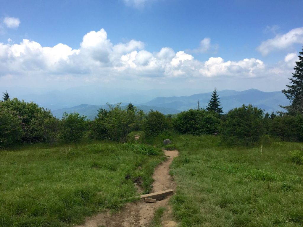
When we finally did reach the bald I was at a loss for words.  We started seeing bright dots of orange throughout the woods as we neared the bald, until we came out into a meadow covered in flame azaleas in every shade of orange, red, and bright pink.  I’ve never seen anything like it.  The trail led through an area of blueberry bushes, blackberry bushes, and azaleas so densely packed that you couldn’t see through them, then opened up into a grassy meadow where we could see farm fields and mountains for miles.

IMG_2198 IMG_2258 IMG_8994 IMG_8996 IMG_8998IMG_2255

Lisa and I survived being music majors together in college, so this was a piece of cake in comparison to that.  This year I’ve been so thankful for the adventurous women in my life who have literally climbed mountains with me…

IMG_2237

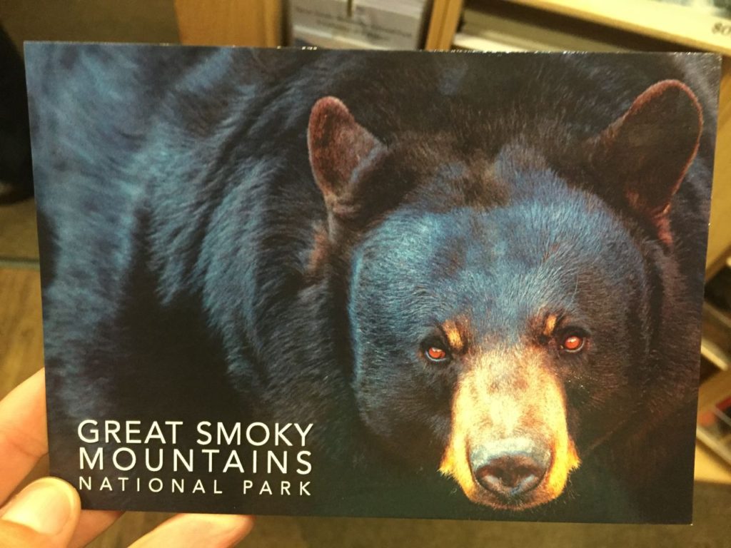
At this point, the second weekend of June, the azaleas were just starting to bloom, so some of them were still budded and a few of them had already passed.  If we’d been a week or two later, the explosion of color would have been dynamic.   We sat and took in the scenery for a while before getting up to talk around the bald.  A couple who’d been on the trail in front of us said there was a bear about 300 yards away in the bushes, so we immediately headed in that direction.  There were several people on horseback who were yelling at the bear, and as we got closer a behemoth of a bear exited the azaleas, walked a short distance and went right back into the shrubbery.  That was all we saw of him and I wasn’t able to get a picture, but he looked like the size of a small car and I took this picture in the gift shop to give some perspective on how utterly giant he was.  We could see the bushes crashing around as he foraged for berries and eventually, he just wasn’t there anymore so we pet the horses and took some pictures with some really gorgeous shrubs.

IMG_2267 IMG_2244 IMG_2245

As the day wore on, we decided to head back down the trail.  We went back through the meadow and into the area where we first entered the bald.  As we were neared the tree line of the woods we heard an enormous crash in the shrubbery directly next to us, like a semi was trying to make its way through the bushes.  Lisa immediately grabbed the bear spray from my pack and we started yelling and banging our trekking poles together.  The noise stopped and we stood there, hearts beating out of our chests, not knowing if the bear was going to keep coming or if it had decided to turn and retreat.  We continued to listen and make noise and finally headed back down the trail…all 5.5 miles of downhill which eventually cost me my right pinky toenail due to boots that weren’t wide enough.  I think I’ve finally made the transition to exclusively using trail runners since I can’t find a pair of boots that don’t kill my feet.

IMG_2234

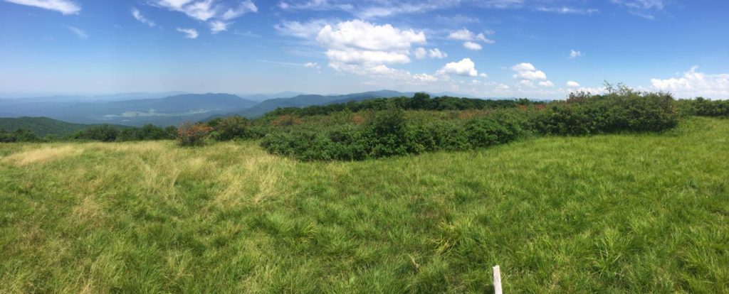
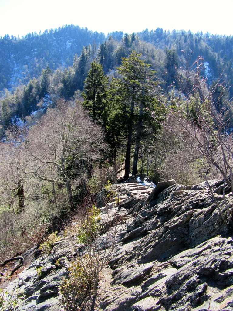
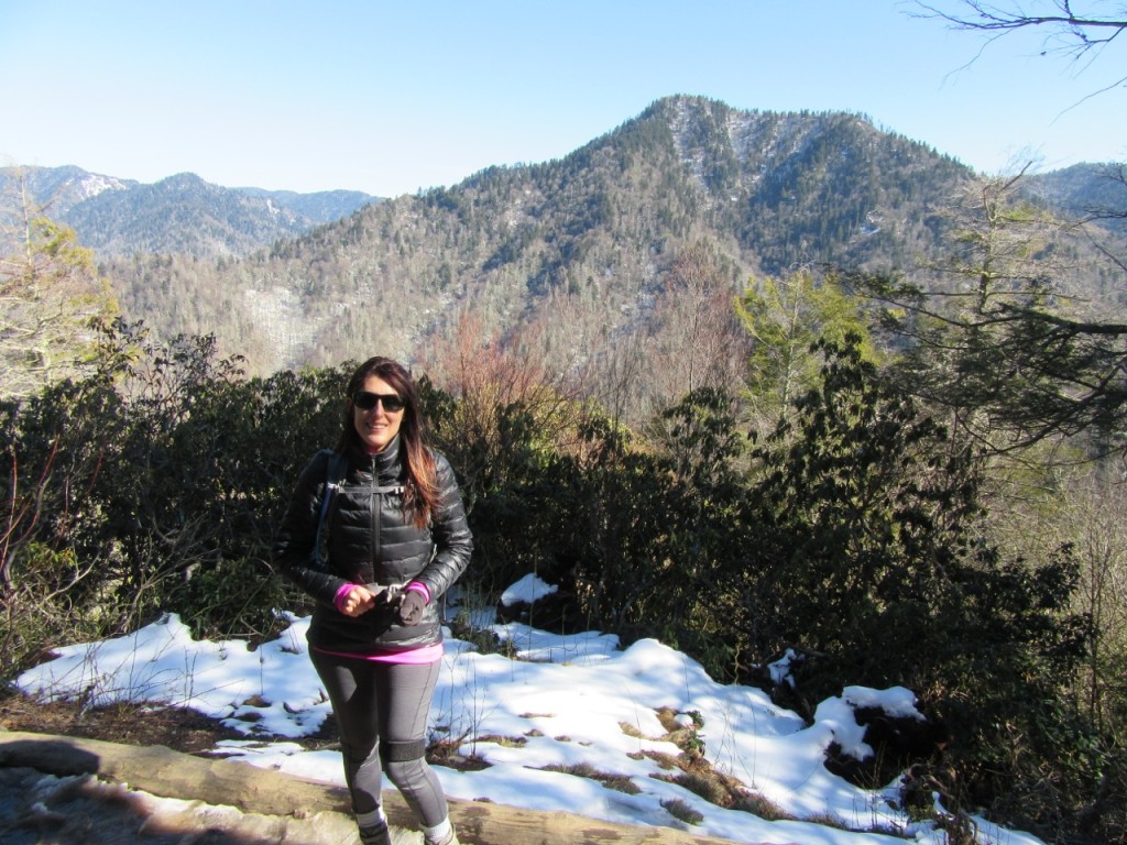
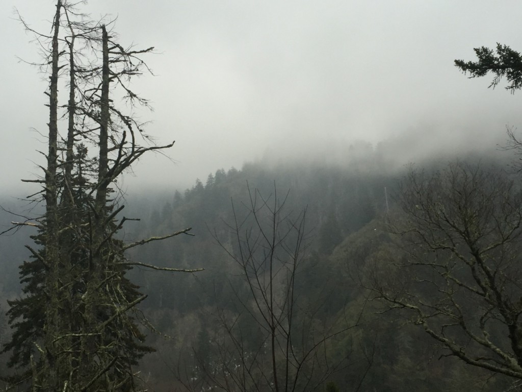
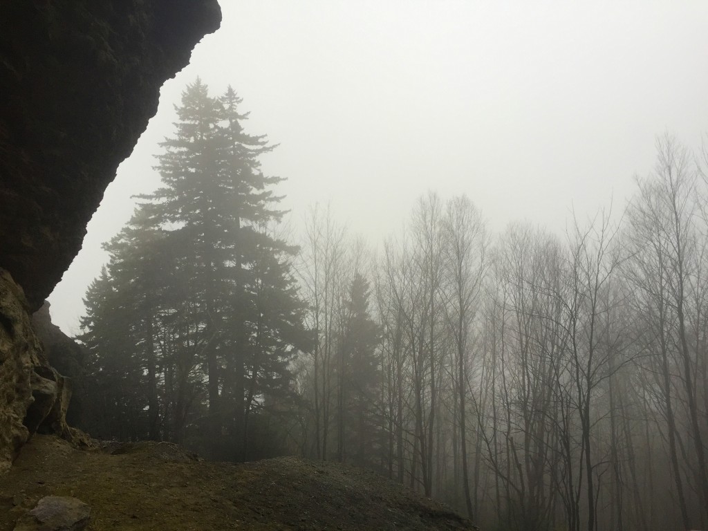
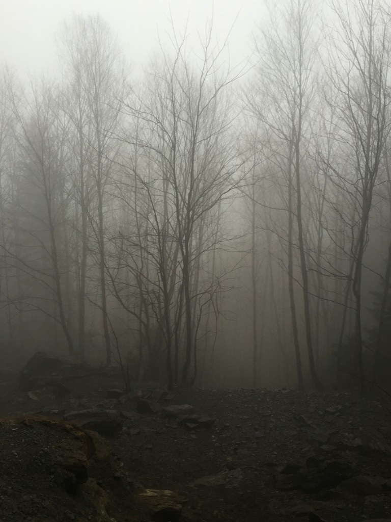
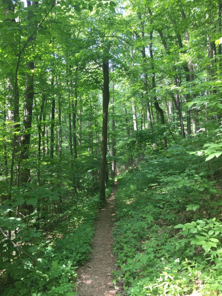
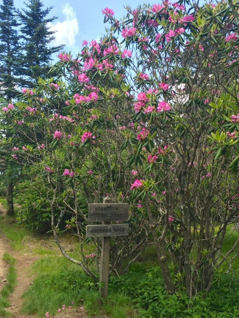
After an utterly exhausting day getting to Gregory Bald, we decided to head up to Andrews Bald, which is accessed at the Clingman’s Dome parking lot.  The trail is 3.6 miles RT and leads out to another bald with sweeping views down to Fontana Lake.  When we parked the car everything was shrouded in mist and looked like rain, but we made the decision to stay.  As we headed down the trail the clouds began to clear and it turned into a glorious day.  The forest on this trail is simply stunning, filled with Fraser firs and mossy logs.  Even though it’s quite a bit more manicured than some of the other trails in the park, the separation from the crowds was immediate when we entered the woods.  A really nice surprise on this bald was the blooming Catawba rhododendrons, which we hadn’t really seen any of on the other trails.  There were also some flame azaleas up here and it was decided that we could have just skipped Gregory Bald and enjoyed this spot just as much if not more.

IMG_2292 IMG_2297 IMG_2332IMG_2306

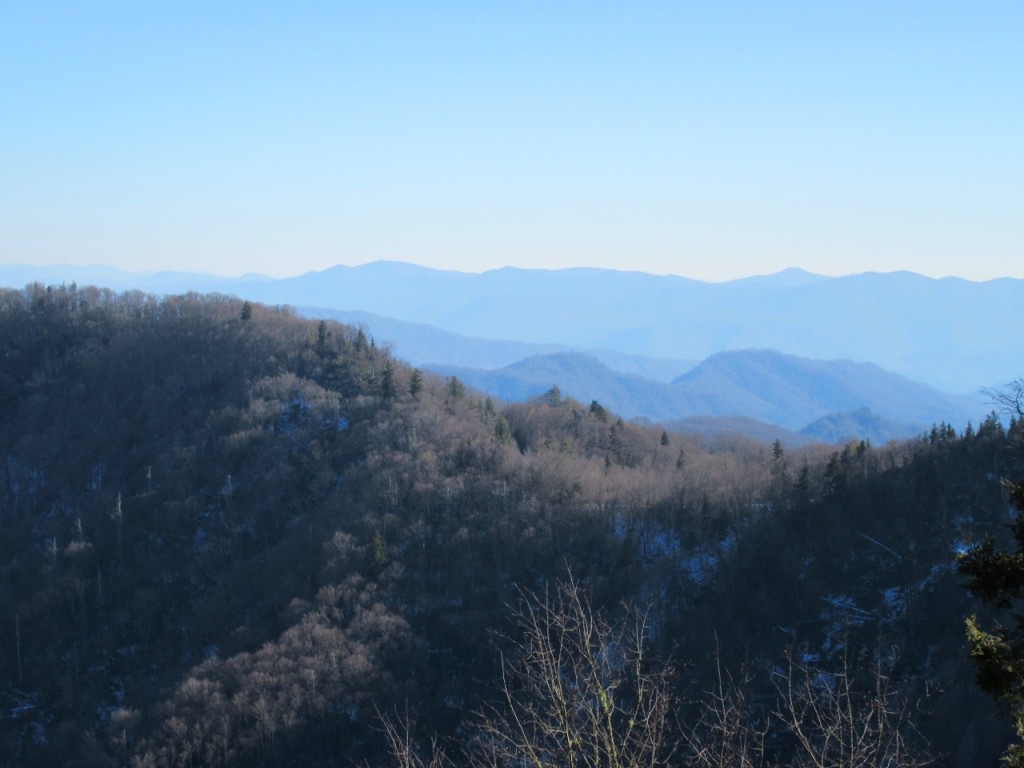
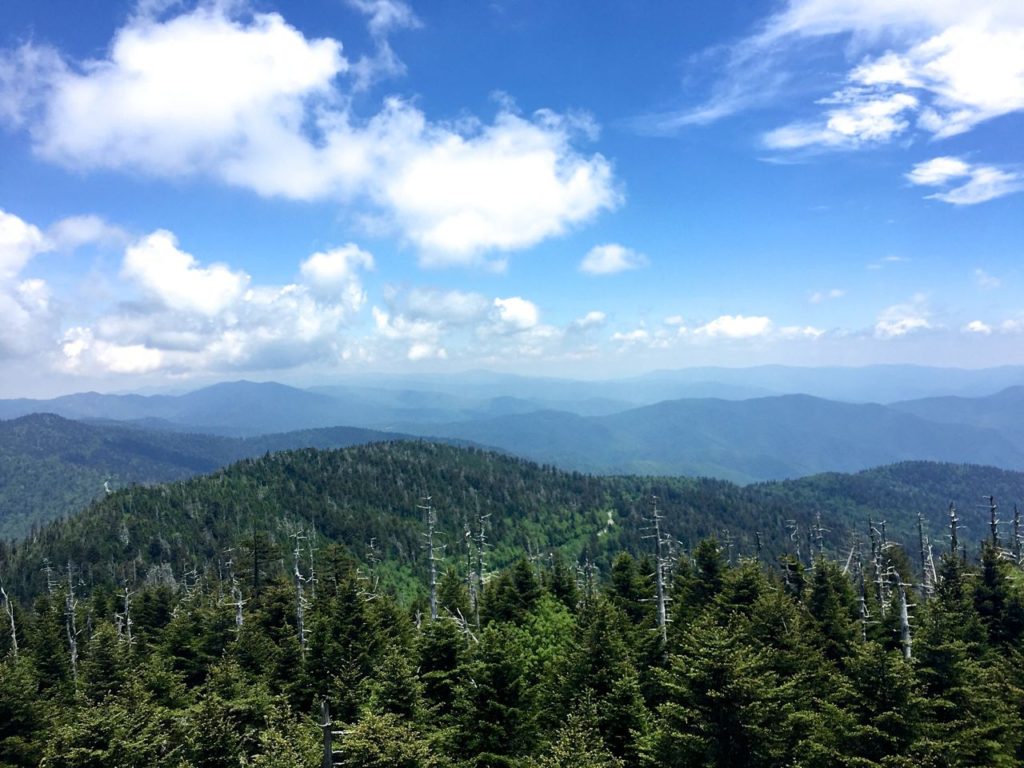
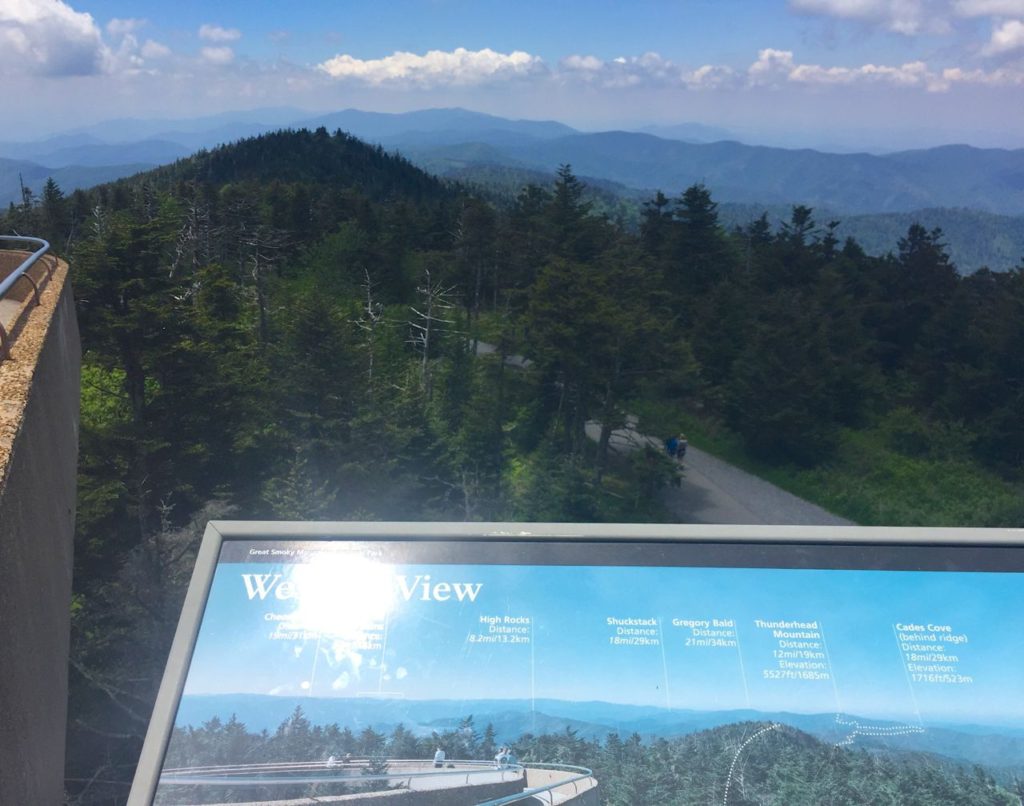
After the Bald we walked up to Clingman’s Dome to take in the views and were able to see where we were yesterday.  It’s an incredible feeling to look across a mountain range to a peak you walked up the day before.

IMG_2355 IMG_2359

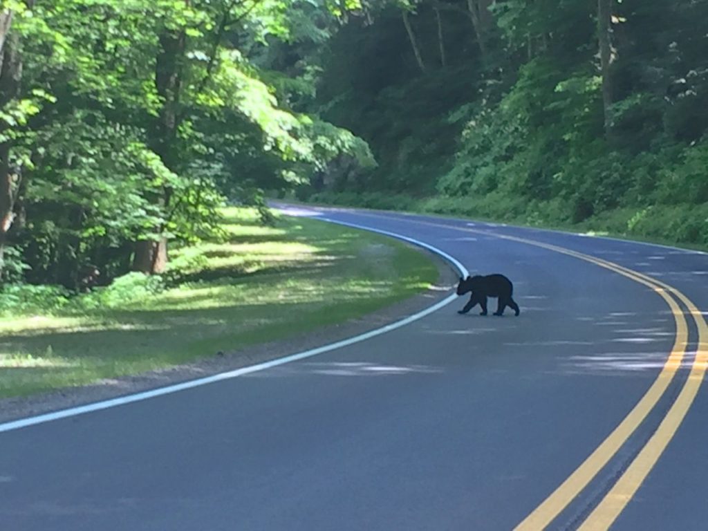
On the way down we saw a little bear crossing the road (right place, right time…bears move quickly!), which was the perfect conclusion to a trip spent in the woods, enjoying all the surprises we saw, dealing with the bugs, and taking in the beauty of wildflowers flung far and wide along grassy hills.

IMG_2366

Filed Under: Hiking, Tennessee, Travel Tagged With: Andrews Bald, Cades Cove, catawba rhododendron, Flame Azalea, Great Smoky Mountains National Park, Gregory Bald

GSMNP: Winter Hikes In Misty Mountains

March 15, 2016 by Leah Leave a Comment

As the weather warms up and I’m starting to sweat on my daily walks, I keep thinking back to a month ago when Rob and I headed to the Smokies again for some more winter hiking.  Hiking in the winter has some serious advantages.  There are less people, the views are unobscured by leaves on the trees, it’s a less sweaty endeavor, and there is a greater sense of peace because it feels like nature is truly asleep.  Due to bad weather in the forecast, we weren’t sure how much we’d actually be able to get into the woods, so the first day there was a mix of sun and clouds with a high of 61 degrees and we headed straight for Chimney Tops.

IMG_1240 IMG_0079

We brought a pair of trekking poles and some yaktrax for our shoes because I knew there could be ice on the trails at this time of year.  Sure enough, we weren’t halfway up that trail before we were encountering a snow covered, slippery mess.  We watched one man walk up 6 steps and slide right back down again.

IMG_0032

Chimney Tops isn’t rated as a difficult trail due to it’s short length of 3.8 miles RT, but the last mile gains over 900 feet in elevation, so between struggling up icy steps and sloshing through pudding-like mud, we felt like we were going to die by the time we reached the rocks at the top.  One guy we met said he’d made fun of people with “hiking sticks” on the way up, but that we could probably set up a lemonade stand by the side of the trail and sell them at a premium.  Once again, trekking poles saved the day.  The wind was blowing hard, but Rob decided to climb to the summit.

IMG_0023IMG_0041 IMG_0056

This was the view looking back down from where we climbed up (it’s a lot farther than it looks).  At one point, I asked Rob to take a picture of me climbing up these rocks because who doesn’t want to post some picture of themselves climbing up a mountain like a freaking superhero?  This was maybe the worst thing I’ve ever asked him to do.  It looked like nothing more than a giant ass climbing clumsily up a pile of rocks.  So much for trying to look adventurous!

IMG_0043

If the wind hadn’t been blowing so strongly, I would have attempted the rest of the climb, but instead I sat there peacefully, holding on to everything in my possession with a death grip so it wouldn’t blow away, while feeling like I’d just landed on top of the world.  I can never, ever get enough of this.

IMG_0046IMG_0060

The next day held the almost certain threat of rain, so after an early breakfast we packed up, put on our rain shells, and headed up to the Alum Cave trail to see how far we could get.  We walked beside a river through a rhododendron covered forest before coming to Arch Rock.  We crossed the stream and headed up the steps which curved around the inside of the rock to the trail on the opposite side.  The walls of the rock were covered in ice and the water from the river sounded like thunder.

IMG_1311

As we climbed in elevation on the trail it became apparent that we were hiking up into a cloud, a literal fluffy cloud, like you see from a plane window and always wonder if it could actually be possible to pull a Mary Poppins and just hang out there for a while.  I’ve never been in this kind of fog in the woods.  It felt like the trees were holding secrets as we noisily tromped through.

IMG_1266 IMG_1267

Every time we came to some sort of overlook, we simply had to imagine the view.  Everything was obscured by clouds and mist, a true Smoky Mountain experience.

IMG_1258

When we got to the cave, we climbed up the sand and stood under the dry overhang, looking out at the trees.  Everything was enchanted by fog.  Some would say the trip wasn’t worth it, but one thing that always amazes me about that woods is that they change as much as the ocean.  Every day there is something new to see and experience, whether it be wildlife, views, waterfalls, mist, rain, or brilliant sunshine.  I wouldn’t have traded this day for anything.

IMG_1271 IMG_1284

We headed back down the trail, making serious use of our trekking poles.  Mine kept me from falling several times and I’m pretty sure we both would have been in bad shape without them.  We made it back to the car with a good amount of time left in the day, so we took Newfound Gap Road straight across the park to the Oconaluftee Visitor Center which also houses a pioneer museum replete with old buildings, gardens, and an orchard, plus Mingus Mill just down the road.  I’m always blown away by the life the early settlers carved out for themselves in the rugged landscape within these mountains.

IMG_1343IMG_1354

Every once in a while, a volunteer at a visitor center will give a bit of hiking advice that’s worth taking, so when we were told that the 7 mile round trip hike to Grotto Falls was a sure bet, we decided to head there the next morning.  The Roaring Fork Motor Nature Trail is closed in the winter, but the Rainbow Falls trailhead is still accessible, so we started there and took the Trillium Gap trail all the way to Grotto Falls.  This was really the perfect time of year to do this particular hike because the wooded trail goes right along the motor trail and I don’t think the experience would have been as enjoyable with bumper to bumper cars meandering past the entire time.  We didn’t pass a soul on the first 3.5 miles to the falls and we had one of the most popular waterfalls in the entire park to ourselves as rain started to come down.

IMG_1396 IMG_1384

Grotto Falls is the only waterfall in the park that you can walk behind.  In fact, the trail actually goes behind the falls, so if you are getting to Mount LeConte this way, you’ll have to duck beneath Grotto Falls.

IMG_1391

As we made our way back to the trailhead it started to rain on us and we hiked through a steady downpour, eventually ending up totally soaked in spite of rain shells and water repellent pants.  Thankfully the day was warm and the heat from our exertion kept us from getting cold.  As soon as we got back to our room, we changed into warm, dry things and headed right back out to drive through Cades Cove and see it in the mist.

Cades Cove is an 11 mile loop that goes through a preserved pioneer community in the mountains.  It’s one of the most popular places in the park to see Black Bears (or so the NPS website says), so every time we’ve gone it’s been a bumper to bumper, ire-inducing affair where you want to kill every gas guzzling SUV driver who goes 5 mph (LITERALLY) through the woods, stopping to view every moving blade of grass and every falling leaf.  The area is beautiful, but my blood pressure and stress level cause obscene amounts of swearing and hatred toward my fellow man.  This time, however, was a different affair entirely.  The optimum time to experience Cades Cove is on a rainy Sunday afternoon in winter.  We were able to maintain a steady speed throughout the drive and it was enjoyable and peaceful in every way.  We saw lots of turkeys and deer, reveling in the peace of the park at this time of year.

IMG_1398

Even though the weather was miserable at points, it didn’t diminish the beauty of the mountains or the fun we had in seeing things in a different light.  Gatlinburg was as disgusting as it always is.  A grossly high percentage of stores in this little hell hole on the edge of paradise display confederate flag products in their windows: t-shirts, underwear, bikinis, beach towels, purses, you name it, it comes in some form of racist merchandise.  In fact, if you like your racism with a pat of butter and a dollop of cream on top, you can even shop at the Paula Deen store in town.  If you wonder where all the people voting for Trump go to vacation and play, it’s in Gatlinburg.  I have a love/hate relationship with this town.  I love the NOC outfitter store and I am really coming to adore Great Smoky Mountains National Park.  Gatlinburg is the gateway to that incredible place, so the people who started this town most likely never envisioned it becoming the tourist trap that it is today.  Unless we want to stay more than 30 minutes away in a more secluded spot, Gatlinburg is our easy access point to the trails we want to hike.  I’m going back at least two more times this year and I absolutely can’t wait to see rhododendrons blooming and try some new hikes.

Until next time when the leaves are on the trees…

IMG_0096

Filed Under: Hiking, Tennessee, Travel Tagged With: Alum Cave, Chimey Tops, Great Smoky Mountains National Park, Grotto Falls, GSMNP, Oconaluftee Visitor Center

Copyright © 2025 · Foodie Pro Theme by Shay Bocks · Built on the Genesis Framework · Powered by WordPress